 Floods in Boliva
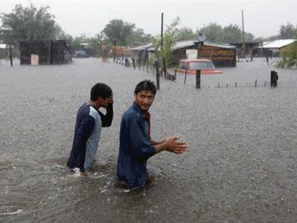
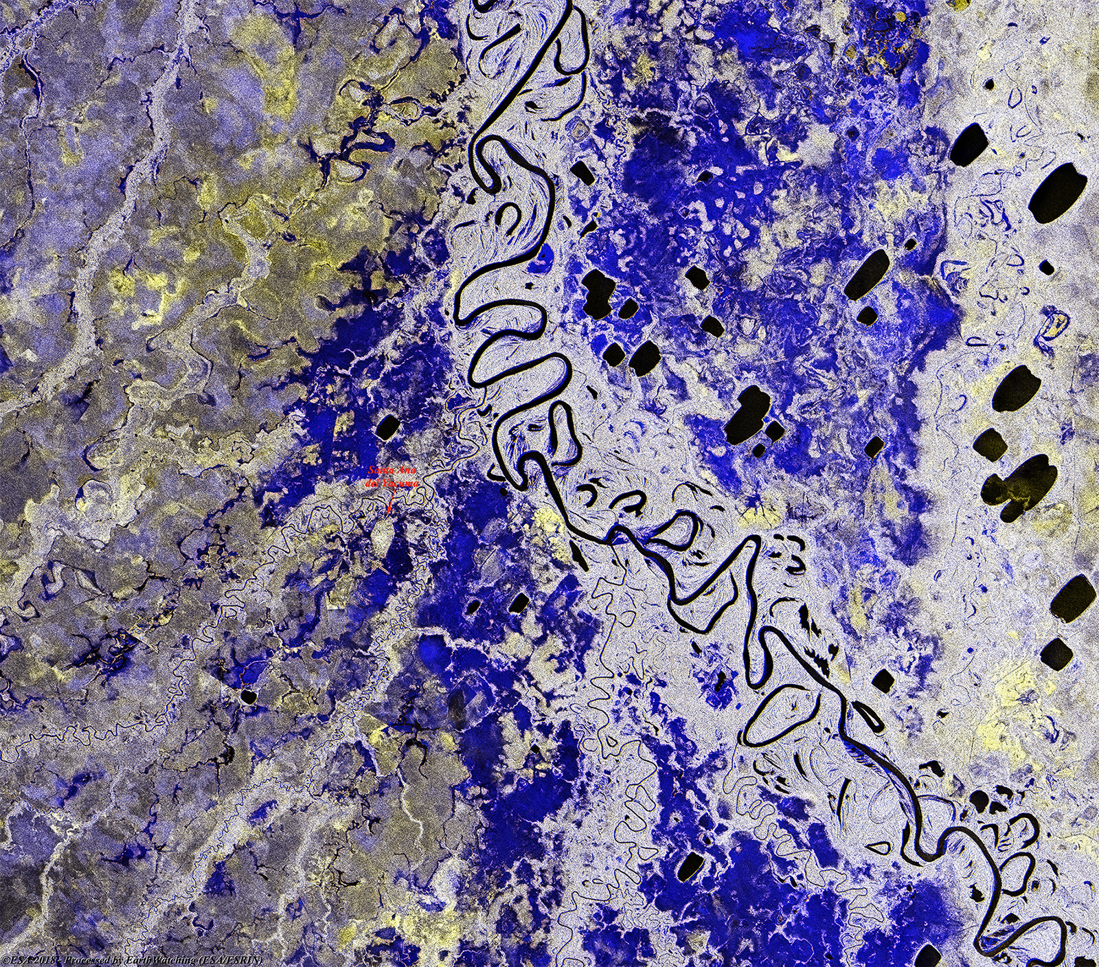
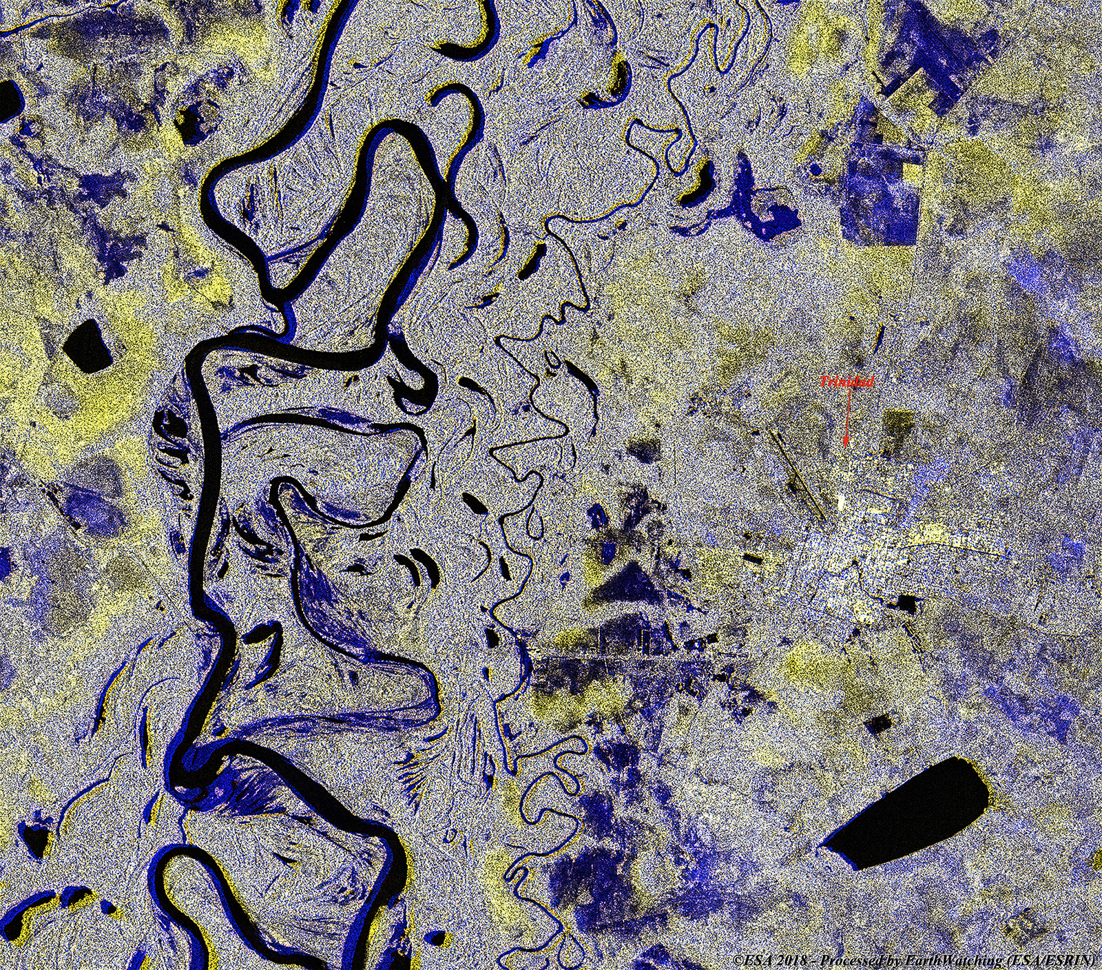
La Paz, Bolivia - President Evo Morales declared a national disaster on Tuesday, 06 March, 2018 after weeks of heavy storms resulted in widespread flooding blamed for scores of deaths, particularly in northeastern Bolivia. In addition to 60 deaths, the heavy rain that began last November has left more than 43,000 people homeless, according to official figures. Five people are reported missing. Dozens of families have been evacuated from hills around the El Beni region's capital city of Trinidad, where they have taken refuge. Inside Trinidad, the only scarce water was potable water. The rainfall during this year's rainy season may exceed last year's total by 50-100 centimetres, according to studies in this area of the Amazon basin. The floods follow days of heavy rain and particularly affect the southern part of the nation along the border with Paraguay and Argentina; which is also experiencing floods. The rain caused the Tupiza River to overflow, flooding the city which shares the same name and affecting an estimated 1,000 people. Reports indicate flood waters reached as high as 7 metres in some places. Due to the flood conditions, some roads in the affected regions have been inundated, making them impassable for relief efforts.
These two false colour images from Sentinel-1B were acquired over the Department of Beni (Santa Ana del Yacuma / Trinidad, Bolivia) and demonstrate one of the most common uses of the radar sensor on board this satellite. Using the SAR instrument, we can monitor the territory and verify the damage (in this case a flood) caused during a natural disaster. The flooding is visible in the comparisons with darker instensity in the grayscale images and in blue in the false folour images. Santa Ana del Yacuma 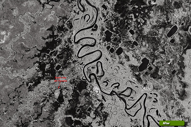 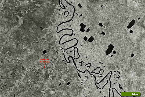 View large format slider over the area View large image in false colour (JPG 4.2 MB)
Trinidad 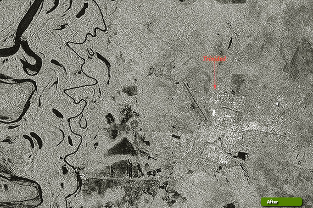 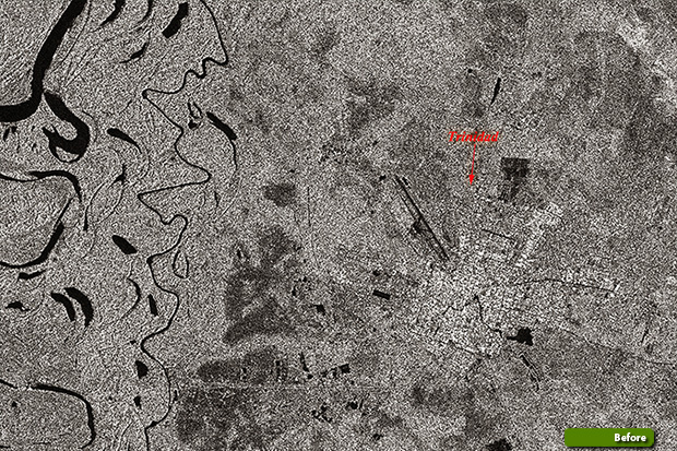 View large format slider over the area View large image in false colour (JPG 4.9 MB)
|
|||||||||||||||||||||||||||||||