 Fires in Pisa, Italy
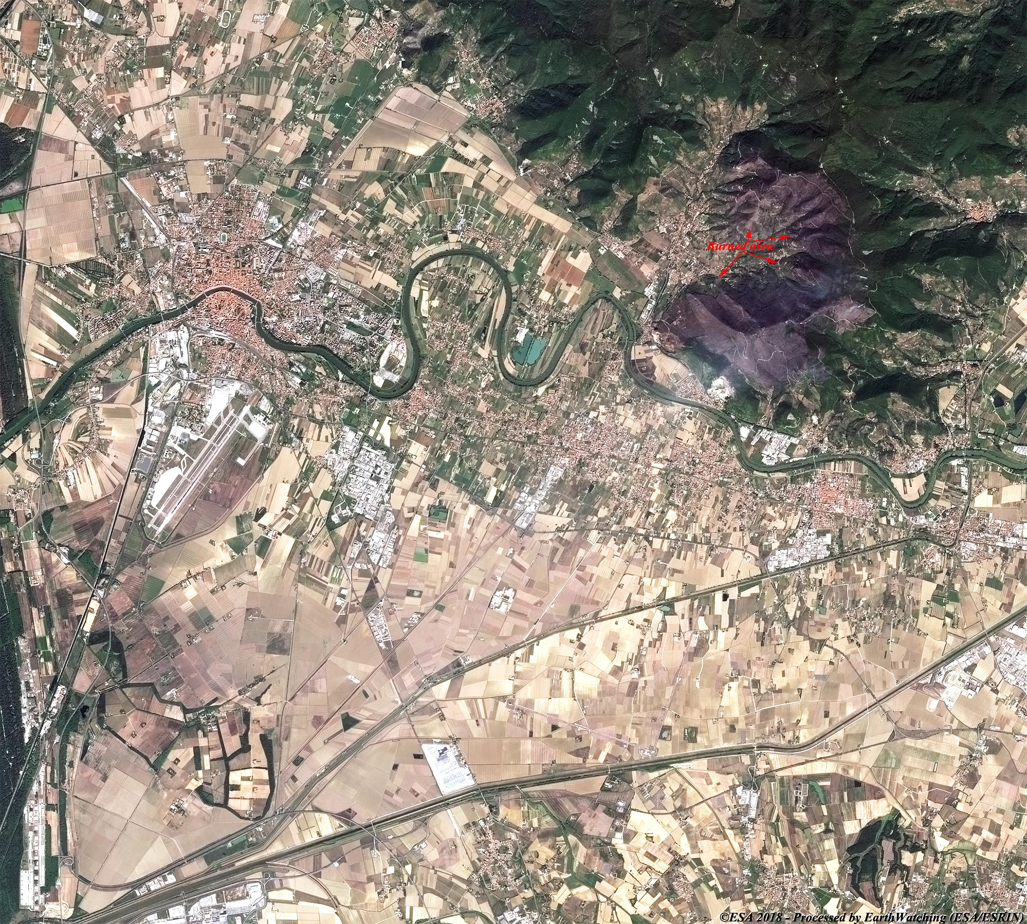
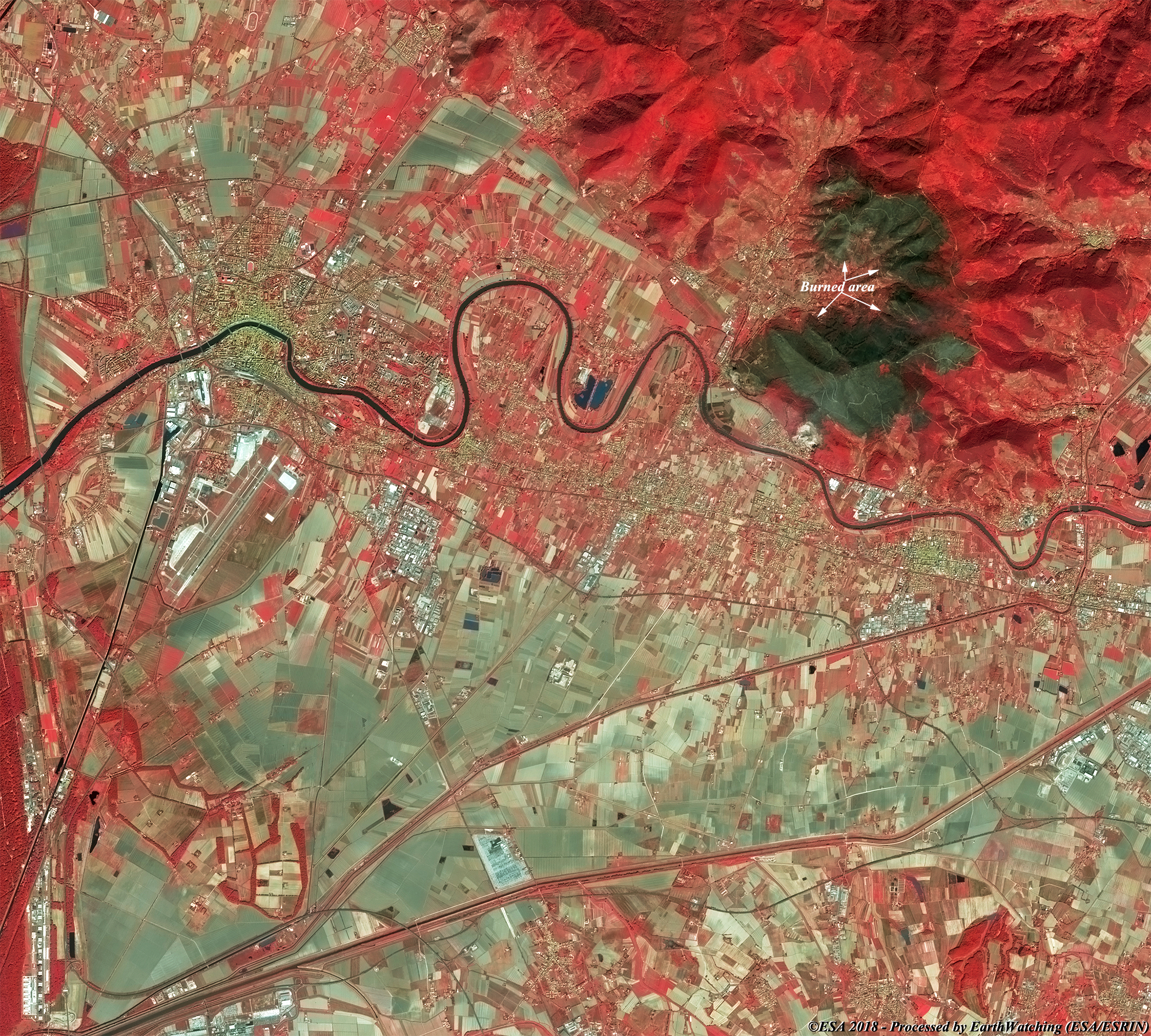
Rome (From Reuters) - Hundreds of people were ordered out of their homes and Pisa airport was shut on Tuesday following a huge fire which swept wooded hills in Italy's central Tuscany region. Officials believe the blaze, which started late on Monday, was started deliberately on Monte Mario, which lies between the Tuscan art cities of Pisa and Lucca. Local authorities said some 700 people were told to leave their homes as a precaution in the towns of Calci and Vicopisano, while schools in the area were all shut. There were no immediate reports of injuries or of damage to properties. Some 600 hectares of woodland were destroyed and a large cloud of smoke cast a pall over Pisa. Two Canadair aircraft and four helicopters crisscrossed the skies, dumping thousands of litres of water on the fires, which were fanned by strong winds. More informations is available on Reuters
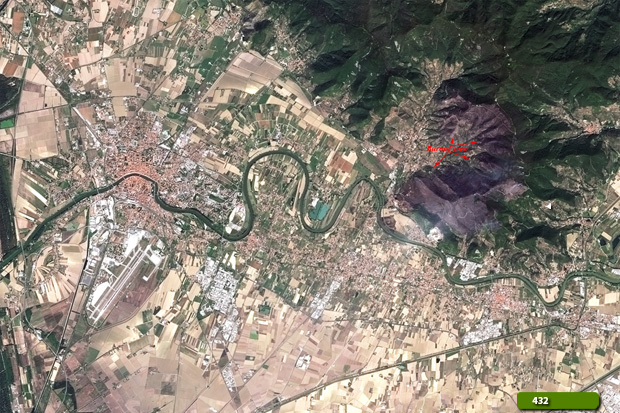
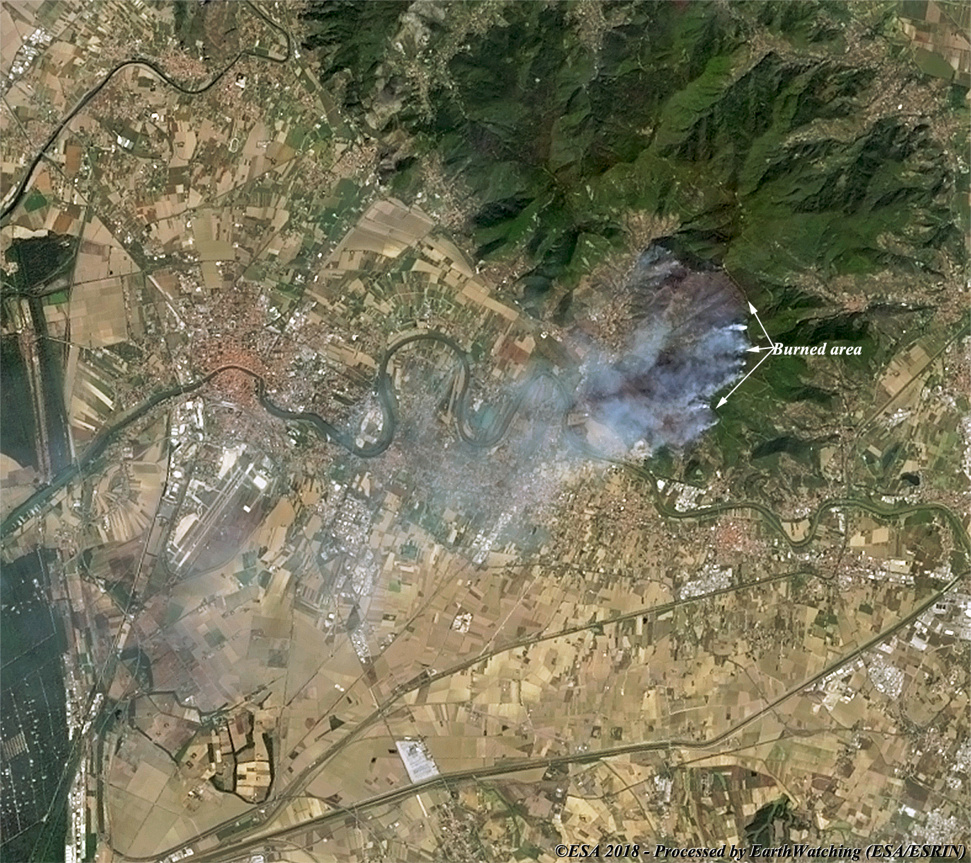
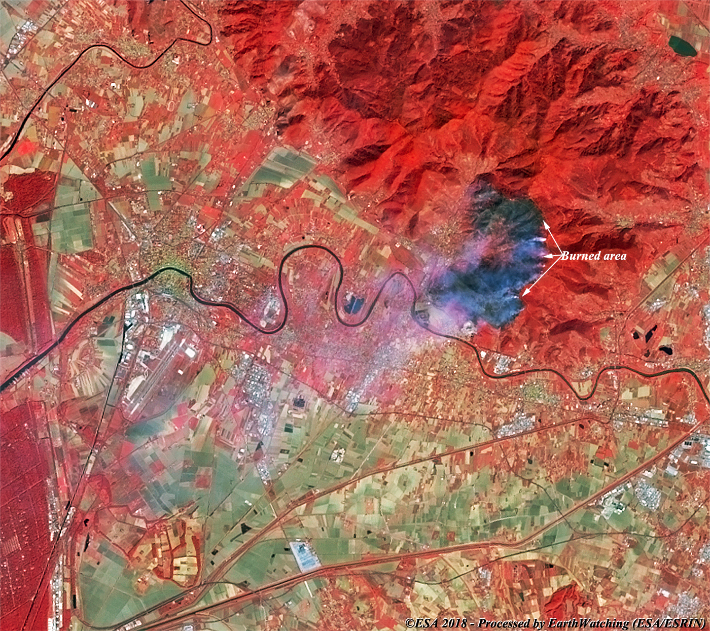
These images acquired by Landsat 8 and Sentinel-2 over central Italy, show the fires that have destroyed 600 hectares of woodland on Mount Serra. The fires have forced approximately 700 people to evacuate their homes. The fire began on 24 September and with flames fanned by strong winds, the fires were visible from miles away. These images processed in natural colour (bands 432) and in false colour (542 Landsat 8 and 843 Sentinel-2) show the large area destroyed. In the false colour images, the burnt areas are black, and in the natural colour images we can see the fires are still active with smoke plumes visible in the Landsat image. The aim of these images is to promote the opportunity to download Landsat data through the ESA portals (also Third Party Missions), where images captured every day are made available in near real time to the users and the scientific community, and with the new generation of satellites from the European Commission's Copernicus project it it possible to monitor these types of events in high resolution. Landsat full resolution data products are freely available for immediate download at: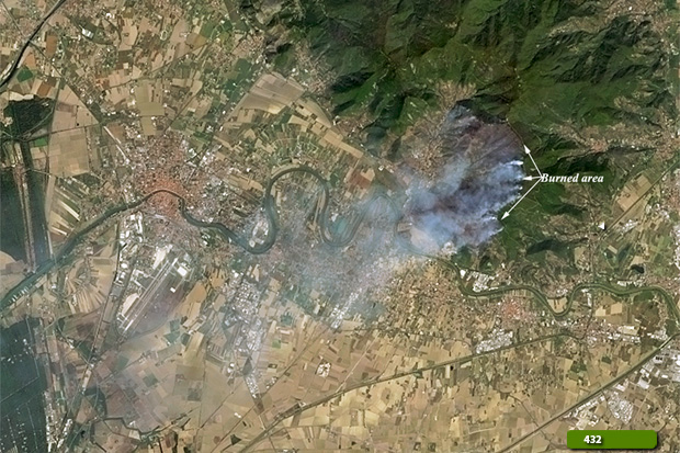  View Landsat 8 OLI high resolution image (Natural colour) (JPG 2.3 MB) View Landsat 8 OLI high resolution image (False colour) (JPG 2.3 MB)
  View Sentinel-2 high resolution image (Natural colour) (JPG 4.7 MB) View Sentinel-2 high resolution image (False colour) (JPG 4.7 MB)
|
|||||||||||||||||||||||||||||||||