 Chicago, USA
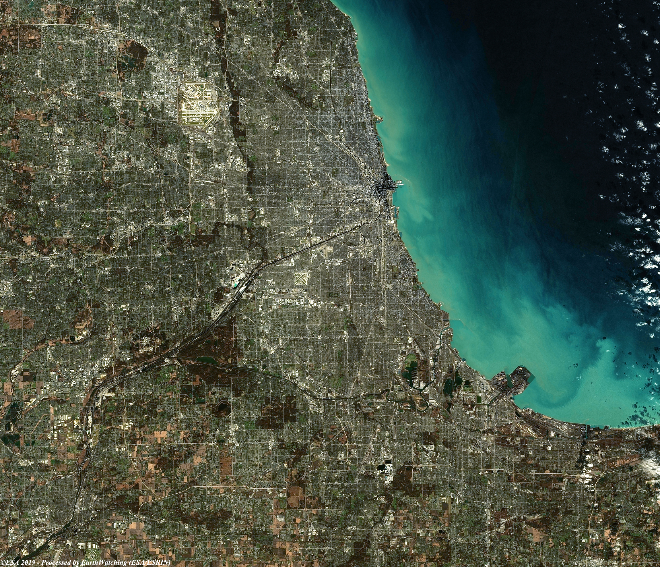
Chicago is located in northeastern Illinois on the southwestern shores of Lake Michigan. It is the principal city in the Chicago metropolitan area, situated in the Midwestern United States and the Great Lakes region. Chicago rests on a continental divide at the site of the Chicago Portage, connecting the Mississippi River and the Great Lakes watersheds. The city lies beside huge freshwater Lake Michigan, and two rivers—the Chicago River in downtown and the Calumet River in the industrial far South Side—flow entirely or partially through Chicago.
Chicago's history and economy are closely tied to its proximity to Lake Michigan. While the Chicago River historically handled much of the region's waterborne cargo, today's huge lake freighters use the city's Lake Calumet Harbor on the South Side. The lake also provides another positive effect: moderating Chicago's climate, making waterfront neighborhoods slightly warmer in winter and cooler in summer
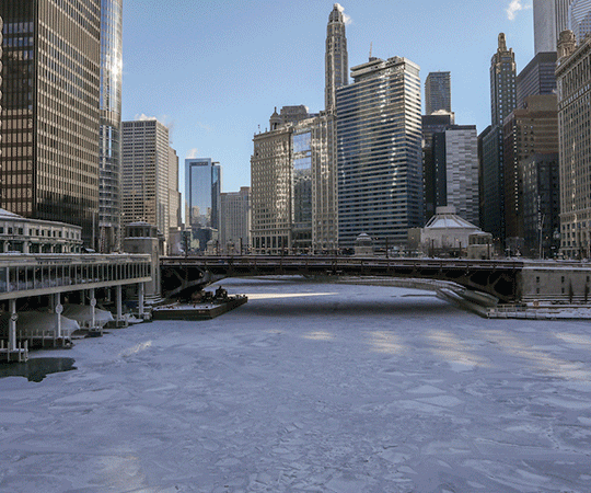
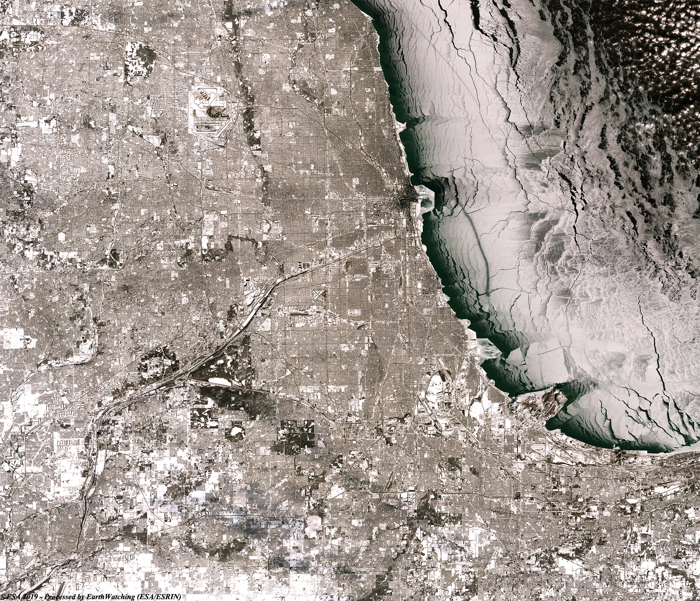
A polar vortex brought temperatures of -40C to the City of Chicago, turning Lake Michigan to solid ice and bringing major disruption to the city and surrounding areas. The images in the comparison below captured by the Copernicus Sentinel-2 satellite, show the stark differences of before and after the vortex. 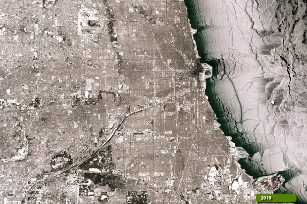 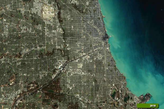 View large format slider in natural color bands View Sentinel-2 high resolution image (After) (JPG 6.2 MB) View Sentinel-2 high resolution image (Before) (JPG 5.9 MB)
|
|||||||||||||||||||