 California Fires
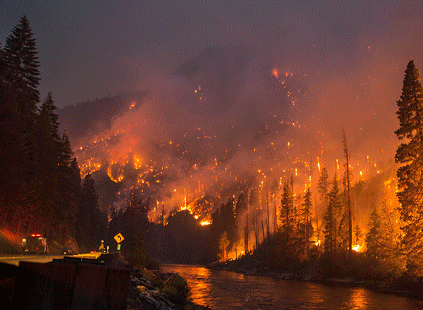
From AFP: The toll in the deadliest wildfires in recent California history climbed to 59 on Wednesday as authorities released a list of 130 people still missing. Most of those unaccounted for are from the Butte County town of Paradise, in northern California, which was virtually erased from the map by the so-called "Camp Fire" blaze that erupted last week. Butte County Sheriff Kory Honea told journalists Wednesday evening that 461 search and rescue personnel and 22 cadaver dogs were involved in the effort to locate those missing and DNA testing was being expedited to identify the victims. "Beginning Thursday, anyone who believes a family member perished can provide a DNA sample" to the sheriff's office, Honea said. Paradise, a town of around 26,000 in the foothills of the Sierra Nevada mountains, was popular with retirees and many of those reported missing by the sheriff's office are elderly -- in their 70s, 80s and 90s. Virtually every home in Paradise, located 80 miles (130 kilometers) north of the state capital Sacramento, was destroyed by the fast-moving fire fueled by high winds.
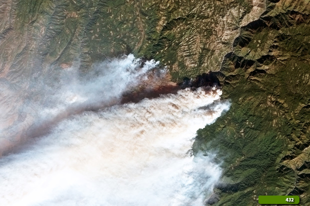
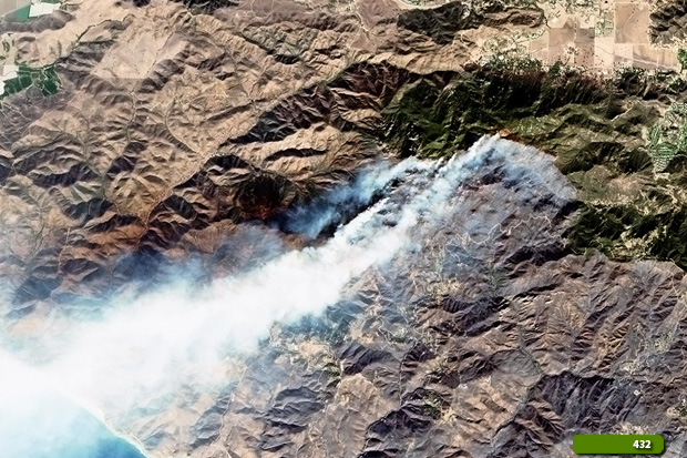
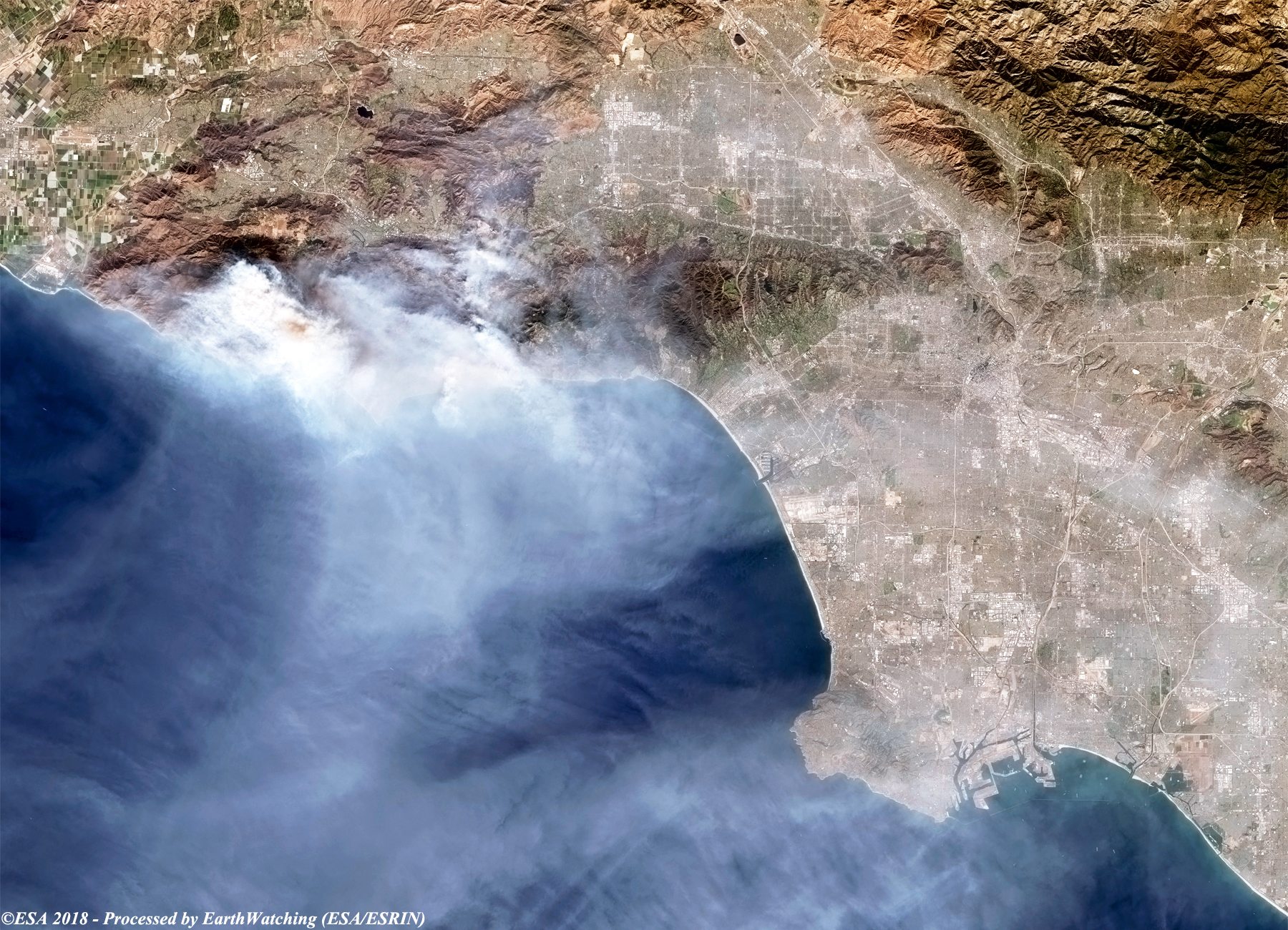
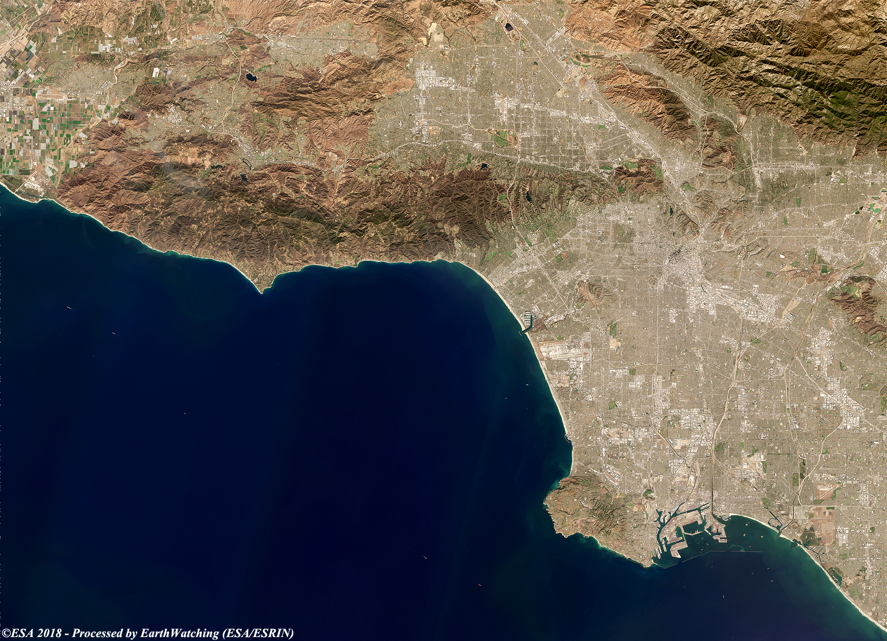
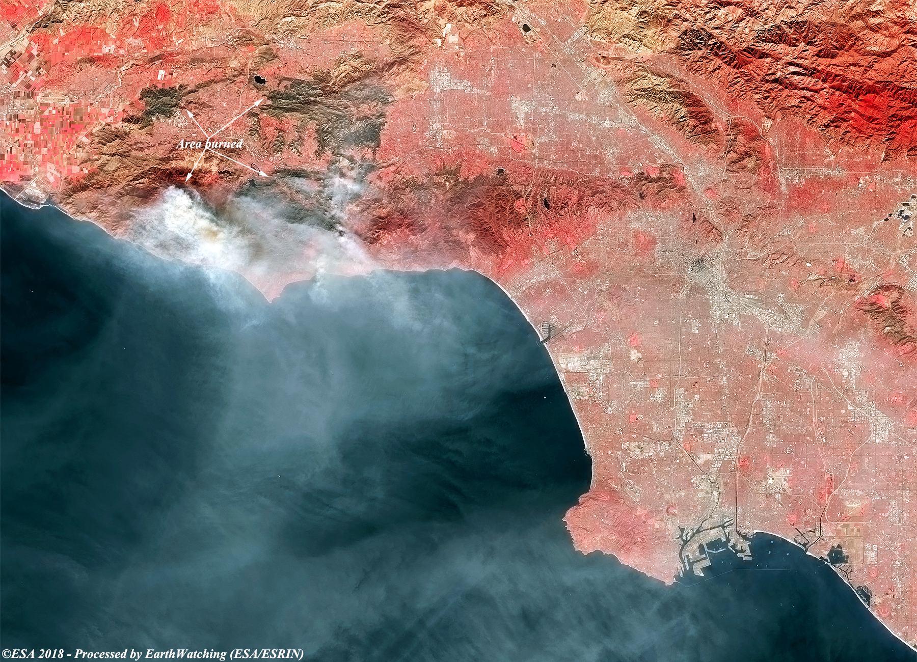
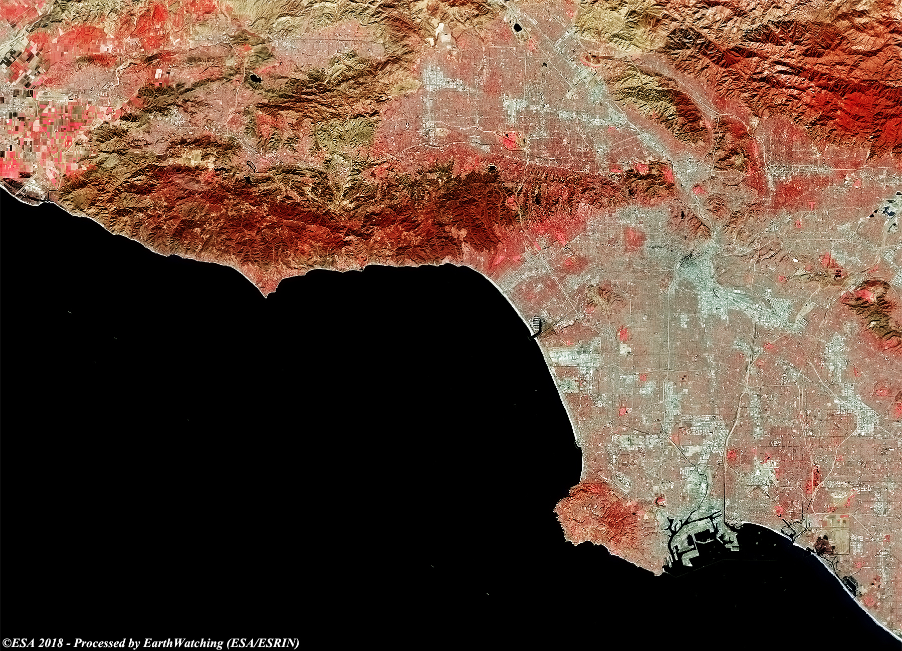
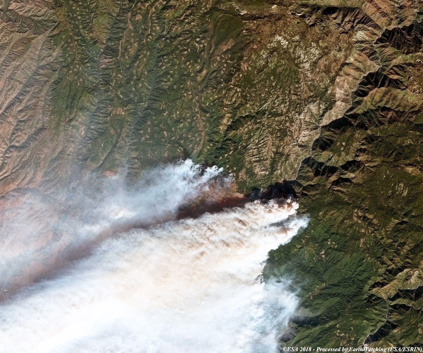
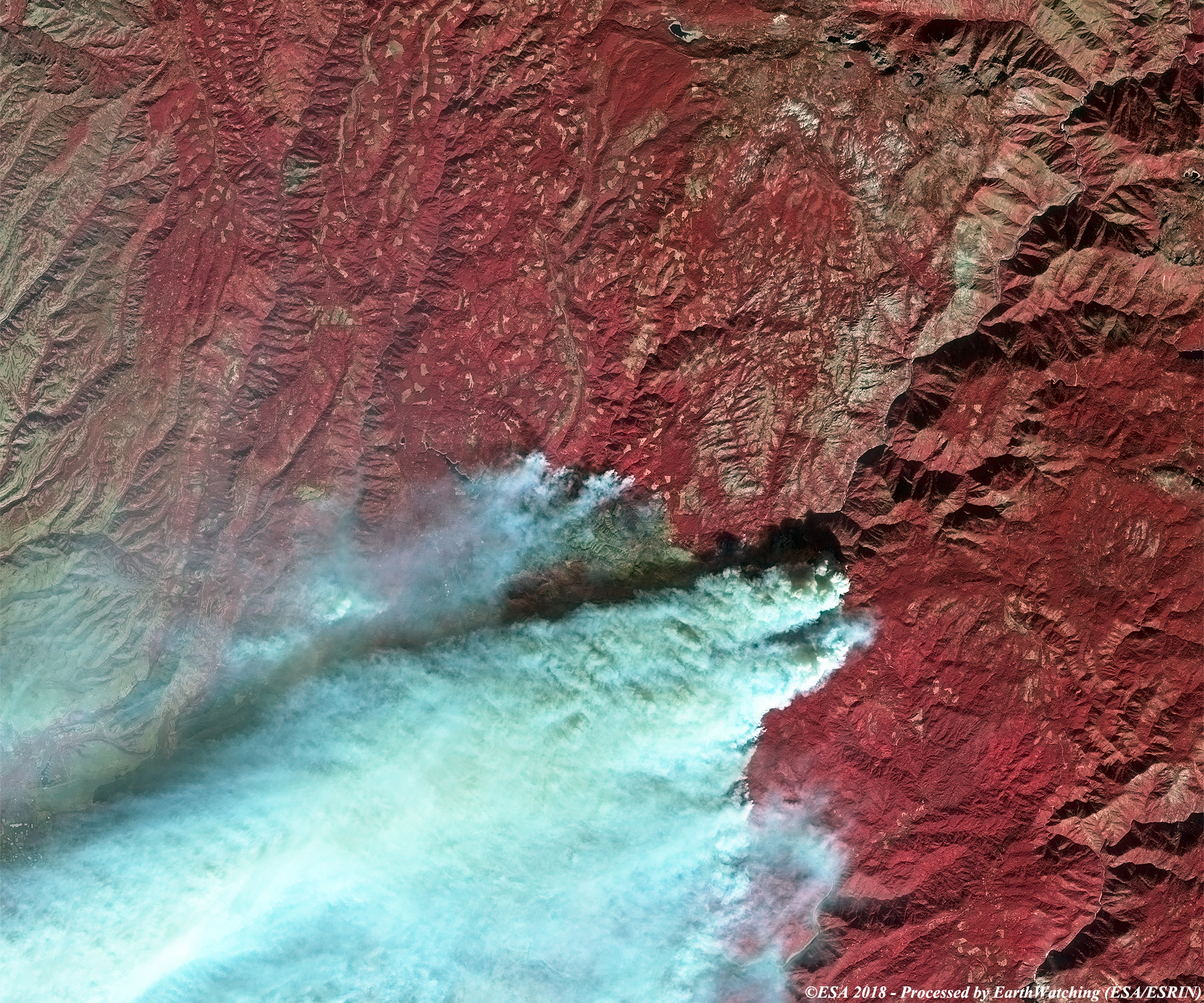
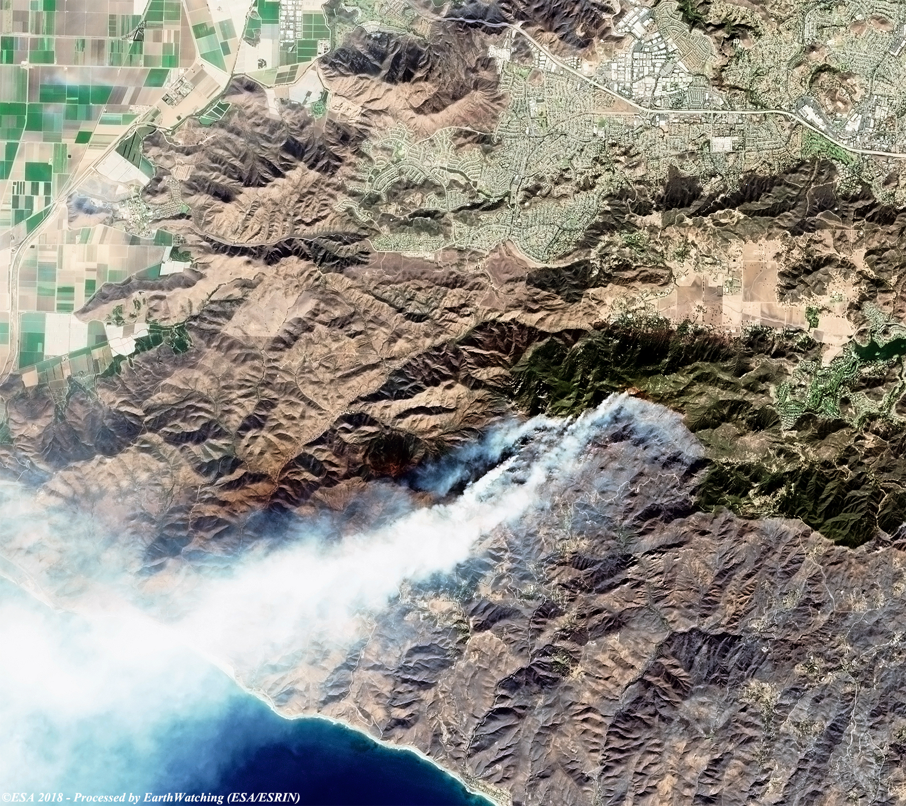
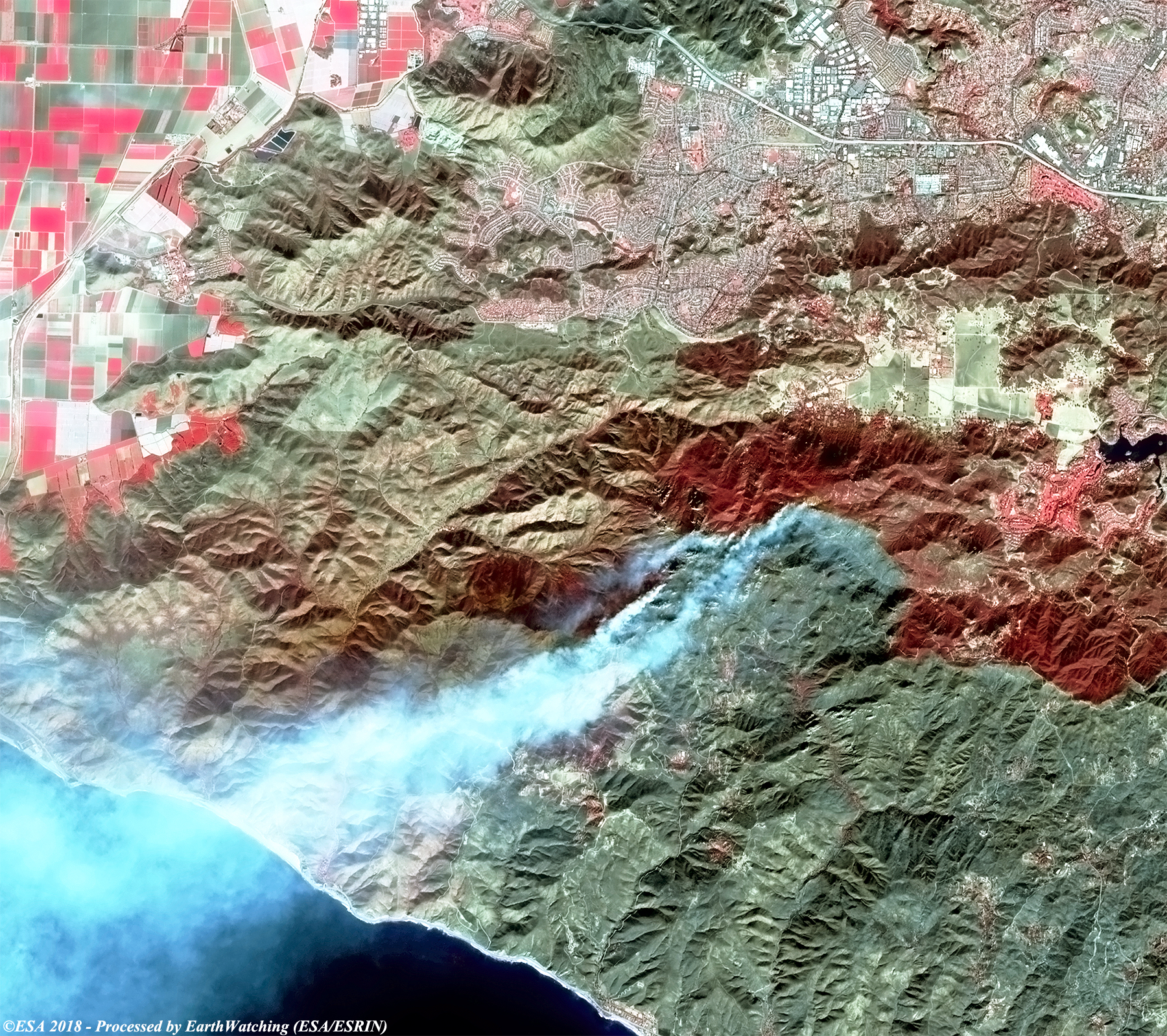
This series of images acquired by the Copernicus Sentinel-2 satellite, show the large fires in Malibu, Sacramento and Thousand Oaks, California. The wildfires spread quickly destroying many thousands of homes and forests. Tall columns of smoke are visible in the images taken while the fires were still burning. The false and true colour images aim to highlight the affected areas and the burn scars that remain.
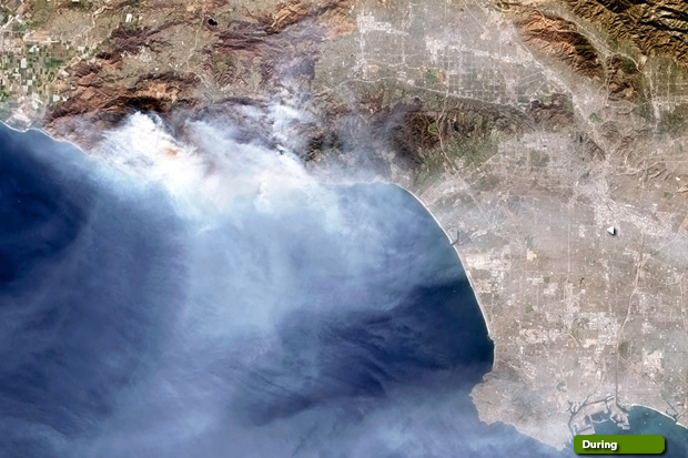 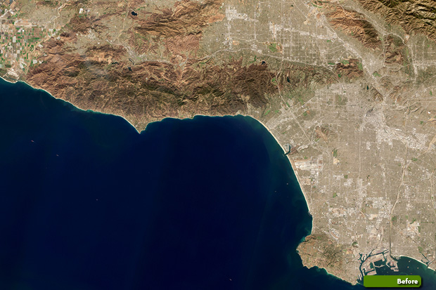 View large format slider in natural color bands View Sentinel 2 high resolution image (during) (JPG 2.1 MB) View Sentinel 2 high resolution image (before) (JPG 3.1 MB) 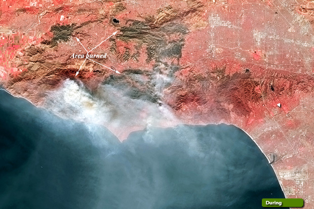 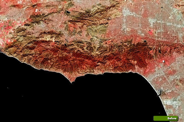 View large format slider in false color View Sentinel 2 high resolution image (during) (JPG 3.0 MB) View Sentinel 2 high resolution image (before) (JPG 2.6 MB)
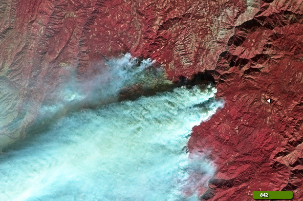  View Sentinel 2 high resolution image in natural color (JPG 3.2 MB) View Sentinel 2 high resolution image in false color (JPG 3.7 MB)
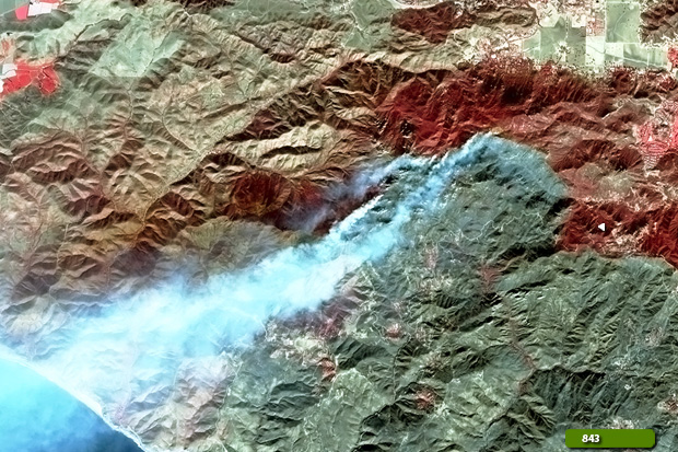  View Sentinel 2 high resolution image in natural color (JPG 3.4 MB) View Sentinel 2 high resolution image in false color (JPG 3.4 MB)
|
||||||||||||||||||||||||||||||||||||||||||||||