 Beirut, Lebanon
Beirut is the capital city of Lebanon and located on a peninsula at the midpoint of its Mediterranean coast. Beirut is the country's largest and main seaport and is one of the oldest cities in the world, inhabited more than 5,000 years ago. The first historical mention of Beirut is found in the ancient Egyptian Tell el Amarna letters dating from the 15th century BC. Beirut is Lebanon's seat of government and plays a central role in the Lebanese economy, with most banks and corporations based in its Central District, Badaro, Rue Verdun, Hamra, Ryad el Soloh street, and Ashrafieh. Following the destructive Lebanese Civil War, Beirut's cultural landscape underwent major reconstruction. Identified and graded for accountancy, advertising, banking/finance and law, Beirut is ranked as a Beta World City by the Globalization and World Cities Research Network. More information is available on: Wikipedia
Our tour of the world in 2018 continues with Beirut, the largest city of Lebanon. Once a famous port, and as recently as the 1970's a banking and cultural centre for the Middle East, Beirut was devastated by civil war and successive Syrian and Israeli occupation between 1975 and 1991. Today, Beirut is one of the most cosmopolitan and religiously diverse cities in Lebanon and the Middle East. Traditional Beirut exists on a peninsula which projects west into the Mediterranean and is flanked by the Lebanon Mountains that rise to the east. The city sits between and atop two hills of Al-Ashrafieh and Al-Musaytibah. Beiruts coastline is diverse, containing large rocky beaches, sandy shores and tall cliffs. This merge of images taken by the Sentinel-2 (optical sensor instruments) and Sentinel-1 (radar SAR instrument), aim to show the different applications the Copernicus project can provide. 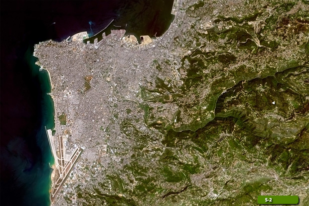 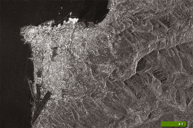 View Sentinel 2 high resolution image (JPG 7.0 MB) View Sentinel 1 high resolution image (JPG 5.9 MB)
|
|||||||||||||||||||