 Athens, Greece
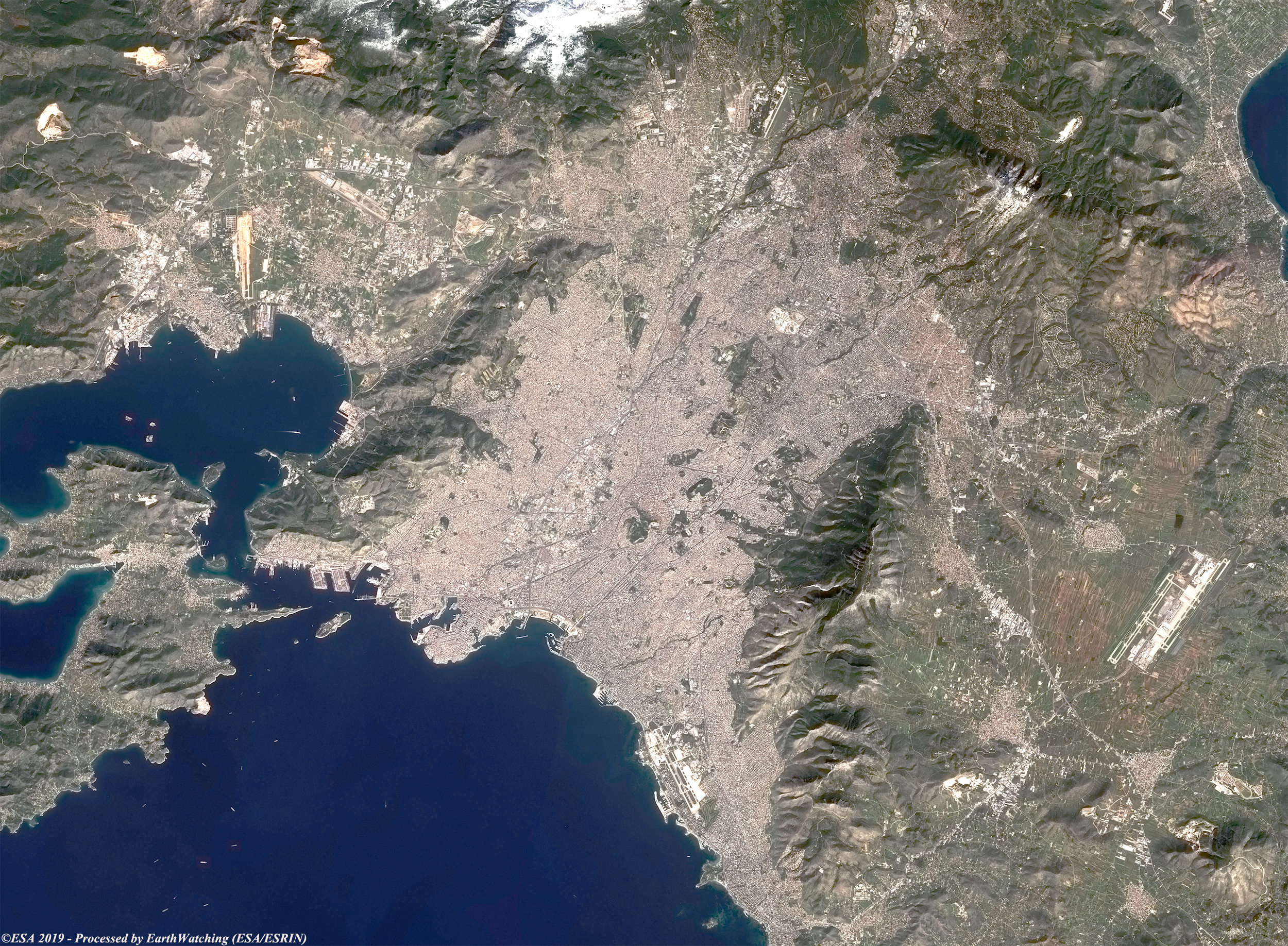
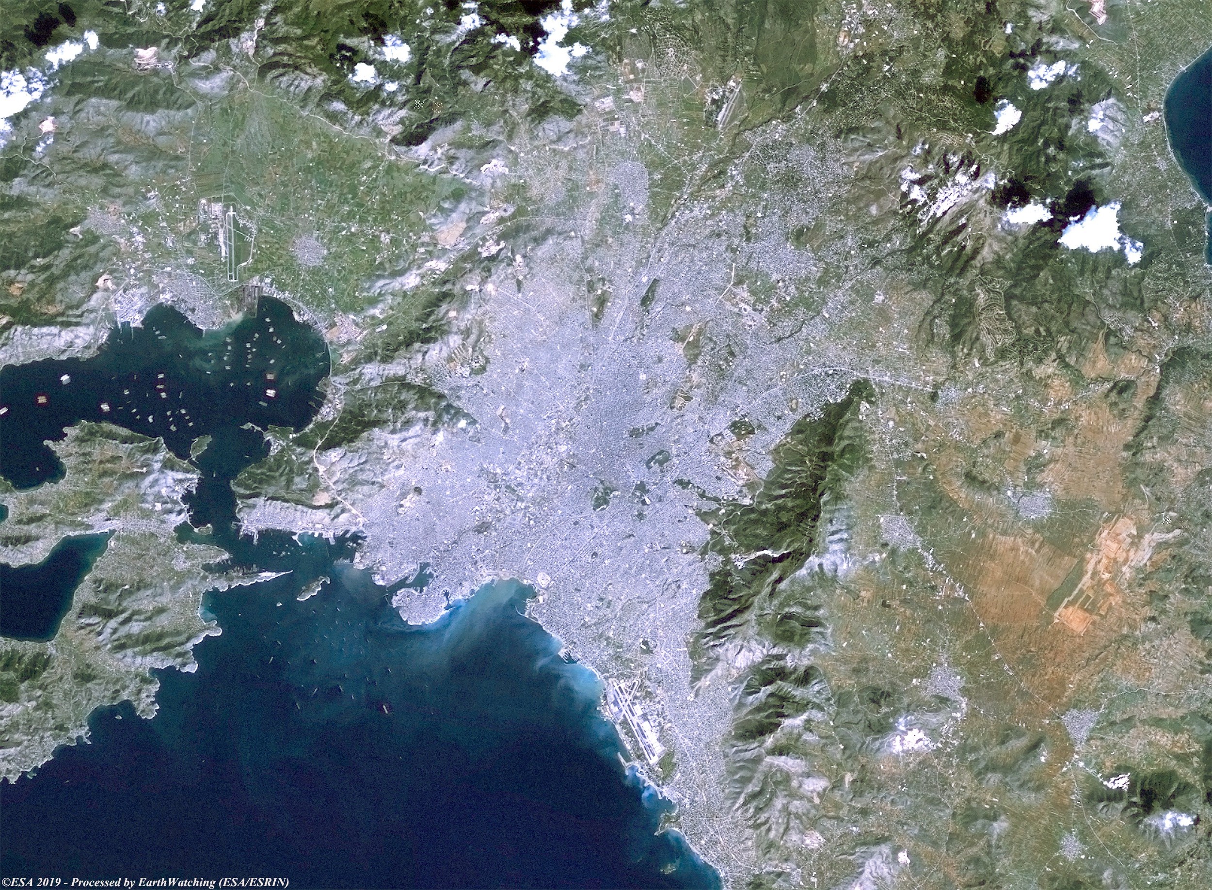
This weeks comparison uses Copernicus Sentinel-2 and Landsat 5 satellite images captured 34 years apart, to highlight urban change in Athens. Situated on the Attic plain on the Greek mainland, Athens is the capital and largest city of the Greece. It is surrounded by mountains on three sides, the most prominent of which are Párnis, Pendéli, and Hymettus (Imittós). Two minor rivers, the Kifisós in the west and the Illisós in the east, flow through the city. With its port, Pireás, or Piraeus, which is located about 8 km to the south-west on the Saronic Gulf (an inlet of the Aegean Sea), forms a unified metropolitan region. These images aim to show how Athens has been developed in a 34 year time-frame, especially towards the north, north-east of the capital. 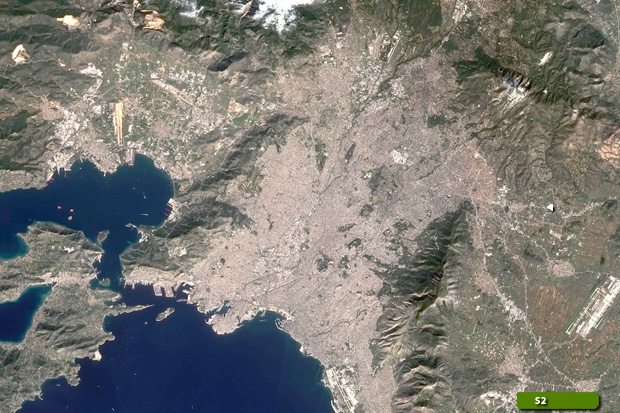 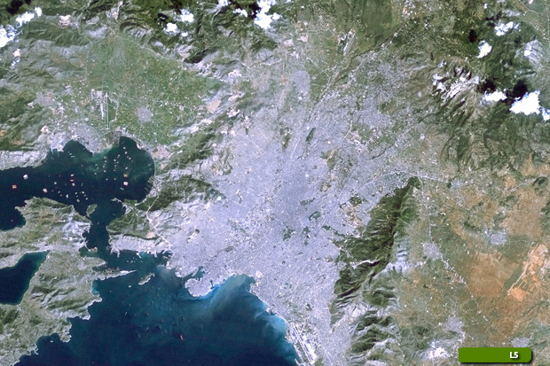 View Sentinel-2 high resolution image (JPG 5.6 MB) View Landsat-5 high resolution image (JPG 1.9 MB)
|
||||||||||||||||