 Venice lagoon, Italy
This weeks image comparison takes us over the Venice lagoon, Italy. The Copernicus Sentinel-2 images are processed in natural color (Bands 4,3,2), and in false color (Bands 8,4,3). The Venice lagoon extends between the mouths of the Piave rivers in the north-east and Brenta in the south-west. The maximum dimensions are 50 kilometers long by 11 wide and its shape resembles that of an orange slice, with the concavity in the northwest. The lagoon of Venice is the largest in Italy, with an area of 550 km2, 67% of which are covered with water, 25% is occupied by salt marshes and 8% by islands. The dammed fishing valleys occupy 15% of the total lagoon area. Being located at the end of a closed sea, the lagoon is subject to large water level excursions, the most visible of which (especially in autumn and spring) cause phenomena such as high water, which periodically floods the lower islands , or the shallow water, which sometimes makes the shallow canals impractical. 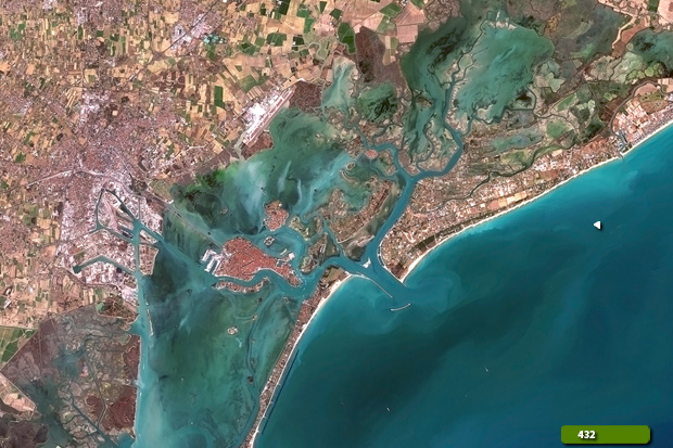 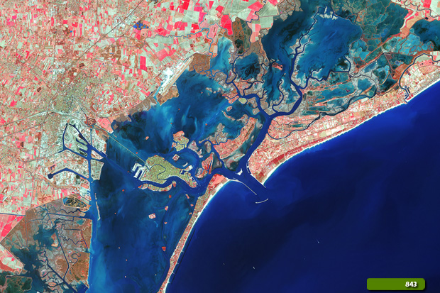 View Sentinel-2 high resolution image (natural color) (JPG 6.8 MB) View Sentinel-2 high resolution image (false color) (JPG 8.2 MB)
|
||||||||||||||||