 Ushuaia, Argentina
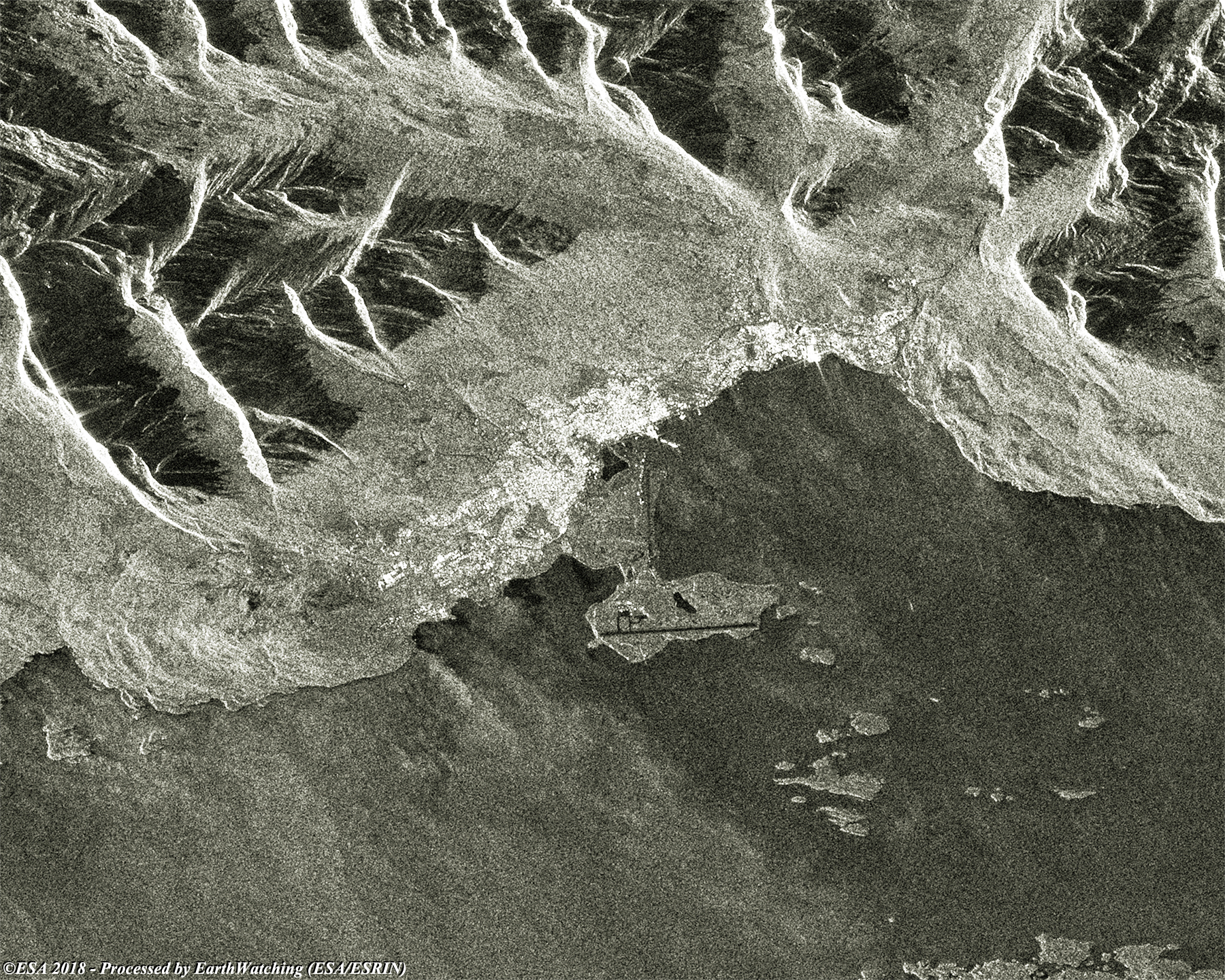
Ushuaia is the capital of Tierra del Fuego, Antártida e Islas del Atlántico Sur Province, Argentina. It is commonly regarded as the southernmost city in the world. Ushuaia is located in a wide bay on the southern coast of Isla Grande de Tierra del Fuego, bounded on the north by the Martial mountain range, and on the south by the Beagle Channel. It is the only municipality in the Department of Ushuaia, which has an area of 9,390 km2. It was founded on 12 October 1884 by Augusto Lasserre and is located on the shores of the Beagle Channel surrounded by the mountain range of the Martial Glacier, in the Bay of Ushuaia. Besides being an administrative centre, it is a light industrial port and tourist hub. Ushuaia has long been described as the southernmost city in the world. While there are settlements farther south, the only one of any notable size is Puerto Williams, a Chilean settlement of some 2,000 residents. As a centre of population, commerce, and culture, and as a town of significant size and importance, Ushuaia however clearly qualifies as a city. A 1998 article in the newspaper Clarín reported that the designation "Southernmost city in the world" had been transferred to Puerto Williams by a joint committee from Argentina and Chile, but this was denied by Argentine authorities, and the Secretariat of Tourism of Argentina continues to use the slogan in official documentation and websites. More information is available on: Wikipedia
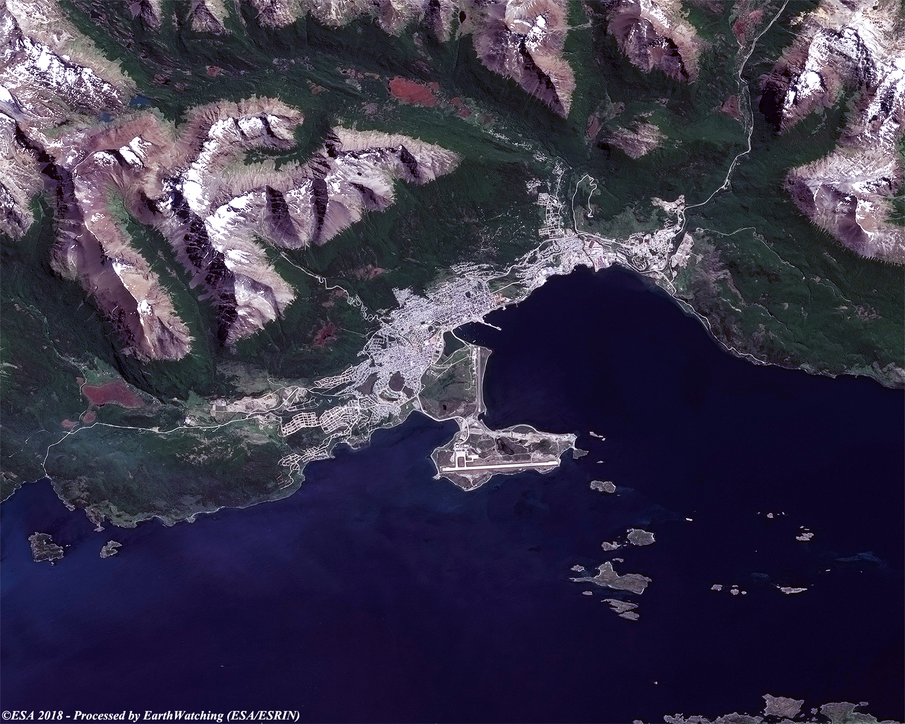
Ushuaia is located 6 metres above sea level on Ushuaia Bay, surrounded by the Andes Fueguinos from west to east. It is the only city in the country that is accessible by crossing part of the Andes mountain range, which runs along the southern edge of the Tierra del Fuego. In order to proceed to Ushuaia, two major foothills of the Andes Fueguinos must be crossed by means of National Route 3: the Sierra Sierras Alvear by means of the mountain range Paso Garibaldi y Garibaldi, and the Sierra Sorondo – Montes Bridges through the valley of the Olivia River. Ushuaia is known the "End of the World", and the name is well-deserved since the town is located at the southernmost tip of South America as mentioned in this article from tripsavvy. With this demonstration of images taken by the Sentinel-2 (optical sensor instruments) in Spring/Summer and Sentinel-1 (radar SAR instrument) in Autumn/Winter, we aim to show the large field of application that the Copernicus Sentinel satellite family can cover. 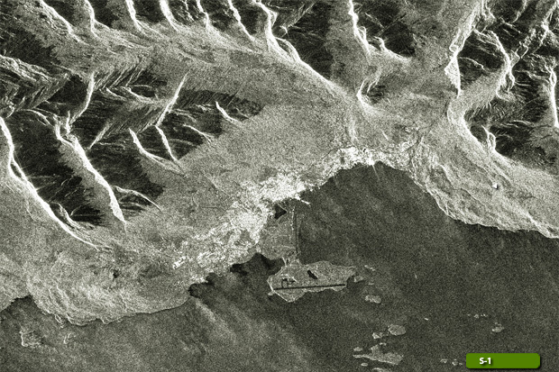 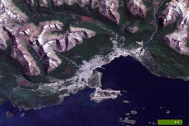 View Sentinel 2 high resolution image (JPG 2.5 MB) View Sentinel 1 high resolution image (JPG 2.7 MB)
|
|||||||||||||||||||