 Saemangeum, South Korea
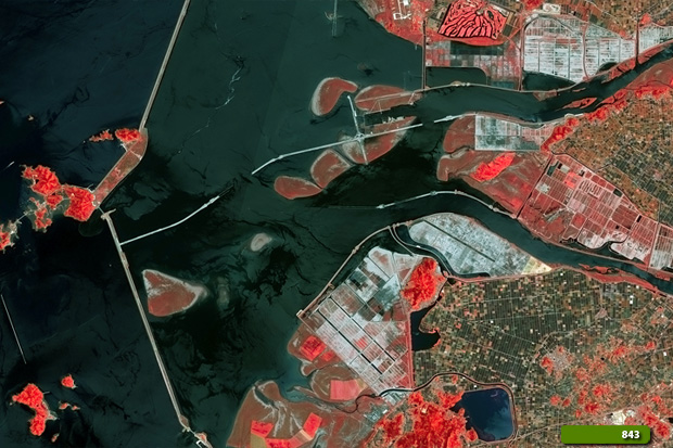
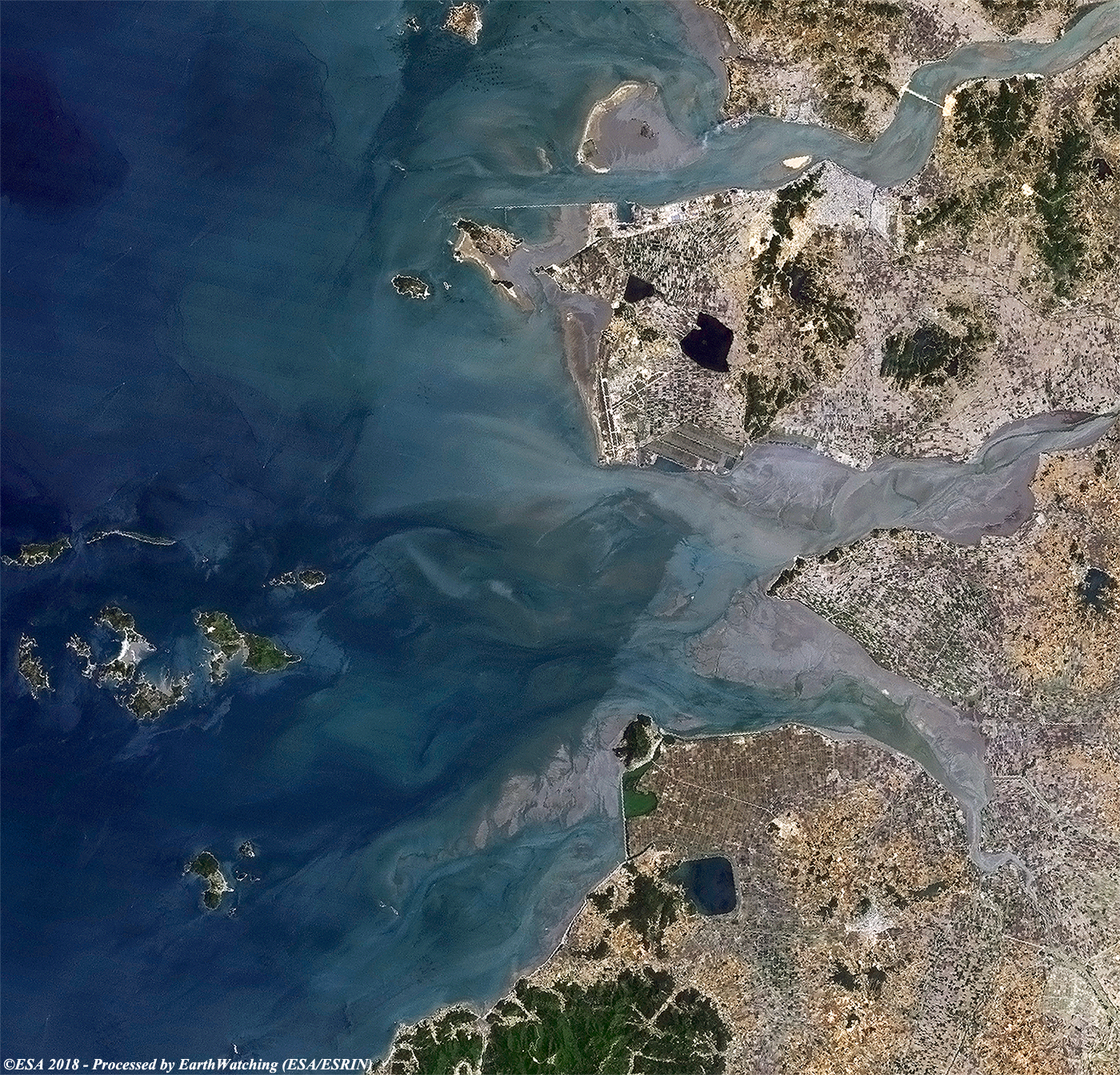
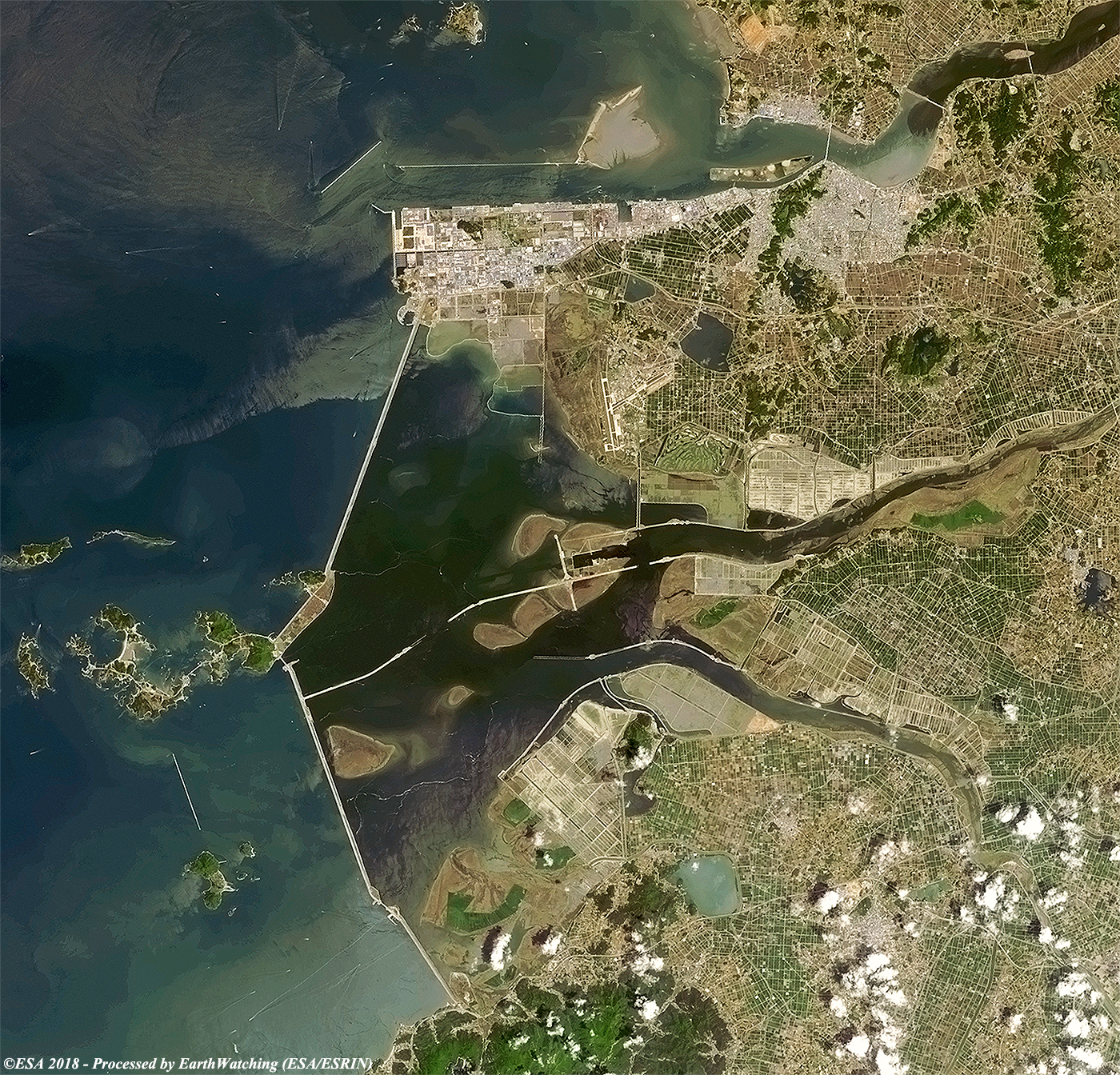
Saemangeum is an estuarine tidal flat on the coast of the Yellow Sea in South Korea. It was dammed by the government of South Korea's Saemangeum Seawall Project, completed in April 27, 2010, after a long fight between the government and environmental activists, and is scheduled to be converted into either agricultural or industrial land. Prior to 2010, it had played an important role as a habitat for migratory birds. The completion of this seawall is likely to be a major contributor to the decline of many species. Around 400,000 shorebirds depended on the Saemangeum estuarine as an important feeding ground on the 24,000 km migration between Asia and Alaska and Russia,inc luding the two endangered waders Nordmann's greenshank and spoon-billed sandpiper (each species with fewer than a thousand surviving birds). A conservation organisation has accused authorities of having failed to monitor the project's impact on local wildlife in a transparent way, and carried out an independent monitoring program in 2006. The Saemangeum lay at the mouths of the Dongjin and Mangyeong Rivers, on the coast of Jeollabuk-do. It is just south of the estuary of the Geum River. Neighboring districts include Gunsan City, Buan County, and Gimje City. The project of filling in the estuary began in 1991, but was slowed by a series of court actions by environmentalists. The completed seawall is some 33 kilometers long, and replaces a coastline that was once more than 100 kilometers long. After the estuary has been completely filled, an area of about 400 km2 (roughly two-thirds the size of Seoul) will have been added to the Korean peninsula, making it one of the biggest land reclamation projects in history.
The estuary was originally called "Mangeum". This name was probably formed from combining the first character of "Mangyeong" and that of "Gimje." Saemanguem was completed on April 27, 2010, officially becoming the longest seawall ever built with the length of 33.9 km, breaking the record of Zuiderzee Works from 1932. On August 2, 2010, Saemanguem was certified by Guinness World Records as the longest man-made sea barrier in the world. Saemangum will be the venue of the 25th World Scout Jamboree, hosted by the Korea Scout Association. More information is available on Wikipedia
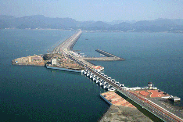
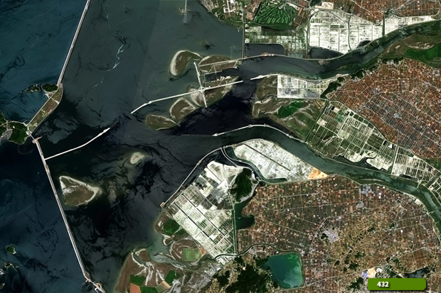
These images acquired by the Landsat-4, Landsat-8 and the Copernicus Sentinel-2 satellite, shows the Saemangeum Seawall in South Korea. The comparisons below use imagery from before and after the construction of artificial islands and the Saemangeum Seawall outside the estuary. The Saemangeum Seawall is located on the southwest coast of the Korean peninsula, and is the world's longest man-made dam, measuring 33 kilometres in length. The dam separates the Yellow Sea and the former Saemangeum estuary. Major development of the area, as well as the creation of the Saemangeum Seawall, is prominent in the Sentinel-2 images which are processed in true and false colour bands to highlight change. Another aim of these images is to promote the opportunity to download Landsat data through the ESA portals (or third party mission free catalogue), where these images are captured every day, and are made available to the users and the scientific community, near real time with the use of the new generation satellites by European Commission (Copernicus Project). Landsat full resolution data products are freely available for immediate download at: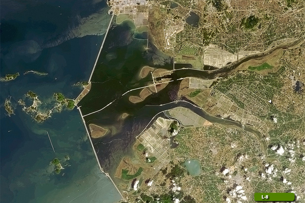 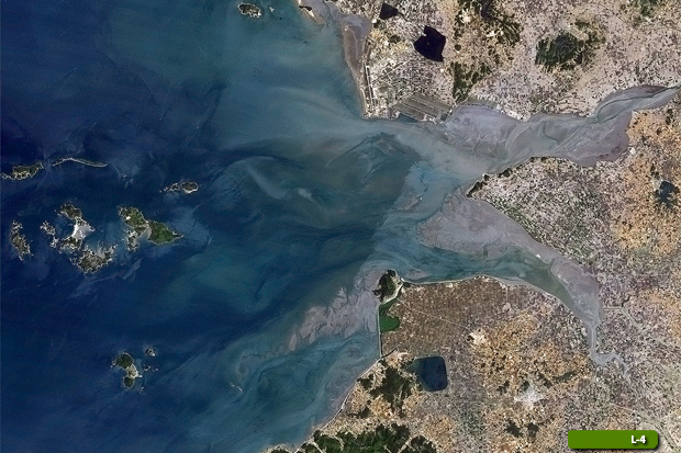 View large format slider in Visible Colour View Landsat 4 TM high resolution image (JPG 2,5 MB) View Landsat 8 OLI high resolution image (JPG 2,7 MB)
  View Sentinel 2 high resolution image in natural color (JPG 8.6 MB) View Sentinel 2 high resolution image in false color (JPG 8.4 MB)
|
|||||||||||||||||||||||||||||||||