 Fires in Sacramento, California
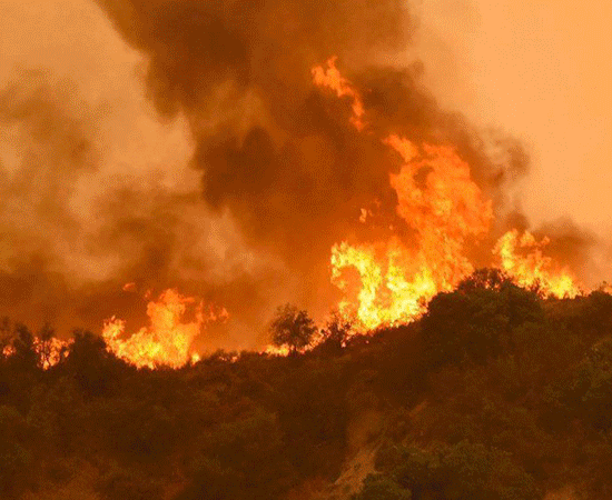
The number of people listed as missing in one of California's deadliest wildfires has surpassed 600, authorities said Thursday, as the remains of seven additional victims were found by rescuers, reported AFP. Butte County Sheriff Kory Honea said the number of missing had more than doubled during the day to 631 as investigators went back and checked emergency calls made when the fire broke out a week ago. "I want you to understand that the chaos we were dealing with was extraordinary" when the fire started, he told journalists, in explaining the staggering new number. The seven additional victims brings to 63 the number of people who have died in the so-called Camp Fire in northern California. At least three other people have died in southern California in another blaze dubbed the Woolsey Fire. President Donald Trump is set to visit California on Saturday to meet with victims of the wildfires believed
More informations are available on the FOCUS Information Agency website.
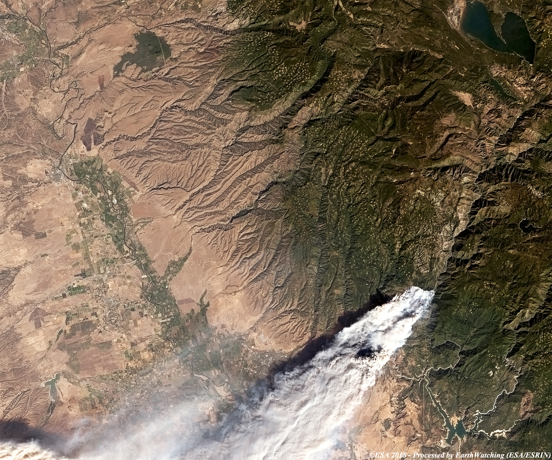
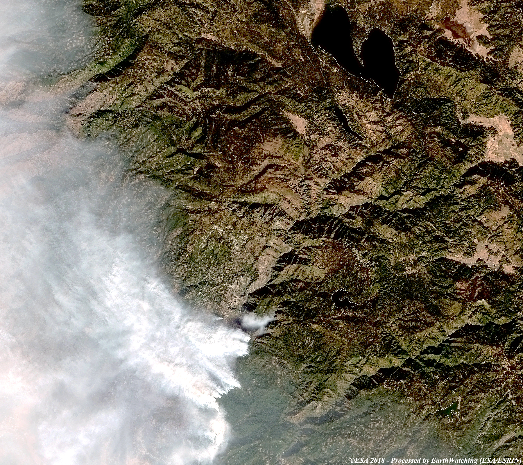
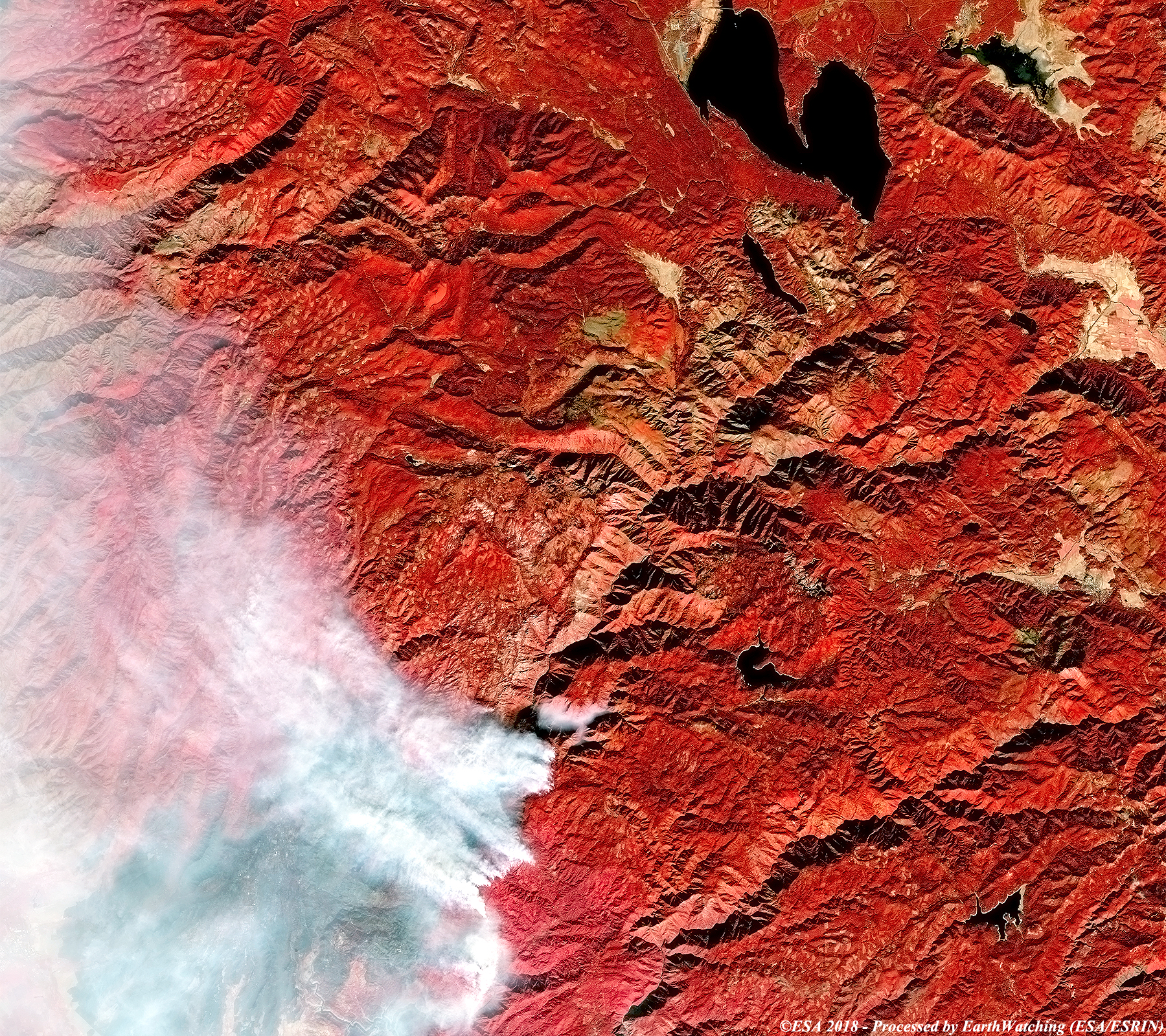
These images acquired by the Landsat 8 OLI and Sentinel-2 satellites show the fires north of Sacremneto over a time period of one week. The Landsat-8 image processed in false color by Landsat 8 highlights the fires intensity. The same area is visible in the image acquired by Sentinel-2, where large columns of smoke can be seen showing the large area destroyed bt the fires. Landsat full resolution data products are freely available for immediate download at: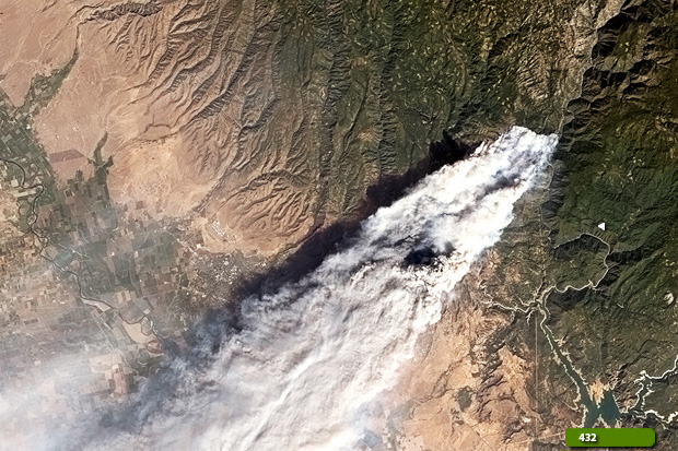 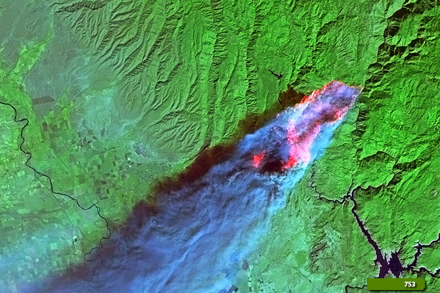 View Landsat 8 OLI high resolution image (natural color) (JPG 3.7 MB) View Landsat 8 OLI high resolution image (false color) (JPG 4.0 MB)
The destruction is emphasised with these images acquired by Sentinel-2. Another aim of these images is to promote the opportunity to download Landsat data through the ESA portals (which is a third party mission), where images captured every day are made available in near real time to users and the scientific community, and the use of the new generation of satellites in the European Commission's Copernicus Sentinels to monitor changes around the world with high resolution. 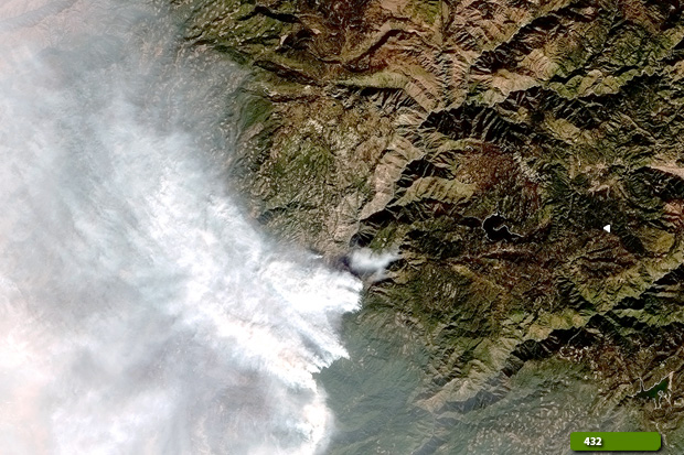 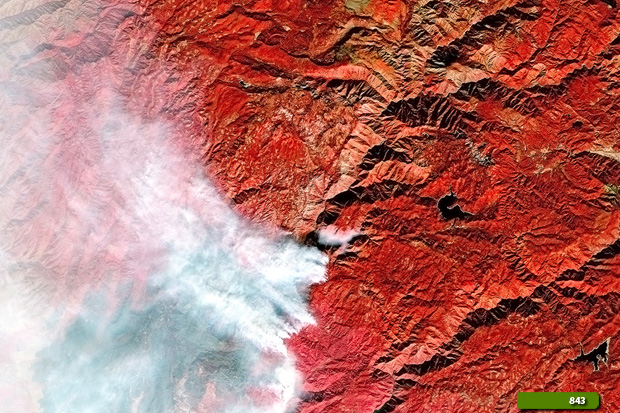 View Sentinel 2 high resolution image (natural color) (JPG 4.3 MB) View Sentinel 2 high resolution image (false color) (JPG 5.0 MB)
|
|||||||||||||||||||||||||||||||||