 Palu, Indonesia
Pal (By AFP - September 30, 2018 @ 7:51am), Indonesia: Nearly 400 people were killed when a powerful quake sent a tsunami barrelling into the Indonesian island of Sulawesi, officials said Saturday, as hospitals struggled to cope with hundreds of injured and rescuers scrambled to reach the stricken region. The national disaster agency put the official death toll so far at 384, all of them in the tsunami-stricken city of Palu, but warned the toll was likely to rise. Some 540 people have been badly injured, it added. There were also concerns over the whereabouts of hundreds of people preparing for a beach festival that had been due to start Friday evening, the disaster agency said. More information is available on the New Straits Times website.

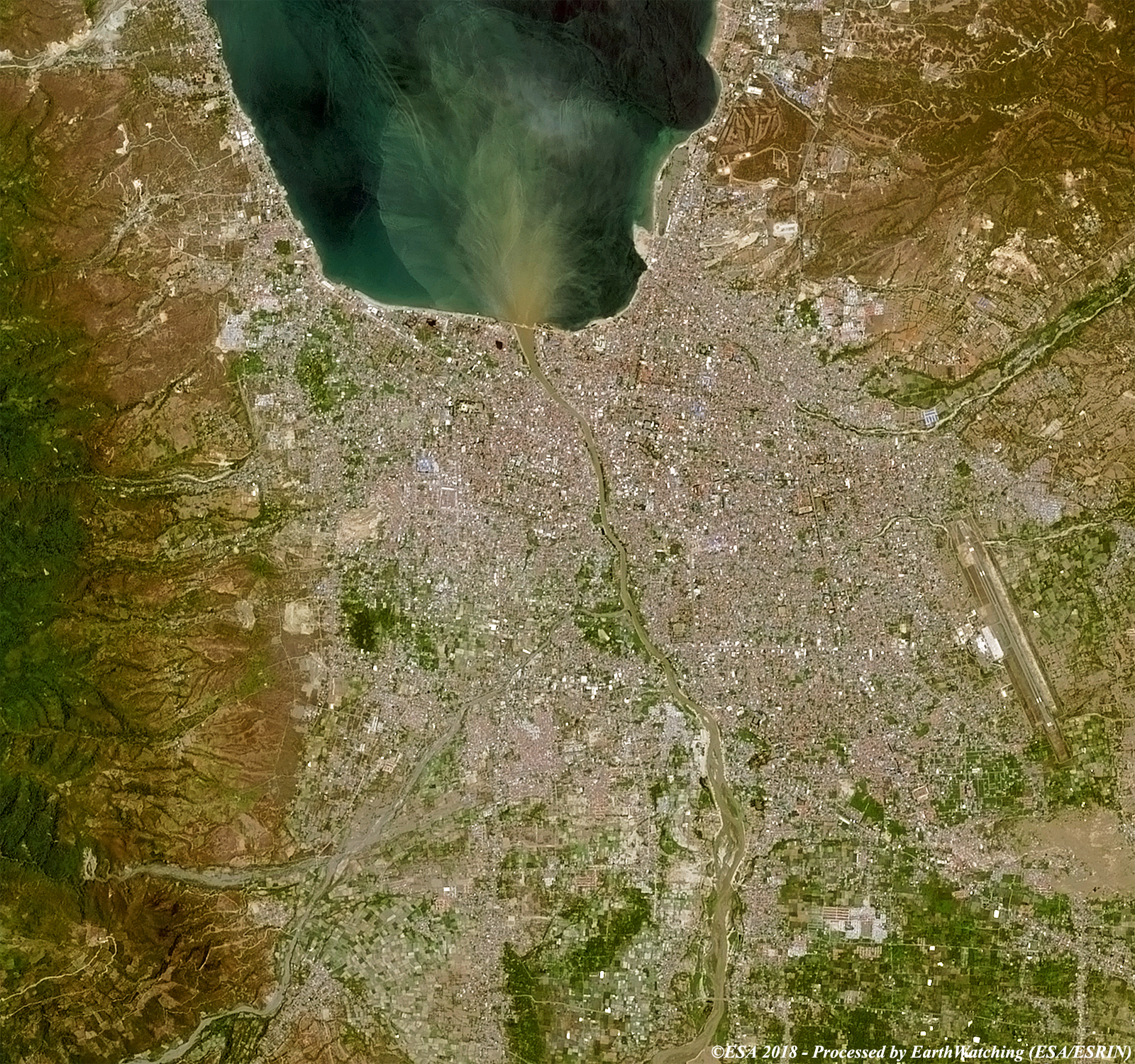
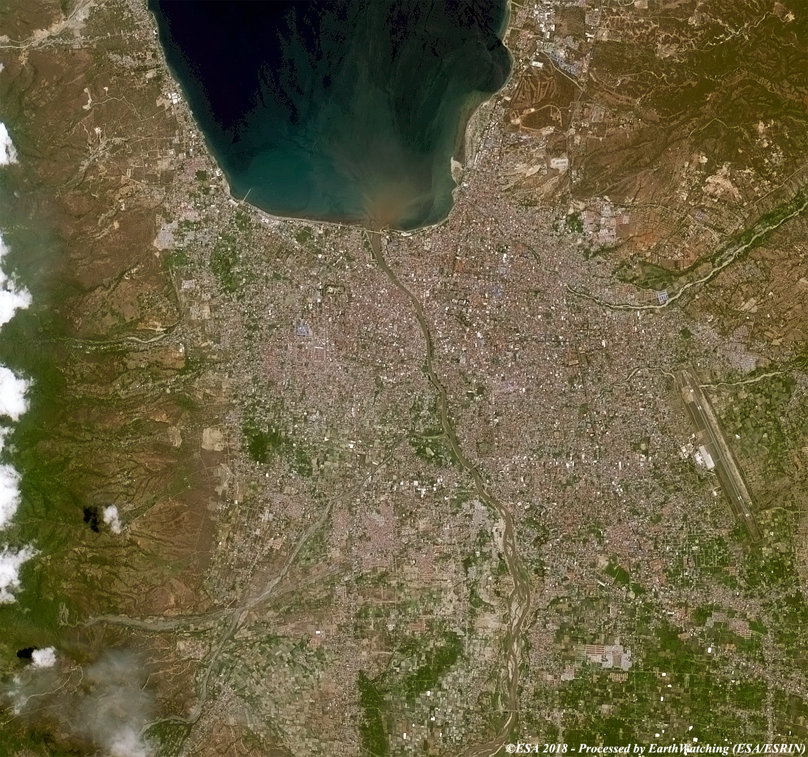
These images acquired by the Copernicus Sentinel-2 satellite, were acquired over the city of Palu, before and after the strong earthquake and tsunami that destroyed parts of the city in September 2018. The data has been processed in false and natural colour to show the damage caused, especially along the coastline. A careful eye, can notice the differences in the delta of the river (especially in the image in false color). Another aim to process these images is to promote to the users and the scientific community, the new generation of the European Commission's Copernicus Sentinel satellites which are capable of monitoring changes around the world with high resolution images. 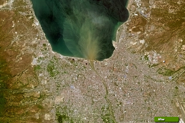 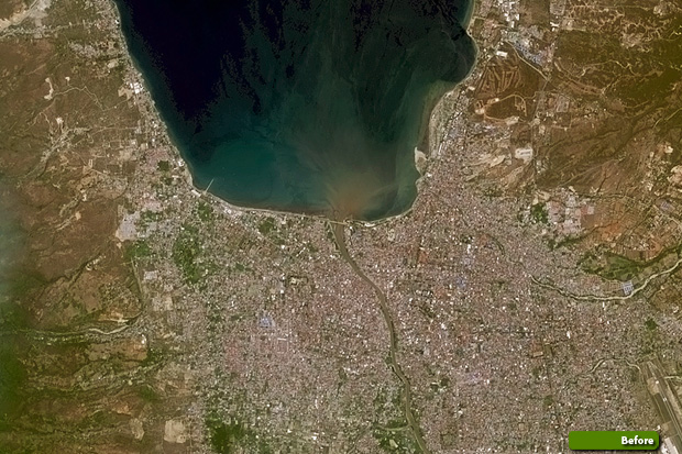 View large format slider in natural colour bands View Sentinel 2 high resolution image (after) (JPG 3.1 MB) View Sentinel 2 high resolution image (before) (JPG 2.9 MB)
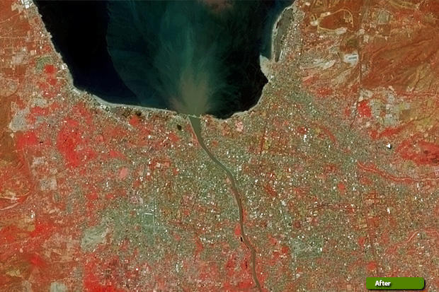 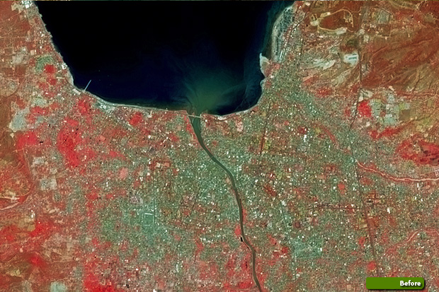 View large format slider in false colour bands View Sentinel 2 high resolution image (after) (JPG 3.1 MB) View Sentinel 2 high resolution image (before) (JPG 3.2 MB)
|
|||||||||||||||||||||||||||||||