 Lisbon, Portugal
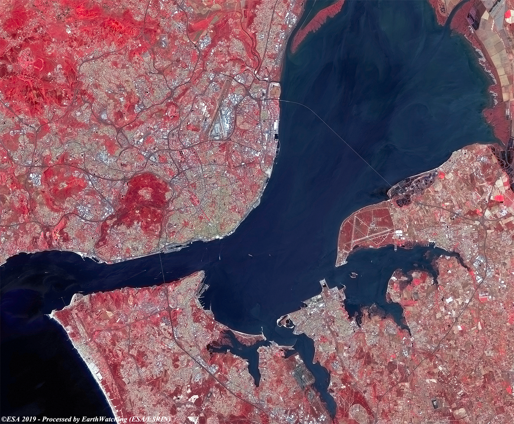
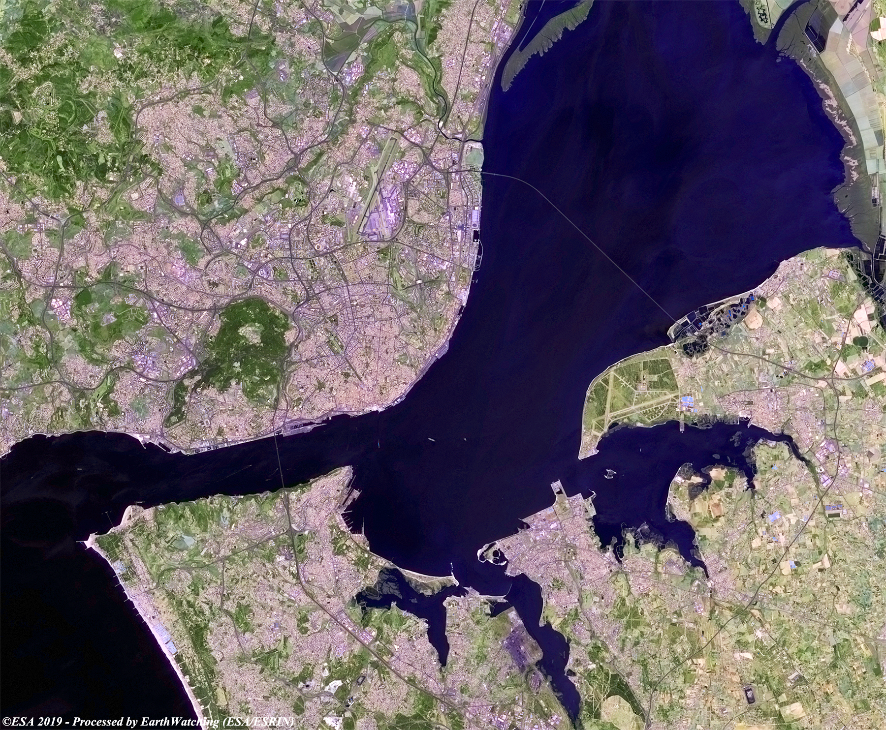
This weeks Sentinel-2 image comparison shows Lisbon, the capital cityof Portugal. Lisbon is located along the Tagus River, with the two banks of the river being connected by two large bridges: the April 25 Bridge, inaugurated in 1966, and the Vasco da Gama bridge, inaugurated in 1998 on the occasion of the Universal Expo '98. Lisbon today is considered a global city, due to its importance in sectors such as finance, commerce, publishing, art, international trade, education and tourism. It is an important economic center, with a growing financial sector and one of the most important ports overlooking the Atlantic Lisbon airport serves around 20 million passengers a year and major roads and highways connect the capital to other Portuguese cities. The city is the seventh most visited in Southern Europe, after Istanbul, Rome, Barcelona, Madrid, Athens and Milan. The image comparison below shows imagery in natural colour (RGB 4,3,2) and in false colour (RGB 12,11,4), where bands with resolution at 40 meters (12,11) are used but resampled at 10 metres, with a view to highlighting urban areas and infrastructure. 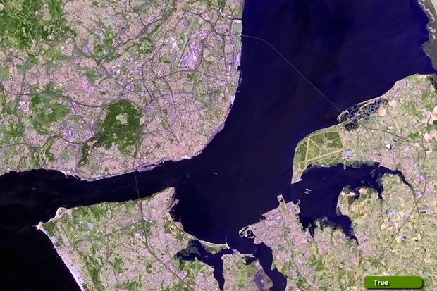 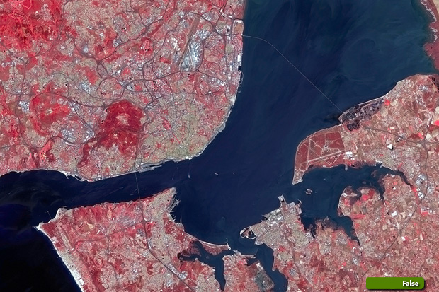 View high resolution image (8,4,3) (JPG 3.2 MB) View high resolution image (12,11,4) (JPG 2.7 MB)
|
||||||||||||||||