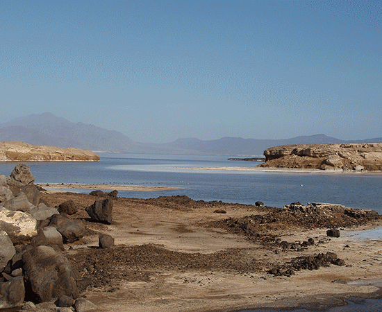
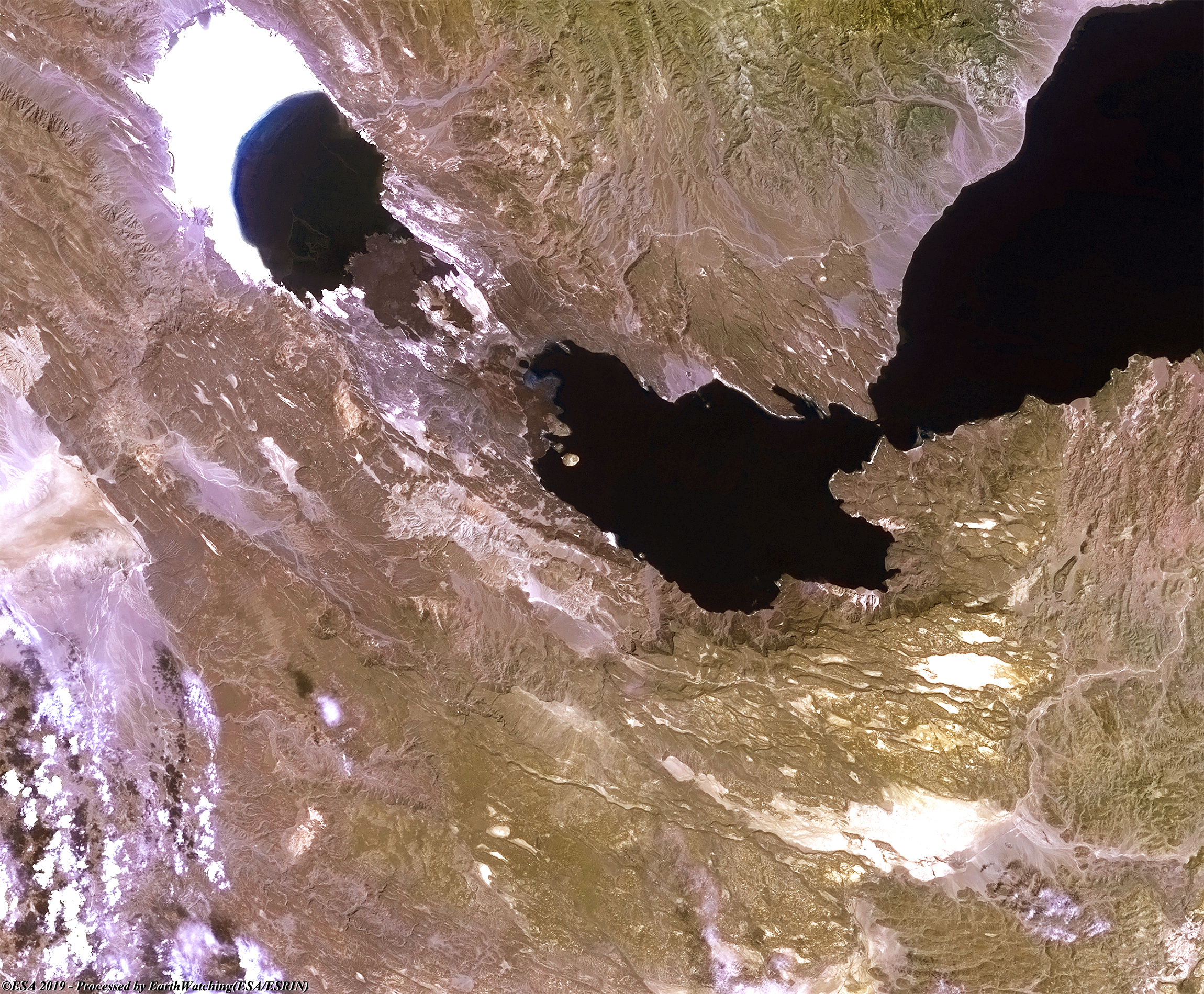
Lake Assal is a crater lake in central-western Djibouti. It is located at the western end of Gulf of Tadjoura in the Tadjoura Region, touching Dikhil Region, at the top of the Great Rift Valley, some 120 km west of Djibouti city. Lake Assal is a saline lake which lies 155 m below sea level in the Afar Triangle, making it the lowest point on land in Africa and the third-lowest point on Earth after the Sea of Galilee and the Dead Sea. No outflow occurs from the lake, and due to high evaporation, the salinity level of its waters is 10 times that of the sea, making it the third most saline body of water in the world behind Don Juan Pond and Gaet'ale Pond. Lake Assal is the world's largest salt reserve, which is exploited under four concessions awarded in 2002 at the southeast end of the lake; the major share of production (nearly 80%) is held by Société d'Exploitation du Lac and Société d'Exploitation du Salt Investment S.A de Djibouti. It is situated approximately 109 kilometres west of the nation's capital Djibouti City.
More information is available on Wikipedia.
|
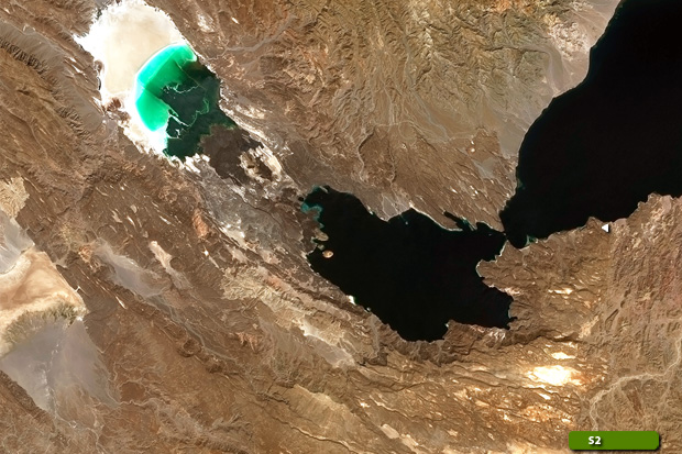
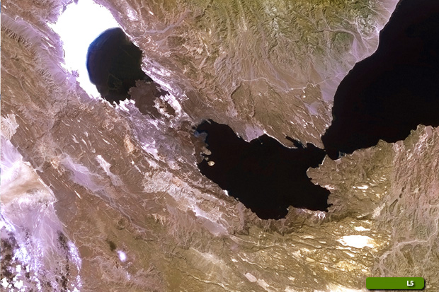
Merge created by Landsat 5 & Sentinel-2 satellite
|
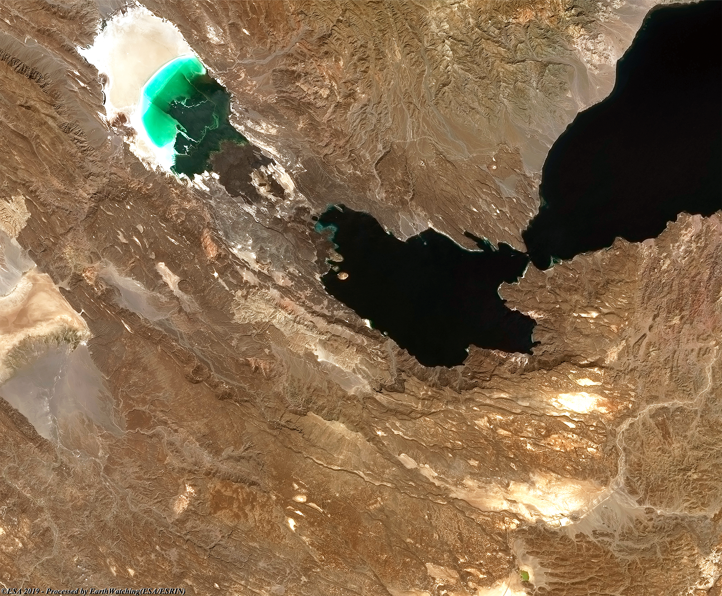
Lake Assal is an atypical lake among the most salty in the world. Located in the lowest depression of the African continent with its 153 meters below sea level and kept in the heart of one of the most inhospitable desert regions, the lake is surrounded by inactive volcanoes and lava sediments of an intense dark black color. A feature of this lake, as shown the images processed through the merging of these images acquired by Sentinel-2 and Landsat 5 satellite, with a time window of 20 years and processed using natural color bands with a resempling data for Landsat from 30 to 10 meters band resolution, shows the particular of this lake to change its color with the variation of light during the day. Its color varies from the blinding white due to the deposit of salt and sodium chloride crystals, to turquoise and emerald green of the shore, the blue and the light blue of the deepest waters with their gradual nuances.
View large format slider
View Sentinel-2 high resolution image (JPG 5.6 MB)
View landsat 5 high resolution image (JPG 5.4 MB)
|
Technical Information of original image |
|
Product: |
Geo Tiff format |
|
Satellite/Sensor: |
Sentinel-2 & Landsat 5 |
|
Resolution: |
10 metres (original data) & 30 metres (with a resampling data to 10 metres) |
|
Acq. Date: |
22 Nov 2018 & 23 Oct 1998 |
|
Band Combination used to create this image: |
4, 3, 2 & 3,2,1 (Natural color) R-G-B bands |
Back to top
 Lake Assal, Djibouti