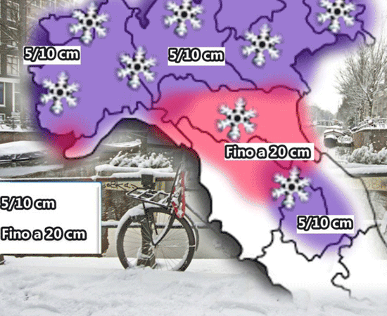
 Snow in Italy
The buriàn or in Russian buran, is a wind of cold air, sometimes very strong, characteristic of the steppes of the Sarmatic plain, west of the Urals. It comes from N-NE and is caused by a depression that upsets the anticyclonic conditions typical of the area. It is often accompanied by blizzards of frozen snow during which the flakes fallen to the ground are lifted again and, mingling with the falling snow, almost zero visibility (blizzard); in this case it takes the name of nypra purga. Sometimes the so called diamond dust is formed due to the strong cold that freezes the pre-existing moisture. The buran frequently goes to Asia, beyond the Urals, to Xinjiang; it rarely reaches lower latitudes and arrives in Italy following oriental trajectories, bypassing the Alpine chain and therefore not turning into a favonio (which in any case is cold, due to a rather varied isobaric configuration, in any case the adiabatic heating del Föhn does not cause large thermal losses). In these cases substantial and sudden thermal collapses occur. This wind gave its name to the Soviet space shuttle Buran. It is because of this icy current, which usually limits itself to expire inside the Siberian territory, that some cold waves, due to the consequent irruption of the Russian-Siberian anticyclone in Europe, have hit many European countries hard in recent decades, including Italy. This happened several times during the twentieth century, particularly February 1929, January and February 1947, February 1956, January 1963, January 1979, March 1987 and December 1996; the 21st century burans in western Europe were the cold wave of February 2012, January 2017 and February 2018.
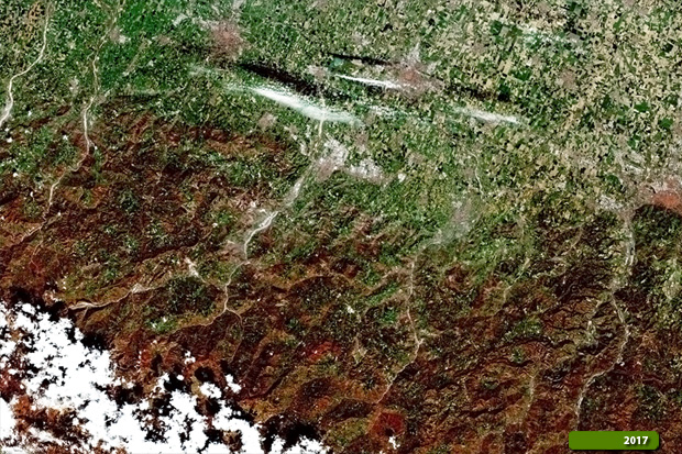
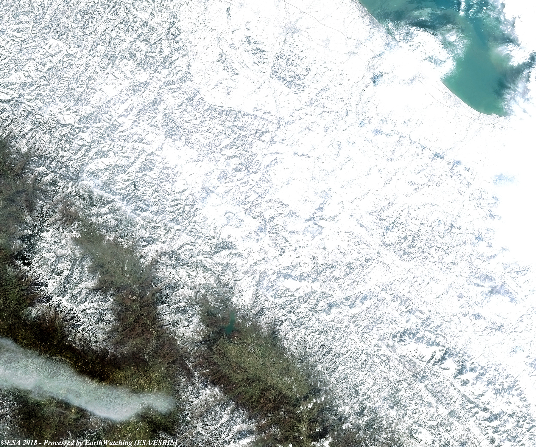
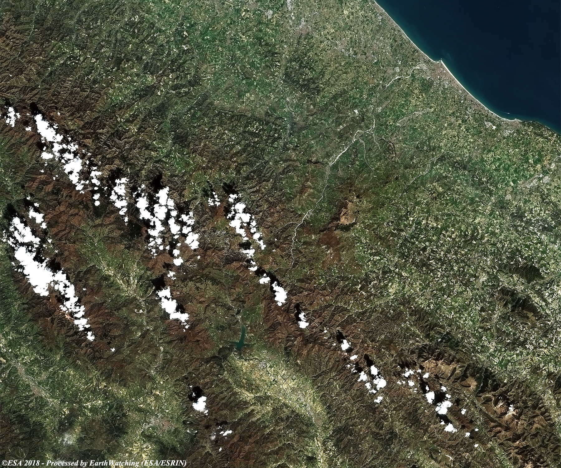
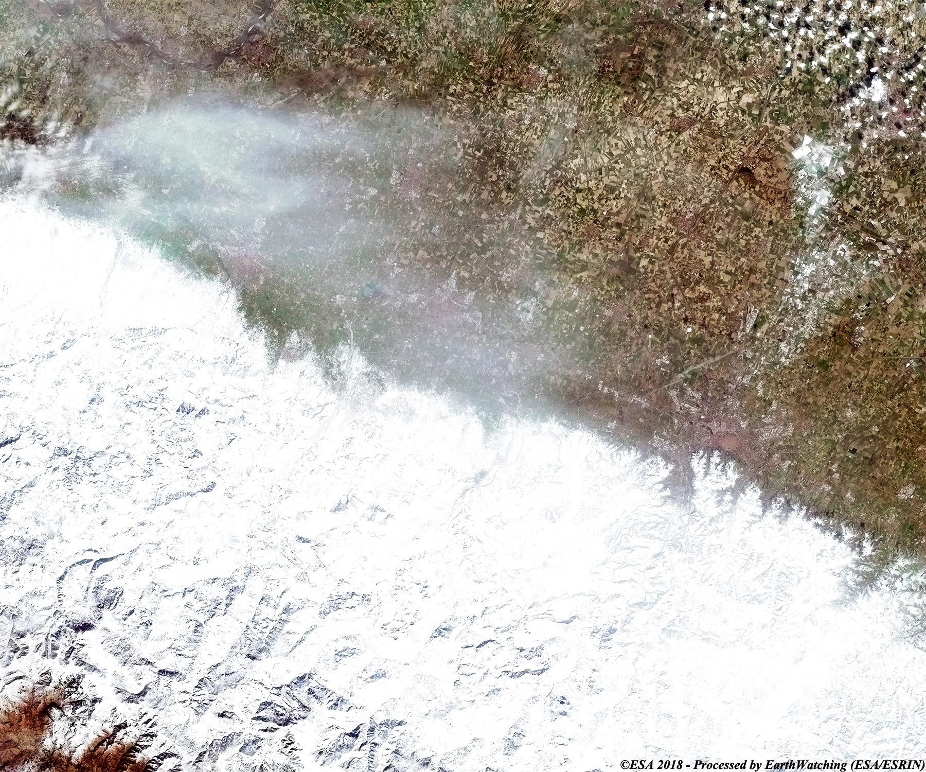
These image comparisons, acquired by the Sentinel-2 optical mission over the Italian peninsula, illustrate the Burian effect; in particular along the Adriatic coast and Emilia Romagna (Rimini - San Marino) and along the Apennines (Bologna - Arezzo), in a time window of one year. These areas were completely covered by snow in February 2018. It was an exceptional snowfall and a similar situation occurred back in 2012 and 1986. For comparison, the images acquired last year show the beginnings of Spring, as the region had not experienced any snow. With this demonstration of images taken by Sentinel-2, we aim to show the large field of application that the Copernicus Sentinel satellite family can cover. 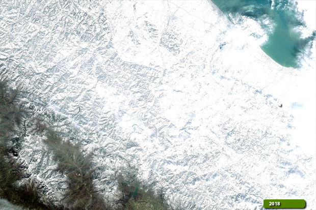 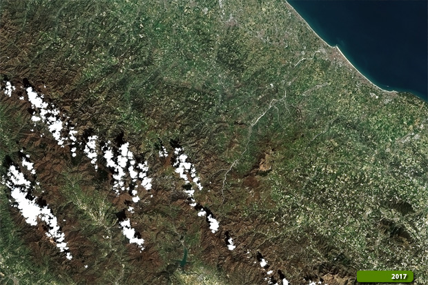 View large format slider over the areas: Arezzo / San Marino View Sentinel 2 high resolution image after (JPG 2.8 MB) View Sentinel 2 high resolution image before (JPG 3.5 MB)
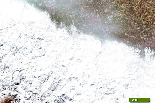  View large format slider over the area over Bologna View Sentinel 2 high resolution image after (JPG 2.5 MB) View Sentinel 2 high resolution image before (JPG 4.0 MB)
|
|||||||||||||||||||