 Easter Island
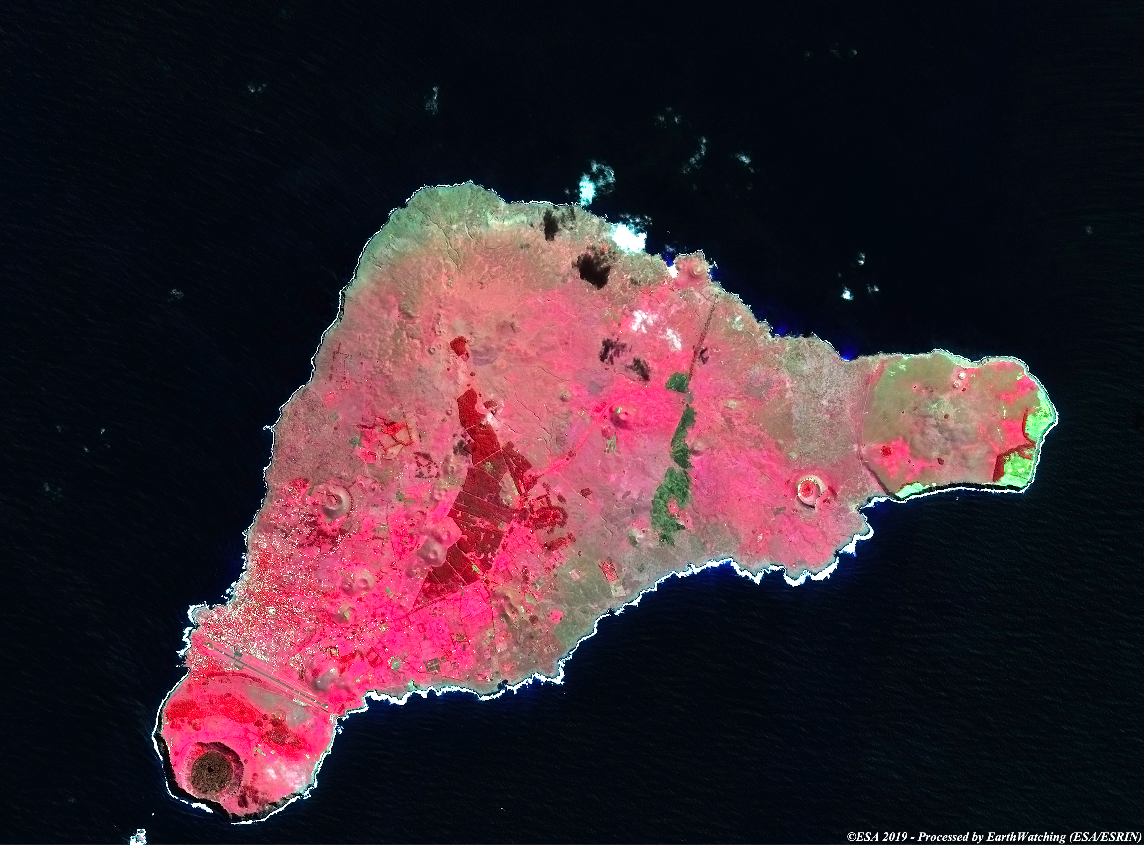
Easter Island is a small island in the southeastern Pacific Ocean that belongs to Chile. The island is one of the most isolated places in the world, at the southeastern most point of the Polynesian Triangle in Oceania. The island's triangular shape is formed by three extinct volcanoes, the Poike, the Rano Kau and the Terevaka (the highest mountain on the island). With its rocky coasts overlooking the ocean, only a few spots have a beach, while its interior is very barren and undulating. This island is also known by the indigenous name of Rapa Nui. It was discovered on Easter Day 1722 by the Dutch explorer Jacob Roggeveen.
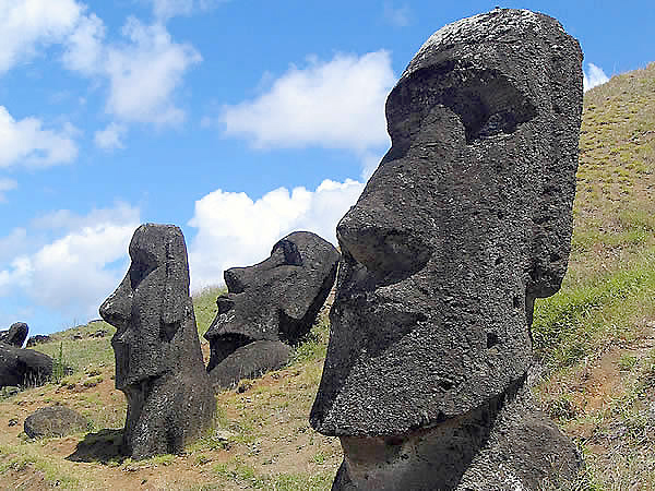
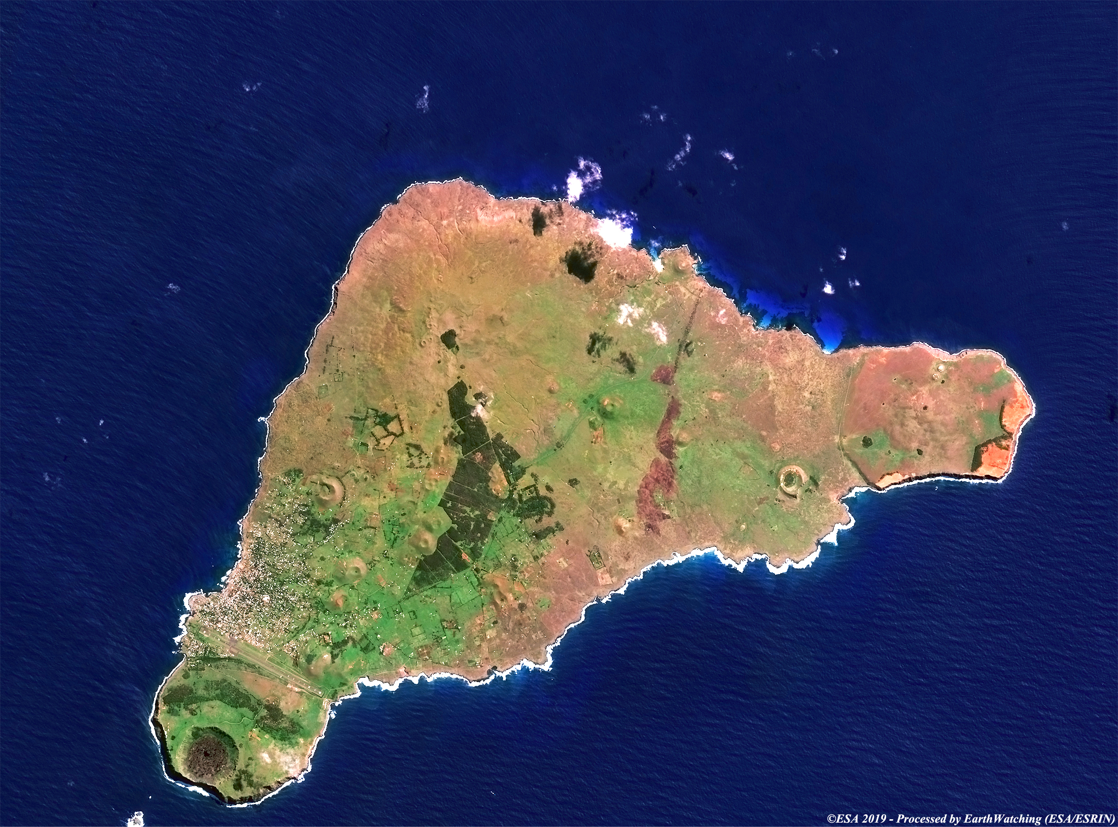
This comparison of images, acquired by Sentinel-2 (optical Sensor), over Easter Island, shows the different results obtained with the multispectral bands Sentinel-2 offers. The island is world famous for its enigmatic stone statues of volcanic nature called Moai. In 1995, UNESCO named Easter Island a World Heritage Site, with much of the island protected within Rapa Nui National Park. About 100 statues still stand on the island; they vary in height from 3 to 12 m. Carved from tuff, a soft volcanic rock, they consist of huge heads with elongated ears and noses. Material for the statues was quarried from the Rano Raraku crater, where modern explorers found an immense unfinished statue, 21 m (68 ft) long. Many of the statues on the burial platforms bore cylindrical, brimmed crowns of red tuff; the largest crown weighs approximately 27 tonnes. With this demonstration of images taken by the Sentinel-2 (optical sensor instruments), we aim to show the large field of application that the Copernicus Sentinel satellite family can cover. 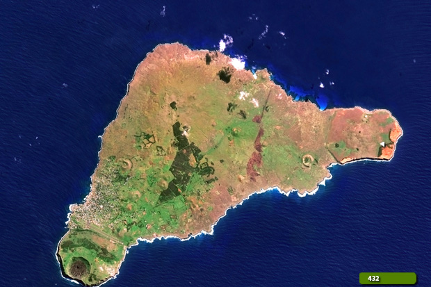 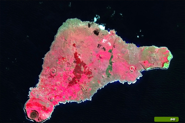 View Sentinel-2 high resolution image in natural colour (JPG 3.2 MB) View Sentinel-2 high resolution image in false colour (JPG 2.7 MB)
|
|||||||||||||||||||