 Djibouti City
Djibouti city lies in north-east Africa, and is capital of the Republic of Djibouti. The city is a port on an inlet of the Gulf of Aden and is the terminus of a rail link to Addis Ababa, Ethiopia. Much of the city's economy is based on the export of Ethiopian products, and on servicing and refuelling Red Sea shipping traffic. The principal exports of Djibouti are coffee, hides, and salt. Djibouti became the capital of French Somaliland in 1892, and of the Republic of Djibouti upon the country's independence from France in 1977.
The aim of this image comparison, is to show how the city has developed during the 20 years between the imagery. In the north, expansion of the port area can be seen and in the south-west area, where there is a platform for container service, just as the new DMP (Doraleh Multi-purpose Port) built at west along the coast. These new storage areas are a consequence of Djibouti exploiting its strategic position as a hub between the Red Sea and the Gulf of Aden, which makes the country an important center of commercial traffic. This commercial transit activity is mainly carried out in the port of Djibouti, which is the economic heart of the country. The port is also an important fuel and transshipment center for ships. 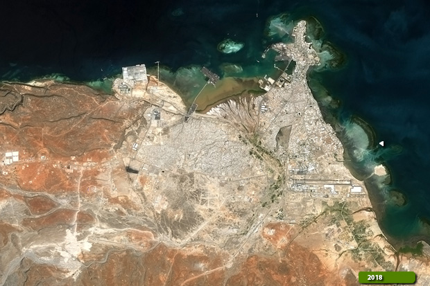 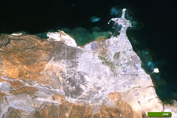 View Sentinel-2 high resolution image (JPG 3.0 MB) View Landsat-5 high resolution image (JPG 3.1 MB)
|
||||||||||||||||