 Venice, Italy - 2004
 View large format jpeg (245 kb)
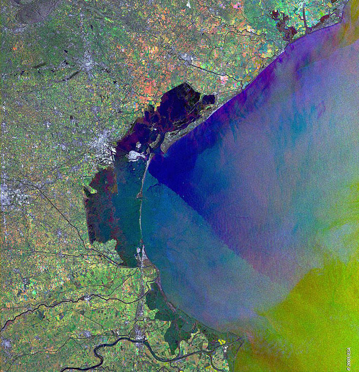
Venice Italy This Synthetic Aperture Radar (SAR) multitemporal colour composite image is centred over the city of Venice, located in northeast Italy. The city stretches across numerous small islands in a marshy lagoon between the mouths of the Po (south) and the Piave (north) rivers, along the Adriatic Sea. The image shows that the coast along the northern Adriatic Sea is low and sandy, bordered by shallow waters and the various coloured patches scattered throughout the image indicating cultivated agricultural fields. Visible is also the causeway (4 km long) for road and rail traffic, connecting Venice to the mainland. The image is made of three ERS-2 SAR PRI (Precision Radar Image) images acquired on different dates and assigning a colour (RGB) to each date of acquisition. Technical Information:
Coordinates:
NE Lat/Long: N 45.70 / E 13.24 |
||