 The Gulf of Taranto, Italy - 2002
 View large format Jpeg (237 Kb)
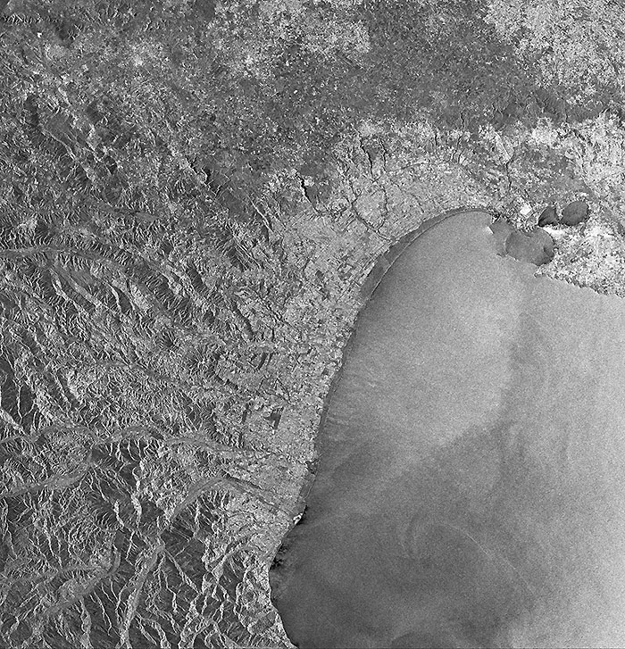
The Gulf of Taranto, Italy The relatively shallow waters of this bay, situated in the Ionian Sea, yield large numbers of mussels and oysters. Top right corner of image, on the western side of the "heel" of the Italian boot: the city of Taranto, the old "Tarentum", called Taras by the Greeks, founded in 707 B.C. by some Spartans. The ancient city was situated on an island, joined by two bridges with the mainland, where the new city is built. The two islets of S. Pietro and S. Paolo protect Taranto Bay (Mar grande) and the commercial port, while the old city forms another bay (Mar piccolo), a military port next in strategic importance to La Spezia. Coast and islets are therefore strongly fortified. The fishing industry flourishes in Mar piccolo. Taranto has a large export trade and extensive works connected with the construction of warships. In Taranto's hinterland: intensely cultivated marine terraces. Centre image: along the coast, rocky tracts but also large beaches, among which, Metaponto and Scanzano that include the mouths of a series of rivers and torrents. Three different regions build in part, the contents of this image: Puglia (on top), Basilicata (in the middle) and Calabria (to the South). To the left: the Appennino Lucano mountain range. Top left corner: Matera (Basilicata), where the Italian ERS Processing and Archiving Facilities (PAF), as well as the Envisat Processing and Archiving Centre (PAC), are located. Coordinates:
NW Lat/Long: N 41.00/ W 17.41 |
||