 San Francisco 2004
 View large format jpeg (408 kb)
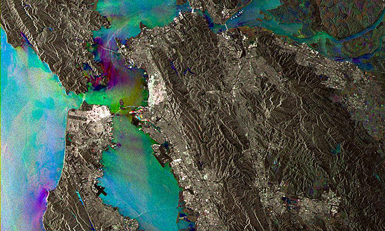
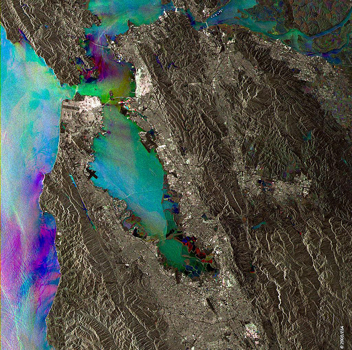
San Francisco This Synthetic Aperture Radar (SAR) multitemporal colour composite image shows the city of San Francisco, California, and its bay. San Francisco lies right on the northern tip of the San Francisco Peninsula, where the bay opens into the Pacific Ocean. The Bay Bridge joins the city to Oakland, on the eastern side, whereas the Golden Gate Bridge connects San Francisco and a portion of the south-facing Marin County headlands near the small bayside town of Sausalito. Another important bridge is the San Mateo Hayward Bridge, streching for 8 Miles (13 km) from San Mateo to the west to Hayward, 10 km to the south of Oakland. To the south of the Golden Gate is the Presidio National Park, clearly visible as the dark area in the northern part of San Francisco. The Golden Gate Park lies further south and can be spotted as the black W-E trending rectangle facing the ocean. The black thick cross to the south of the city is the San Francisco International Airport, better known as SFO, its IATA (International Air Transport Association) acronym. The Golden Gate is one of the most famous suspension bridge in the world, is 1.22 miles (1970 m] long and the distance between the towers ("main span") is 4200 feet (1280 m), and their height is 746 feet (230 m) above the water. San Francisco lies on one of the most seismic area on our planet. A Magnitude 7.9 (Moment Magnitude Scale) earthquake hit the city on April 18, 1906, which was almost completely destroyed by subsequent fires. The image is made of three ERS-2 SAR PRI (Precision Radar Image) images acquired on different dates, in which a different colour (RGB) was assigned to each date of acquisition. Technical Information:
Coordinates:
NE Lat/Long: N 38.11 / W 121.41 |
||