 Paris, France - 2004
 View large format Jpeg (249 Kb)
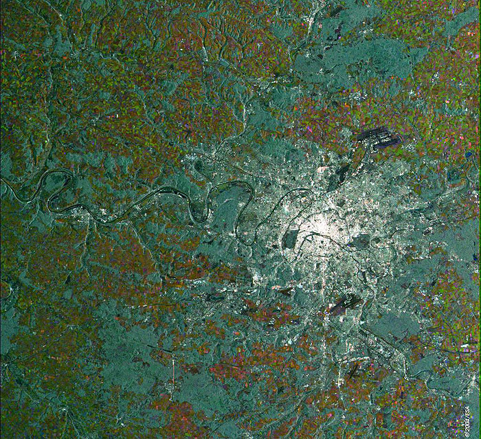
Paris, France This ERS-2 Synthetic Aperture Radar (SAR) multitemporal colour composite image is centred over Paris, the capital of France (seen as a large bright area centre image), and most of the Ile de France area. Visible major landmarks of the image are: the Seine River that flows from the bottom right, through the city and continues onward to the English Channel, the Peripherique (City Ring road); outside the Peripherique, the Bois de Boulogne to the west and the Bois de Vincennes to the east. Wooded areas ("bois") are visible as grey patches as well throughout the image. Also to the west of the city, just south of the second loop of the Seine after it leaves the city flowing northward, the Grand Canal of the Chateau of Versailles can be seen as a black cross shape, just west of the small airport of Velizy-Villacoublay. The black runways of the city's major airports, Charles De Gaulle in the north and Orly International in the south, are also visible. The colourful patches are agricultural fields, mostly wheatfields. The image is made of three ERS-2 SAR PRI (Precision Radar Image) images acquired on different dates and assigning a colour (RGB) to each date of acquisition. Technical Information:
Coordinates:
NE Lat/Long: N 49.14 / E 02.54 |
||