 Naples, Italy - 2004
 View large format Jpeg (318 Kb)
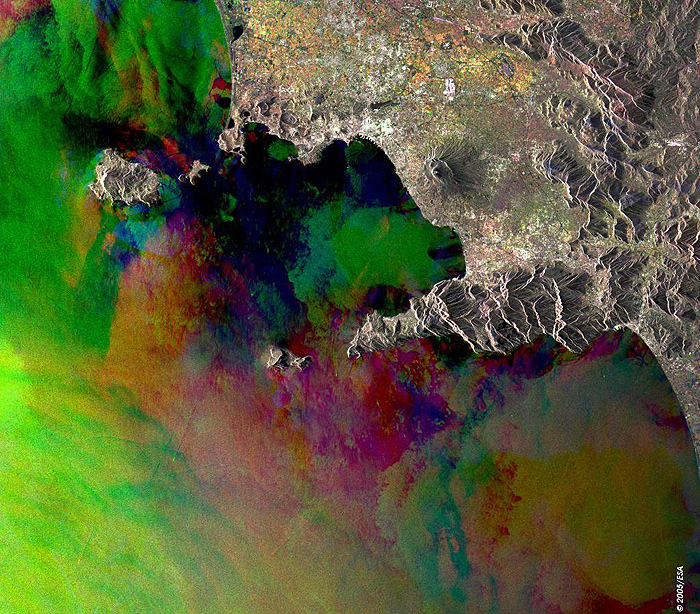
Naples, Italy This Synthetic Aperture Radar (SAR) multitemporal colour composite image is centred over the area of Naples, located in the southern part of Italy in the region of Campania. The image illustrates: the city of Naples (large bright area) seated on the northern edge of the Bay of Naples, the volcano Mount Vesuvius is to the southeast, the islands of Ischia and Procida are to the west and the island of Capri is southwest, to the southeast is Salerno and the Gulf of Salerno. The different colours in the bay areas indicate wind causing sea surface roughness on the date of acquisition. The various colour patches to the north of the city of Naples are cultivated agricultural fields. The image is made of three ERS-2 SAR PRI (Precision Radar Image) images acquired on different dates and assigning a colour (RGB) to each date of acquisition. Technical Information:
Coordinates:
NE Lat/Long: N 41.16 / E 14.75 |
||