 Moscow, Russia - 2004
 View large format jpeg (320 kb)
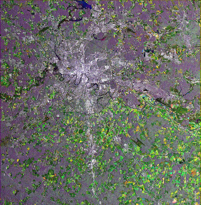
Moscow, Russia This Synthetic Aperture Radar (SAR) multitemporal colour composite image centres over Moscow, the capital of Russia. The city can be easily spotted as the large bright area at the centre of the image. The river Moskva, also known as the Moscow River, flows through Moscow from North West to South East with its characteristic winding pattern. Moscow was the capital of the former Soviet Union and of Muscovite Russia, the pre-Imperial Russia. The border between Europe and Asia runs down the west side of the Ural Mountains, 1300km east of Moscow. The many multicoloured patches throughout the image represent cultivated agricultural fields. By contrast, the grey-coloured patches illustrate a landscape that is primarily a rolling plain and is heavily forested. The blue patch to the north of the city is the Uchinskoye Reservoir, which feeds a powerful hydroelectric station supplying energy to most parts of Moscow. The black "H" shape southeast of the city is the Domodedovo Airport, one of Moscow’s five airports. Sheremetevo-2 is to the northwest. The image is made of three ERS-2 SAR PRI (Precision Radar Image) images acquired on different dates. A RGB colour was assigned to each date of acquisition. Technical Information:
Coordinates:
NE Lat/Long: N 55.93 / E 38.63 |
||