 Highlands, Scotland - 2002
 View large format Jpeg (234 Kb)
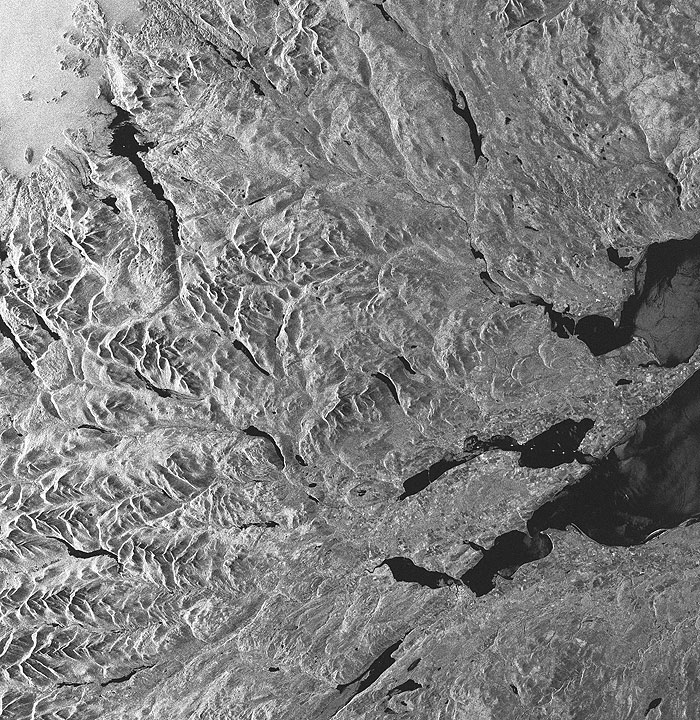
Highlands, Scotland The ERS SAR image shows the central part of the Scottish Highlands between the North Sea and the North Minch, belonging to the Atlantic Ocean. Between these two extremes the North-West Highlands are stretched out. They include different well-distinguishable types of morphology, especially comparing the southwestern and the northern part of the image. The heather vegetation of the higher section of this landscape appears brighter, mainly because of the bog-type structure of the soil and their high water content. The valley bottoms are usually used as pasture and appear darker, as expected. To the east the A9 highway crosses the scene. Its three bridges are best visible (enlargements). The northernmost crosses the Dornoch Firth near Clashmore.
Further south the Moray Firth is imaged with a series of ships and moored structures visible as bright points. Inverness is discernable south of the image centre (enlargement). Here too, the highway bridge is clearly seen. In the upper left corner, the area around Loch Broom is present. The bright appearance of the sea is not only due to the roughness, i.e. of high winds, but is mainly due to the steep incidence angle of the radar - at near range location. In contrast to this the waters of the inner part of the Firth are smooth and therefore dark, independent from the incidence angle. Coordinates:
NE Lat/Long: N 57.12/ W 02.53 |
||