 Havana, Cuba - 1999
 View large format jpg (213 Kb)
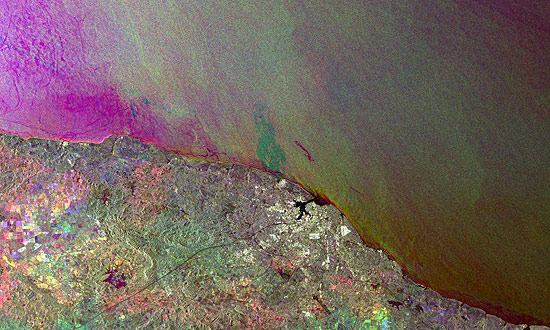
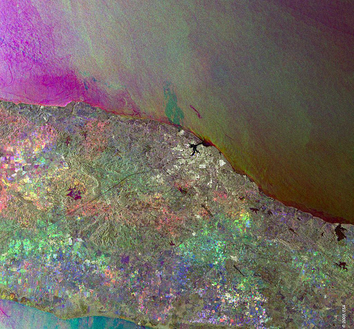
Havana Cuba This Synthetic Aperture Radar (SAR) multitemporal colour composite image is centred over the city of Havana, Cuba (bright area centre image). The image shows a landscape consisting mostly of flat to rolling plains and hills to the south of Havana. Visible also to the north are the Straits of Florida and the greater North Atlantic Ocean, to the northwest is the Gulf of Mexico, to the south is the Caribbean Sea. The various colour patches sparse throughout the image are cultivated agricultural fields. The circular coloured patterns in the central southern part of the island are irrigated fields. The image is made of three ERS-2 SAR PRI (Precision Radar Image) images acquired on different dates and assigning a colour (RGB) to each date of acquisition. Technical Information:
Coordinates:
NE Lat/Long: N 23.18 / W 81.41 |
||