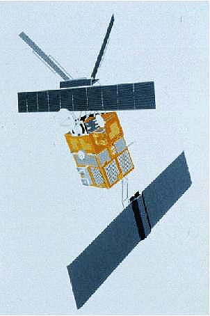
The ERS-2 satellite was launched on 21 April 1995, as a successor to the ERS-1 satellite. ERS-2 has now been successfully operational for ten years, and the following features highlight some of the applications the mission has been utilised for, as well as some technical details of the satellite.
|
Preliminary results of change detection analysis over the region of Banda Aceh (North-West Sumatra) following the tsunami, using ASAR and SAR |
A change detection analysis between ASAR data acquired after the tsunami (ASAR IS2 orb: 15188 25/01/2005) and ERS-2 SAR data acquired before the tsunami (ERS-2 orb: 39537 12/11/2002) reveals severe changes on the North-Western coast and close to the city of Banda Aceh. The following colour composites show (bright green) objects with a strong radar signature before the tsunami which are no longer detected by the radar instrument after the tsunami event. These radar-detected changes show a high degree of correlation with damaged areas identified on mapsheets produced by RESPOND (GMES): destroyed or silted-up infrastructures, suburbs, buildings...
The SAR and ASAR data used for this preliminary analysis will be part of a data package that shall soon be made available for free by ESA to the Scientific Community.
|
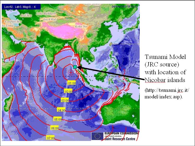
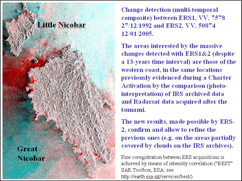
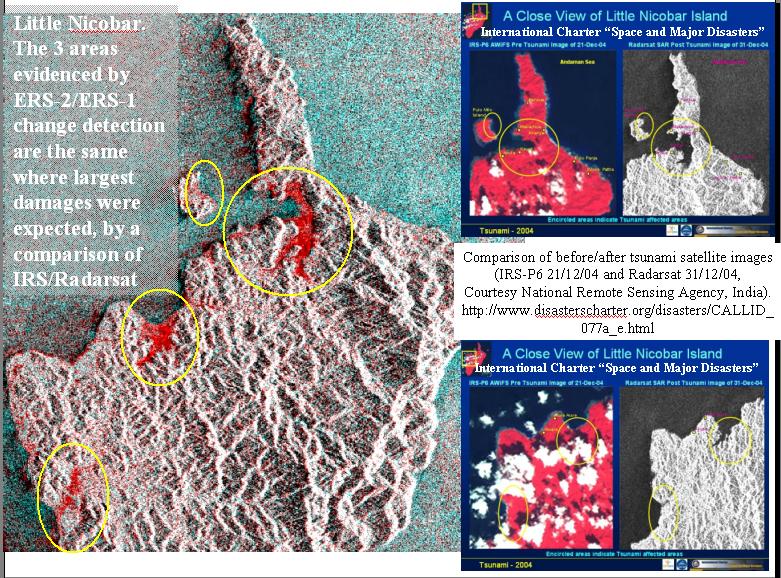
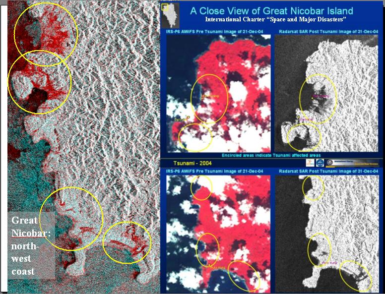
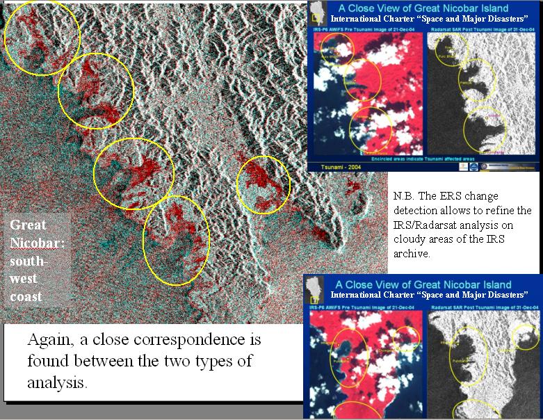
Tsunami damage: ERS-2 change detection over Nicobar Islands |
A quick analysis of radiometric change between ERS-2 (acquired in January 2005) and ERS-1 archive on the islands of Little and Great Nicobar (Northern Sumatra) reveals large changes on the western coast (as expected, given the tsunami wave propagation), exactly on the same locations evidenced by a comparison (by photo-interpretation) of IRS (optical archive) & Radarsat (SAR post-event acquisitions) performed in a Charter Activation. These new results were obtained in the preparation of a scientific data package of ASAR and SAR data that will soon be made available by ESA for free to the scientific community.
Largely identical to ERS-1. The platform is based on the design developed for the French SPOT satellite.
Payload electronics accommodated in a box-shaped housing on the platform; antennas fitted to a bearing structure.
AMI - Active Microwave Instrument consisting of a Synthetic Aperture Radar (SAR) and a wind scatterometer (both in the C-band).
RA - Radar Altimeter: takes precise measurements of the distance from the ocean surface and of wave heights.
ATSR - Along-Track Scanning Radiometer (operating in the infrared and visible ranges): measures sea surface temperatures and the vegetation cover of land surfaces.
GOME - Global Ozone Monitoring Experiment, an absorption spectrometer which measures the presence of ozone, trace gases and aerosols in the stratosphere and troposphere.
MS - Microwave Sounder: supplies data on atmospheric humidity.
PRARE - Precise Range And range Rate Equipment: ERS orbit and trajectory determination.
LRR - Laser Reflector: determines satellite position using ground-based laser stations.
IDHT - Instrument Data Handling and Transmission: temporary on-board data storage by means of two 6.5 GBit tape recorders, equivalent to the data volume acquired in one orbit. Recording, formatting and transmission of data at 105 Mbit/s (transmission of SAR imaging data in real time), or 15 Mbit/s (transfer from tape recorder).
Overall height: 11.8 m
Solar generator: 11.7 x 2.4 m
SAR antenna: 10 x 1 m
Total mass: 2516 kg
Back to top
 ERS-2 - Ten years in orbit (1995-2005)