 El Salvador - 2001
 View large format jpeg (250 kb)
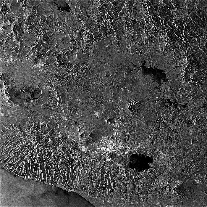
El Salvador, Central America The image shows a great part of the Republic of El Salvador. It is the only country in Central America facing the Pacific Ocean (see bottom left) that does not border the Atlantic Ocean too. It consists of a central plateau lying between two volcanic mountain ranges that run east to west. The highest point is Santa Ana volcano, 2,385 m above sea level (centre left). Here, on the nearby lake, one can see wind effects on the surface, as detected by the SAR, which are totally absent over the other lakes in the image. Earthquakes and volcanic eruptions are common in the country. The most recent earthquake (4.4 Richter degrees) was registered in September 2001 with epicentre near San Salvador, the capital (bottom part of image, to the centre) , but strongest ones occurred early this year and made over 1000 victims.
Upper left: town of Santa Ana |
||