 Dublin, Ireland - 2003
 View large format Jpeg (249 Kb)
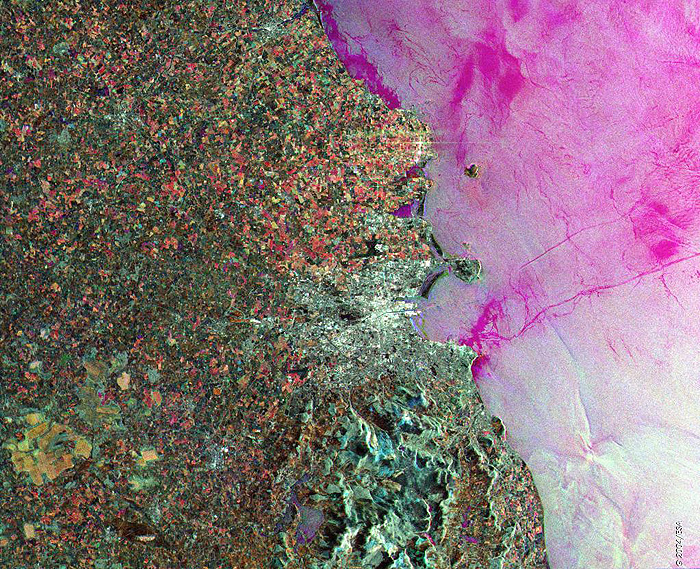
Dublin, Ireland This ERS-2 Synthetic Aperture Radar (SAR) multitemporal colour composite image is centred over Dublin, the capital of Ireland (bright area centre image). From the image it is noticeable that the terrain surrounding Dublin is generally flat, except in the extreme southern portion, which contains the northern extremities of the Wicklow Mountains. Also that the coastline is indented with a number of creeks and bays, notably the Dublin Bay, formed by the Howth Peninsula on the north and receives the waters of the River Liffey, which flows through the city, dividing Dublin into north and south sides. The Dublin Airport, a black X-shaped area, is visible to the north of the city. Technical Information:
Coordinates:
NE Lat/Long: N 53.80 / W 5.35 |
||