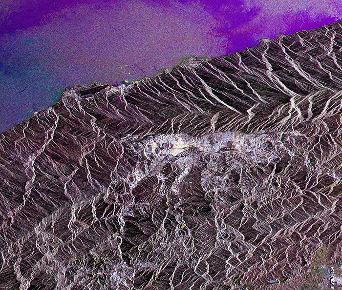
 Caracas, Venezuela - 2002
 View large format Jpeg (399 Kb)
Caracas, Venezuela This Synthetic Aperture Radar (SAR) multitemporal color composite image was generated with three different acquisition dates. The image is centered along the Cordillera de la Costa, where is visible as large bright area, Caracas, the capital of Venezuela. Built in the fertile valley, located in the north of the country, near the Caribbean port of La Guaira, it is the major commercial and industrial center of Venezuela. The International Simon Bolivar Airport (top right border), can be seen. Technical Information:
Coordinates:
NW Lat/Long: N 10.38 / W 67.03 |
||