 Cairo, Egypt - 2004
 View large format Jpeg (270 Kb)
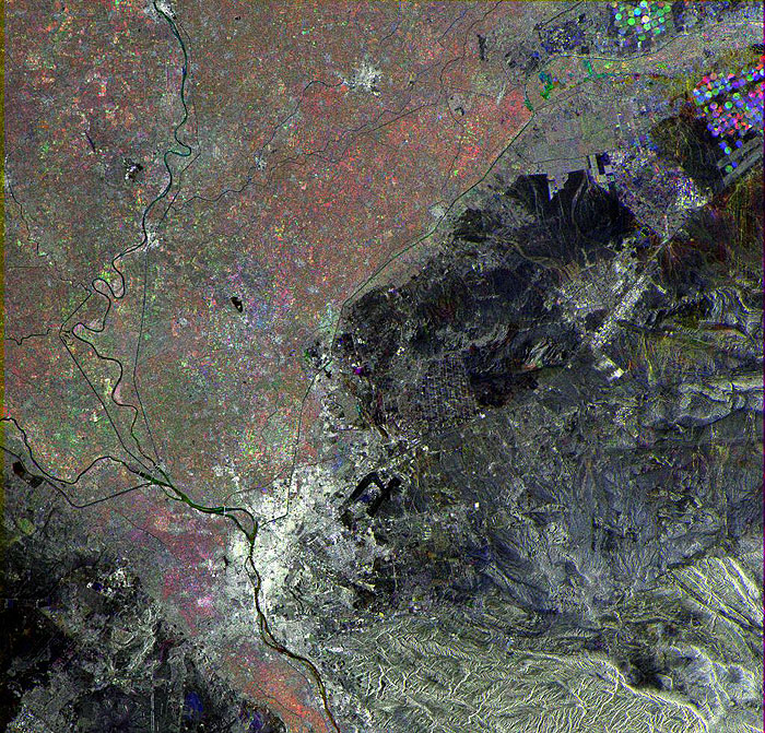
Cairo, Egypt This ERS-2 Synthetic Aperture Radar (SAR) multitemporal colour composite image shows an area of 100 Km swath width over the city capital of Cairo, Egypt, seen as a large bright area in the lower part of the image. Visible also is the Nile River that crosses the image from south to north and the Arabian Desert seen as dark areas surrounding the Nile Delta on both sides. The circular patterns in the upper right corner are irrigated cultivated fields. The image is made of three ERS-2 SAR PRI (Precision Radar Image) images acquired on different dates and assigning a colour (RGB) to each date of acquisition. Technical Information:
Coordinates:
NE Lat/Long: N 30.57 / E 32.05 |
||