 Beirut, Lebanon - 2004
 View large format Jpeg (355 Kb)
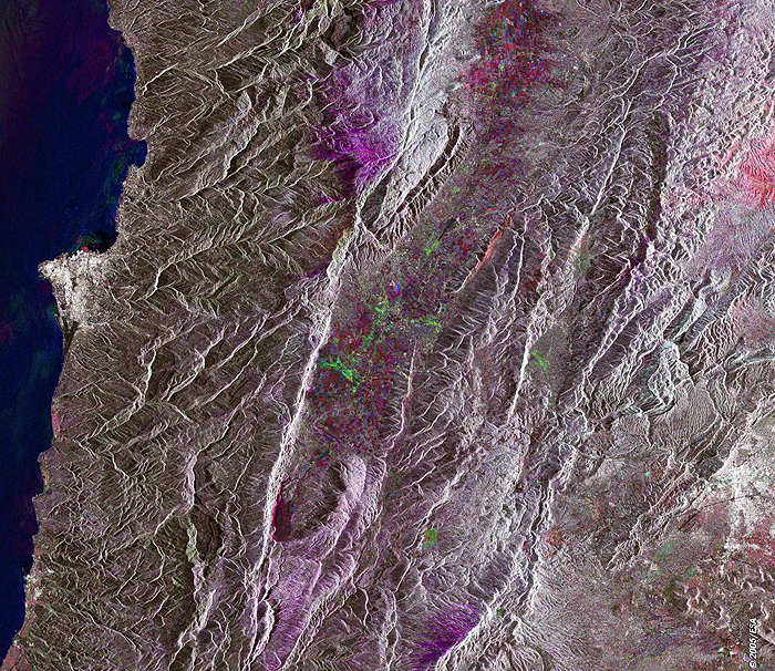
Beirut, Lebanon This image shows Beirut and its surroundings. It is composed of three ERS-2 SAR images which were acquired on different dates. An RGB colour was assigned to each date of acquisition. Beirut is the capital, largest city and chief seaport of Lebanon. It lies on a spur where the narrow coastal plain projects into the Mediterranean Sea, with Mount Lebanon mountains at its back to the east. The mountain range extends across the whole country, rising up to 3,090 m (10,131 ft). The landscape changes quite abruptly in the region, and the changes in scenery are related to altitudes rather than being the result of geographical distances. This is due to the fact that the Mount Lebanon chain runs very close to the coast, at about 160 km (100 mi) from the Mediterranean. Pine and oak forests are common in these mountains. Technical Information:
Coordinates:
NE Lat/Long: N 34.09 / E 35.20 |
||