 Beijing, China - 2002
 View large format jpeg (333 Kb)
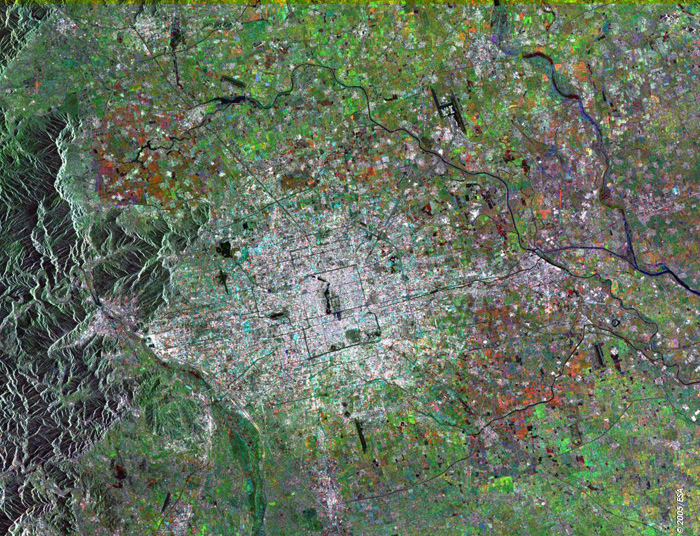
Beijing China This Synthetic Aperture Radar (SAR) multitemporal colour composite image is centred over the city of Beijing (bright area centre image), capital and largest city of China. The image shows the urban area of Beijing spreading out in bands of concentric ring roads. Tian'anmen square is right at the centre of Beijing, and is directly to the south of the Forbidden City and to the east of Zhongnanhai. Running through central Beijing from east to west is the well known Chang'an Avenue. The city capital's airport is visible as a black "H" figure northeast of the city. The various colour patches dispersed throughout the image indicate cultivated agricultural fields. The image is made of three ERS-2 SAR PRI (Precision Radar Image) images acquired on different dates and assigning a colour (RGB) to each date of acquisition. Technical Information:
Coordinates:
NE Lat/Long: N 40.44/ E 117.25 |
||