 Wildfires in Australia
Record-breaking temperatures and months of severe drought have fuelled a series of massive bushfires across Australia. Although recent cooler conditions and rain have brought some respite, more than 100 fires are still burning in the states of New South Wales and Victoria. Some 28 people have so far been killed - including four firefighters - and an estimated 10 million hectares (100,000 sq km or 15.6 million acres) of bush, forest and parks across Australia has burned. Read more on the BBC. In the Wollemi National Park the Gospers Mountain fire has burned more than 500,000 hectares since starting after a lightning strike in October. Specially deployed teams of firefighters have saved the only known natural stand of Wollemi pines, so-called "dinosaur trees" that fossil records show existed up to 200m years ago, from the bushfires that have devastated New South Wales. The images Below from the Landsat-8 satellite are processed in infrared false colour to highlight the burned areas. 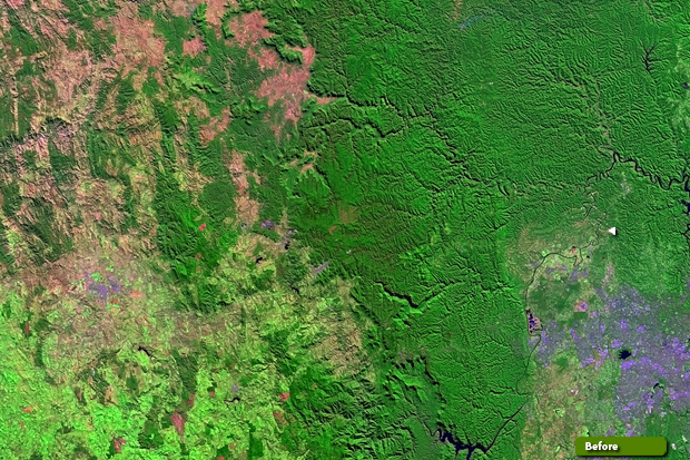 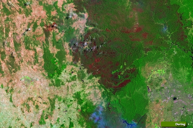 View high resolution image (During) (JPG 8.5 MB) View high resolution image (Before) (JPG 10.2 MB)
Kangaroo Island, a popular tourist destination and wildlife park off Australia's southeast coast, has seen some of the worst damage to the nation's biodiversity. Fires have overrun nearly half of the 1,700-square-mile island, and rescuers have been going tree to tree, trying to save what they can. The comparison of images below acquired by Copernicus Sentinel-2 over Kangaroo Island show a stretch of forest in the north-east of the island completely destroyed by fire. 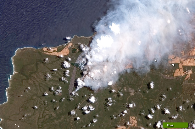 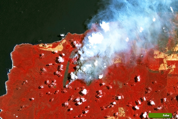 View high resolution image (Natural color) (JPG 7.0 MB) View high resolution image (False color) (JPG 7.0 MB)
|
||||||||||||||||||||||||||||