 Marib Dam, Yemen
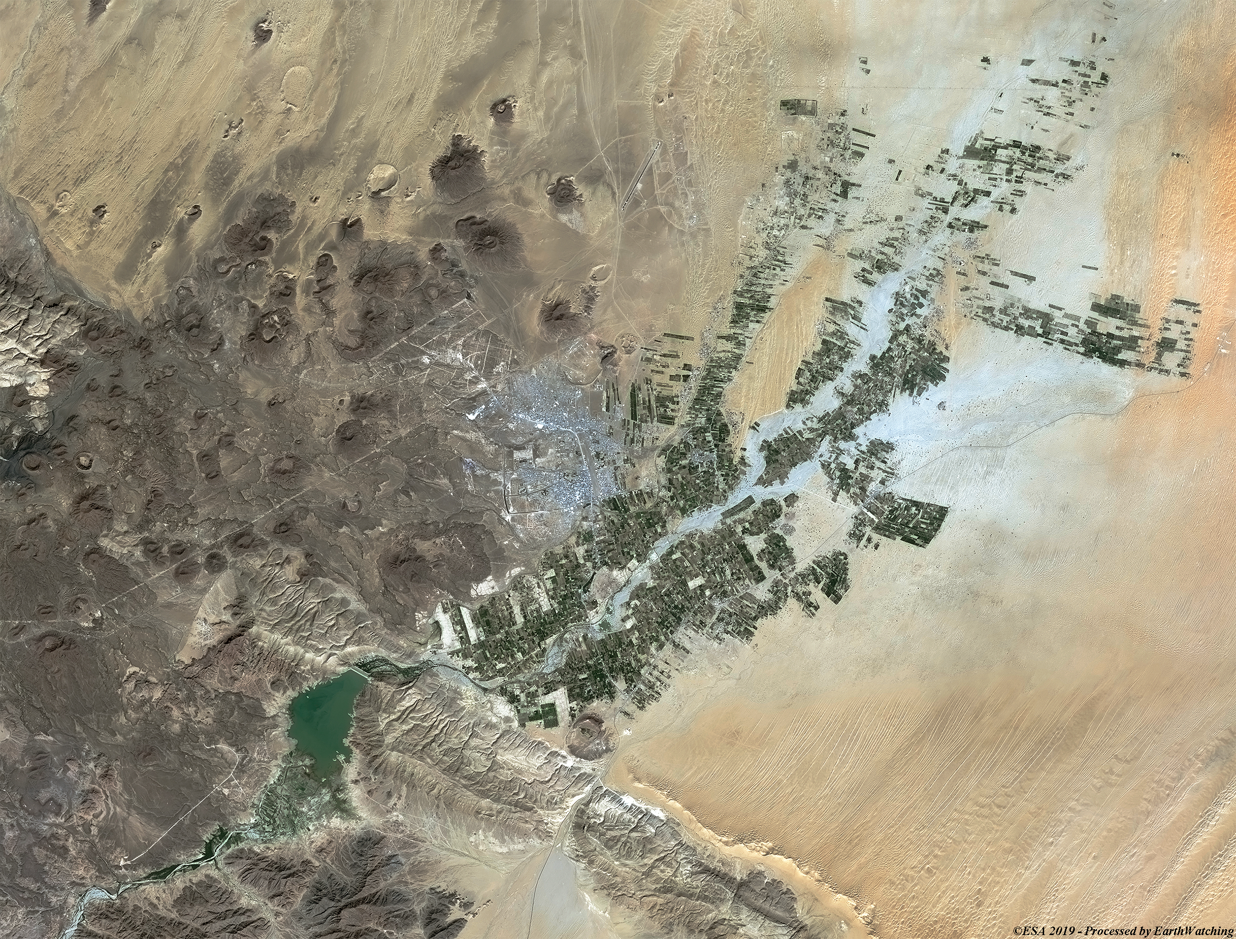
This image acquired by Copernicus Sentinel-2, shows the area of Marib. It is the ancient capital of the kingdom of Saba and the most important archaeological site in Yemen. It is located at the center of the region on the southwestern end of the Arabian Peninsula, which was called "Arabia Felix" by the Romans. Marib's prosperity was largely due to the great dam (South of the city). The dam is one of the engineering marvels of the ancient world, it was built to curb the waters of the Wadi Adhana in the Dhana valley, to collect the monsoon rains and make the desert land fertile. The imposing ruins of the dam are visited every year by thousands of tourists. The images also show a volcanic area north-west of the city, forming part of the "Harra of Arhab" lava field. This field consists of a basaltic plateau and a two stratovolcanoes. 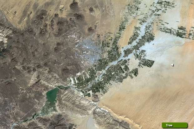 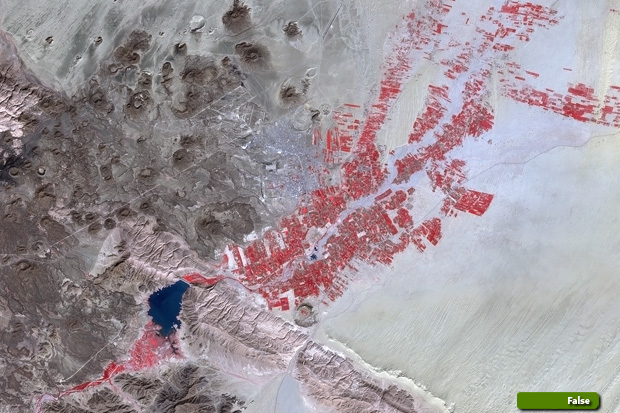 High resolution image in true colour (JPG 5.4 MB) High resolution image in false colour (JPG 5.2 MB)
|
||||||||||||||||