 Browse SAR Events by Year
20 Years of SAR
Browse SAR Events by Year
20 Years of SAR
 View large format Jpeg (427 Kb)
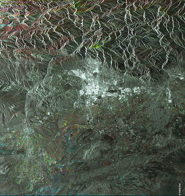
Tehran Iran This Synthetic Aperture Radar (SAR) multitemporal colour composite image is centred over the city of Tehran (bright area centre image), capital and largest city of Iran, located in the northern part of the country. The image illustrates that the city sits on a sandy plateau between the slopes of the Elburz Mountains (north) and the northwestern fringes of the Dasht-e Kavir desert (dark area bottom right). The various colour patches sparse to the southwest and south of the city indicate cultivated agricultural fields. Visible are the airports serving Tehran: Mehrabad International Airport, the old airport located in the western part of the city, Khomeini International Airport, outside the city and to the south and also the Doshan Tappeh Airfield to the east. The image is made of three ERS-2 SAR PRI (Precision Radar Image) images acquired on different dates and assigning a colour (RGB) to each date of acquisition. Technical Information:
Coordinates:
NE Lat/Long: N 35.99 / E 52.10 |
||