 Browse SAR Events by Year
20 Years of SAR
Browse SAR Events by Year
20 Years of SAR
This wide-swath radar image (400km wide) acquired at Kiruna Station on 03 June 2004 shows Normandy (or Normandie as it is known in French), a region and former province of France, bordering on the English Channel. In area it corresponds approximately to the modern departments of Seine-Maritime, Eure, Orne, Calvados, and Manche; its former capital was Rouen. Normandy was the location of the Allied invasion of German-occupied France during World War II. Le Havre, city in north-western France, in Seine-Maritime Department, on the English Channel, at the mouth of the Seine River, in Normandy. The city is a major seaport of France; its harbour has extensive facilities for transatlantic and transchannel shipping. It is also a commercial and manufacturing centre; products include ships, machinery, textiles, and processed food. Although badly damaged in World War II (1939-1945), Le Havre retains several old buildings, some restored since the war. Points of interest in the city include the Church of Notre Dame (16th-17th century), and the modern church of Saint Joseph, as well as the André Malraux Museum of Fine Arts. Rouen, city, northern France, capital of Seine-Maritime Department, on the Seine River, near the English Channel, in Normandy (Normandie). The city is a seaport for Paris and a major manufacturing centre; products include textiles, clothing, paper, refined petroleum, and chemicals. The city was badly damaged in World War II, but most of its numerous architectural monuments were restored after 1945. The chief structures include the Gothic Cathedral of Notre Dame (12th-15th century), noted for its Tour de Beurre ("butter tower"), which contains a large carillon; the large Flamboyant-Gothic Church of Saint Maclou (15th century); the Church of Saint Ouen (12th-15th century); the Tour de Jeanne d'Arc, a tower in which Joan of Arc was imprisoned in 1430; and the late Gothic Palais de Justice, once the seat of the parlement (law courts) of Normandy. To the north of the gulf of St. Malò, it is possible to see the islands of Jersey and Guernsey (U.K.) in the English Channel. To the southeast of Rouen (on the left of the image) it's possible to see along the Seine river, Paris, the capital and largest city of the country. It is located in France's Île-de-France region, on the Seine River, 370 km upstream from the river's outlet on the English Channel. Paris is known as the "City of Lights" for its world-renowned beauty and charm. People from around the world flock to the city to view its impressive array of monuments and museums, savour its cuisine, and relax in its sidewalk cafes and nightclubs. Paris is the political, cultural, and economic centre of France as well as one of the most vibrant metropolises in the world. About 15 percent of France's inhabitants live in the Paris metropolitan area. Paris is named after the Parisii, a Celtic people who settled on the city's central island-the Île de la Cité-in the 3rd century BC. The city has since spread north and south of the Seine. The city lies in a depression. The highest elevation is 129 m at the summit of Montmartre in northern Paris. 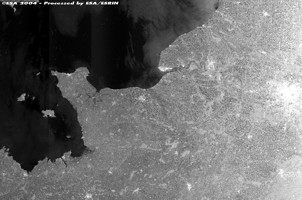
|
|||||