 Browse SAR Events by Year
20 Years of SAR
Browse SAR Events by Year
20 Years of SAR
 View large format jpeg (378 kb)
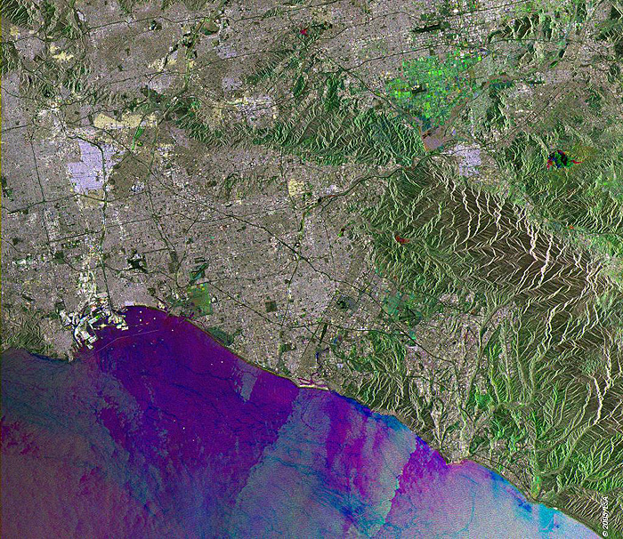
Los Angeles USA This Synthetic Aperture Radar (SAR) multitemporal colour composite image is centred over most of the city of Los Angeles (grey area), a large coastal metropolis located in southern California in the western United States. The area is situated in a semitropical Mediterranean climate zone, with no significant seasonal changes, therefore resulting in a less colourful multitemporal coloured image. Visible landmarks are: the Port of Los Angeles, located on San Pedro Bay (centre left), the Los Angeles River, a seasonal river that flows through Los Angeles and empties into the San Pedro Bay, and the Santa Ana Mountain Range (centre left). The image is made of three ERS-2 SAR PRI (Precision Radar Image) images acquired on different dates and assigning a colour (RGB) to each date of acquisition. Technical Information:
Coordinates:
NE Lat/Long: N 34.21 / W 117.18 |
||