These two Envisat images, acquired with the Advanced Synthetic Aperture Radar (ASAR), show the Latium Province and the city of Naples and its surroundings, in Italy.
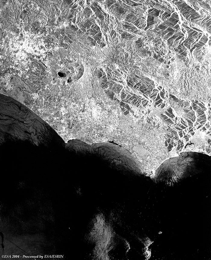
This Envisat (IMM) radar image acquired over the Tyrrhenian coast, shows Rome (large bright area) and the Latium province surrounding it; and in the upper left of the image at the Alban Hills where the volcanic lakes Albano and Nemi can be seen. The Pontine Marshes, swamp district, central Italy, in Lazio (Latium), extending southeast from Velletri to the Tyrrhenian Sea at Terracina are all visible within this image. About 800 sq km in area, the district is separated from the sea by sand dunes and is traversed by the Appian Way (small bright area near the Gaeta Gulf). The Ponziane islands are visible in the lower right portion of the image (south of Pontine Marshes).
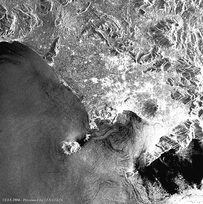
This Envisat radar image shows Naples (Italian: Napoli; ancient Neapolis), city, in southern Italy, capital of Naples Province and of the Campania Region. An important seaport, Naples is built on the slopes and at the base of a range of hills bordering the Bay of Naples, an inlet of the Tyrrhenian Sea. Visible to the east of the city is the volcano Mount Vesuvius. To the south are visible the Ischia, Procida and Capri Islands along the Gulf of Naples. Also to the east of Naples the Gulf of Gaeta and the Campi Flegrei are visible. To the southeast of Naples the Amalfi coasts (lower left of the image) can be seen and the black area in this sea show calm waters.
Back to top
 Browse SAR Events by Year