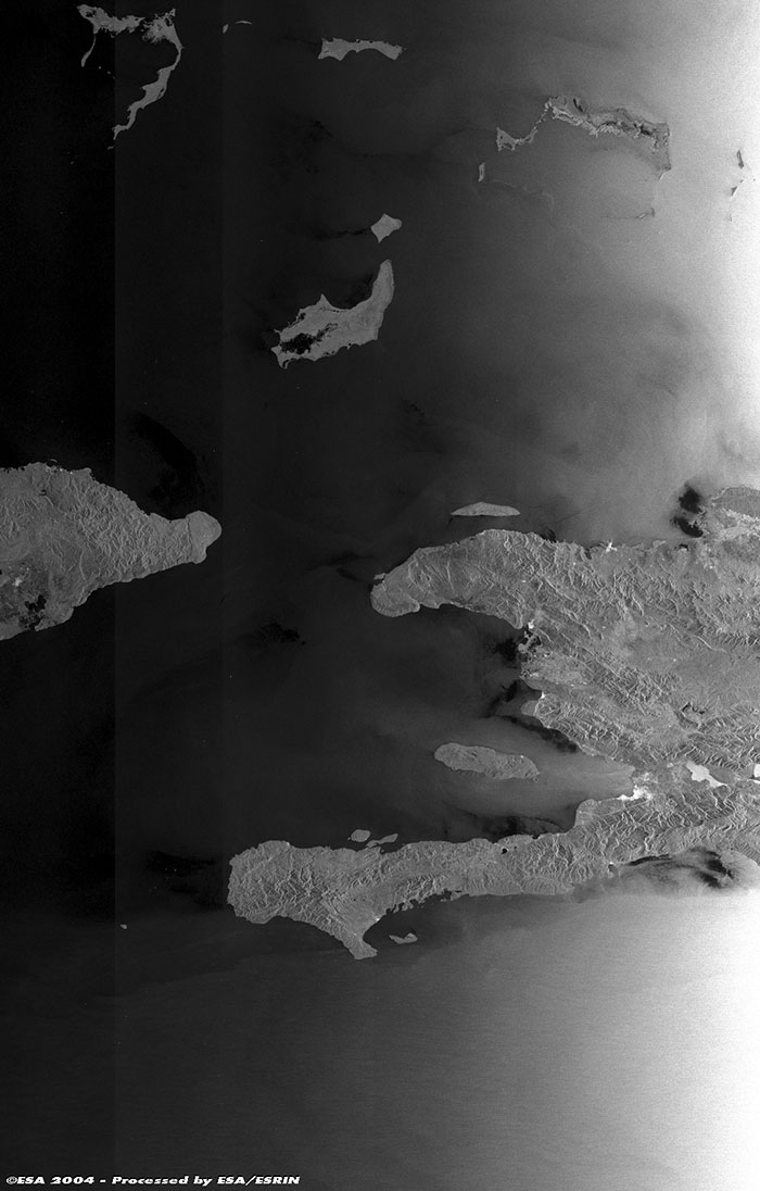
This Envisat ASAR (orbit 11788) wide-swath radar image (400km wide) was acquired at Kiruna on 01 June 2004 during the flooding over Haiti. An independent republic of the West Indies, occupying the western third of the island of Hispaniola, Haiti is bounded on the north by the Atlantic Ocean, on the east by the Dominican Republic, on the south by the Caribbean Sea, and on the west by the Windward Passage, which separates it from Cuba. Its area is 27,750 sq km (10,714 sq mi). Port-au-Prince is Haiti's capital and largest city. Haiti consists of two peninsulas, which are separated by the Gonâve Gulf. Much of Haiti's land is mountainous. In all, five mountain ranges cross the country. The Chaîne du Haut Piton, which runs along the northern peninsula, reaches a height of 1,183 m. The Massif de la Selle, which begins just southeast of Port-au-Prince, reaches a height of 2,680 m (8,793 ft) at Pic la Selle, the highest point in Haiti. The Massif de la Hotte reaches a height of 2,347 m at the extreme western end of the southern peninsula. The other chains, which include the Massif des Montagnes Noires and Chaîne des Cahos, and the solitary peak of Montagne Terrible, range between 1,128 and 1,580 m high.
The Gonave Gulf contains the largest of Haiti's offshore islands, the island of Gonâve. The other islands include Île de la Tortue (Tortuga) and Grande Cayemite. Haiti's shoreline is irregular and there are many natural harbours. The numerous rivers-most of which are short, swift, and unnavigable-have their sources in the mountains. Only the Artibonite River, the country's largest, is navigable for any length. Near the top of the image it is possible to see the Turks and Caicos Islands, a British dependency in the West Indies, southeast of the Bahamas. The islands form two groups. The Turks Islands comprise six uninhabited cays, two inhabited islands (Grand Turk and Salt Cay), and a large number of small rocky islands. The Caicos Islands comprise six principal islands, including Grand Caicos (24 sq km/9.4 sq mi), the largest in the dependency, and a number of islets.
Back to top
 Browse SAR Events by Year