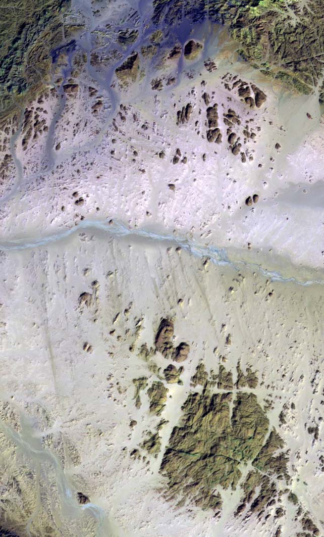
The El'Allaqi Wadi is located between the political and administrative boundary lines of Egypt and Sudan. The main geological feature present in these images consists of a sandstone and greywake basement from which has been extruded a granite magma (Dokan volcanics) from the East Africa Rift Valley opening. The outcropping lithologies are composed of metamorphic and sedimentary rocks represented, in the images, as small or big structures isolated essentially by water and wind erosional processes.
This Landsat TM data (bands 7-5-2) makes it possible to distinguish the main surface like the wadi El'Allaqi (in light cyan) crossing the middle part of the picture and the different outcropping litologies (in brown tones) by different colours.
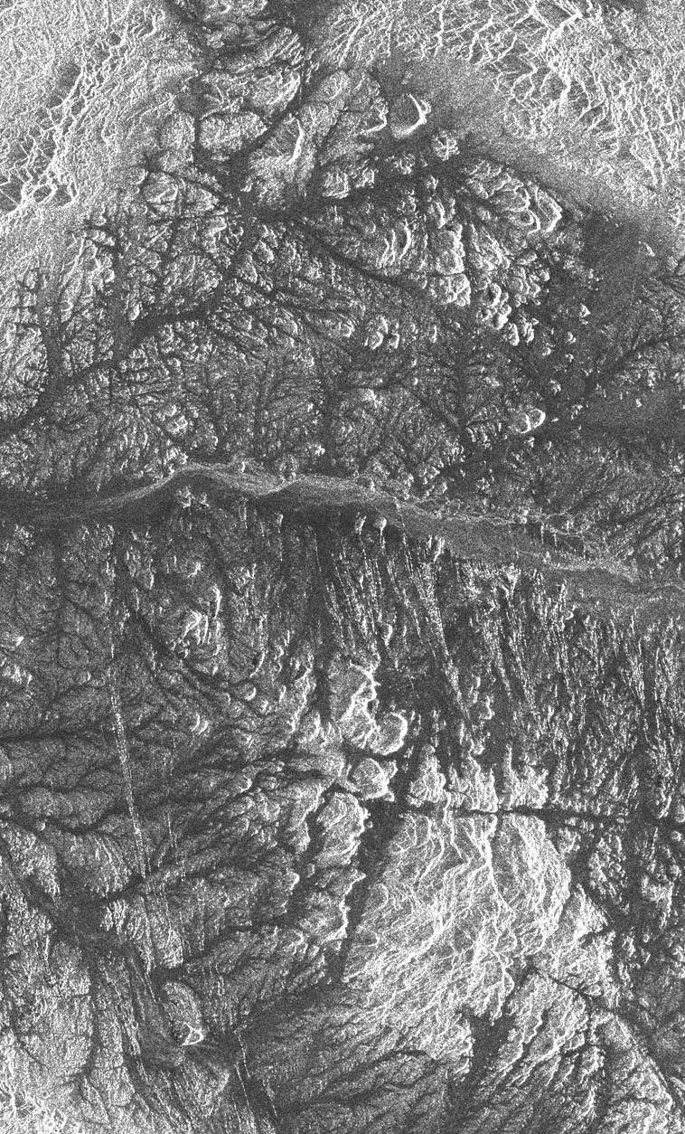
The ERS-1 Synthetic Aperture Radar reveals a complex dendrithic drainage structure. It is the result of different surface roughness conditions and the microwave capability to penetrate the sand (if the soil is completely dry).
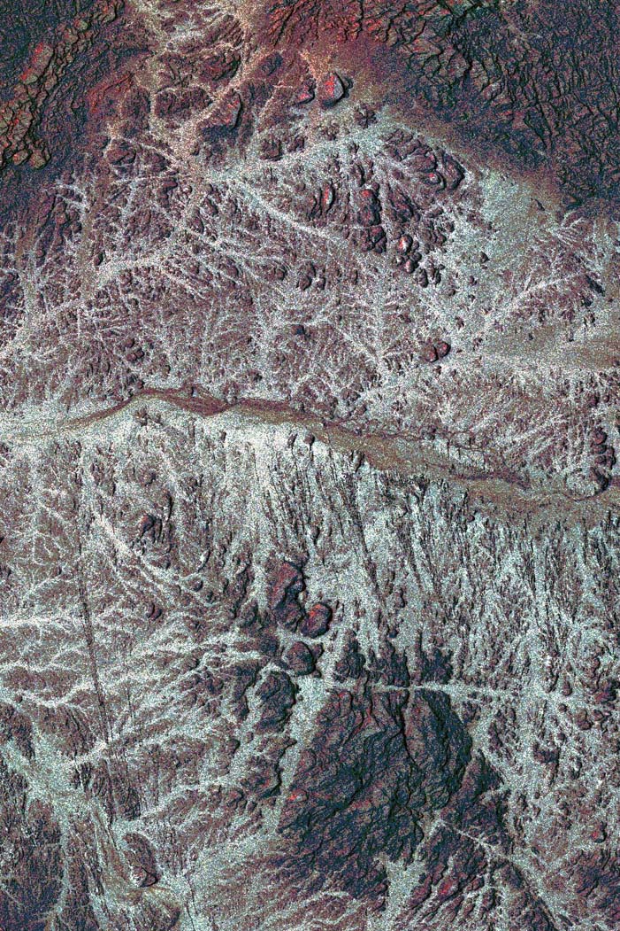
This optical - radar merge (obtained by substitution of the Landsat intensity channel with the ERS image), enables the surface and underground information to be highlighted.
Back to top
 Browse SAR Events by Year