 Browse SAR Events by Year
20 Years of SAR
Browse SAR Events by Year
20 Years of SAR
 View large format jpeg (288 kb)
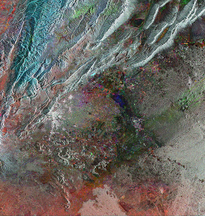
Damascus Syria This Synthetic Aperture Radar (SAR) multitemporal colour composite image is centred over Damascus (bright area centre left), the capital city of Syria and one of the world's oldest cities. Damascus is situated on a plateau 690 metres above sea level, bordered by the Anti-Lebanon Mountains to the west, and the desert to the east. Visible throughout the arid plateau region east of Damascus are oases, streams, and a few interior rivers that empty into swamps and small lakes providing water for local irrigation. Most important of these is the Barada, a river that rises in the Anti-Lebanon Mountains and disappears into the desert. The Barada creates the Al Ghutah Oasis, surrounding Damascus, a verdant area some 370 kilometers square, that has enabled Damascus to prosper since ancient times. The image is made of three ERS-2 SAR PRI (Precision Radar Image) images acquired on different dates and assigning a colour (RGB) to each date of acquisition. Technical Information:
Coordinates:
NE Lat/Long: N 33.87 / E 37.20 |
||