 Browse SAR Events by Year
20 Years of SAR
Browse SAR Events by Year
20 Years of SAR
 View large format jpeg (248 kb)
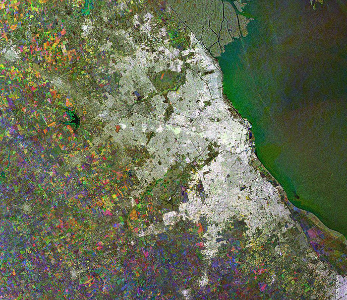
Buenos Aires Argentina This Synthetic Aperture Radar (SAR) multitemporal colour composite image is centred over Buenos Aires, the city capitol of Argentina and its largest city and port, as well as one of the largest cities in South America. Buenos Aires is located on the southern side of the La Plata River, on the southeast coast of the South American continent and covers an area of almost 3,885 square kilometres. The terrain of the area consists almost entirely of a flat or gently undulating plain. The various colour patches to the west and south of the city indicate cultivated agricultural fields. The image is made of three ERS-2 SAR PRI (Precision Radar Image) images acquired on different dates and assigning a colour (RGB) to each date of acquisition. Technical Information:
Coordinates:
NE Lat/Long: S 34.21 / W 58.18 |
||