 Browse SAR Events by Year
20 Years of SAR
Browse SAR Events by Year
20 Years of SAR
 View large format jpeg (268 kb)
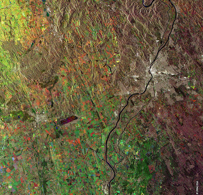
Budapest, Hungary This Synthetic Aperture Radar (SAR) multitemporal colour composite image is centred over the city capital and also largest city of Hungry, Budapest (large bright area). It is seated along the banks of the Danube River, visible as a large dark line flowing from North to South across the image. The river divides the community of Buda on the west bank and the community of Pest on the east bank. The left side of the image is part of the low, rolling plain known as the Great Hungarian Plain, or the Great Alföld. The magenta area between Sofia and the city of Szekesfehervar is Lake Velencei. The colour of the lake is due to wind on the 15 June 2003 (red) and 28 September 2003 (blue). The different colours of the field indicate different cultures. The image is made of three ERS-2 SAR PRI (Precision Radar Image) images acquired on different dates and assigning a colour (RGB) to each date of acquisition. Technical Information:
Coordinates:
NE Lat/Long: N 47.90 / E 19.25 |
||