 Browse SAR Events by Year
20 Years of SAR
Browse SAR Events by Year
20 Years of SAR
 View large format jpeg (351 Kb)
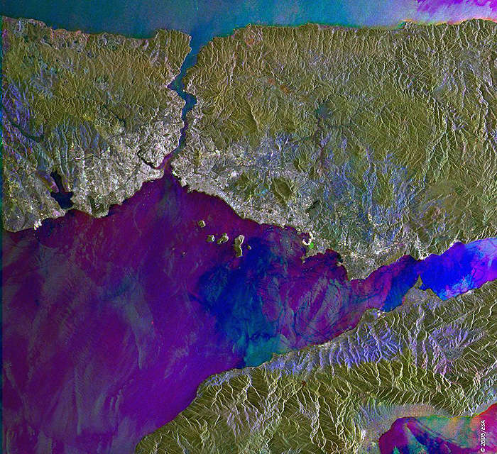
The Bosphorus Strait, Turkey This Synthetic Aperture Radar (SAR) multitemporal colour composite image is centred over the Bosporus strait, located in the northwest of Turkey. It separates the European part (Rumeli - left) of Turkey from its Asian part (Anadolu - right), connecting the Sea of Marmara with the Black Sea. It is 30 km long, with a maximum width of 3,700 meters at the northern entrance, and a minimum width of 750 meters between Anadoluhisari and Rumelihisari. The southern shores of the strait are heavily populated as the city of Istanbul (bright area) straddles it and encompasses the natural harbor known as the Golden Horn. The image is made of three ERS-2 SAR PRI (Precision Radar Image) images acquired on different dates and assigning a colour (RGB) to each date of acquisition. Technical Information:
Coordinates:
NE Lat/Long: N 41.30 / E 29.86 |
||