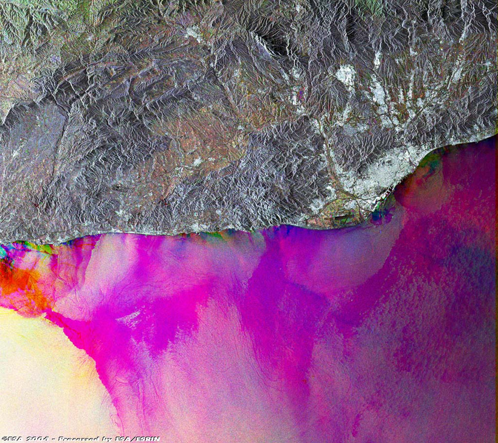
This Advanced Synthetic Aperture Radar (ASAR) multi-temporal colour composite image shows an area of 100 Km swath width over the province of Barcelona, in north-eastern Spain; the capital of Barcelona Province and the autonomous region of Catalonia, a seaport on the Mediterranean Sea between the Llobregat and Besós rivers. Barcelona is the second largest Spanish city in population and the principal industrial and commercial center of the country. The chief manufactures are textiles, precision instruments, machinery, railroad equipment, paper, glass, and plastics.
Barcelona is a major Mediterranean port and a financial and publishing centre of Spain. The city of Barcelona, visible centre left of the image as a large bright white area, is the second most populated city and the principal industrial and commercial centre of the country. Barcelona is also one of the major Mediterranean ports and a financial and publishing centre of Spain. The oldest section of the city was built on the harbour and is traversed by the Rambla, a paved thoroughfare extending from the harbour to the Plaza de Cataluña, the focal point of the city (viewed in actual pixel size). The image is made of three ASAR images acquired on different dates and assigning a colour (RGB) to each date (Red: 19 February 2004, Green: 17 October 2003, Blue: 19 June 2003).
Back to top
 Browse SAR Events by Year