- All Categories (13622)
- Data (1)
- News (56)
- Missions (24)
- Events (10)
- Tools (4)
- Activities (5)
- Campaigns (2)
- Documents (13520)
NEWS
Discover the latest news on the European Space Agency's Earth Observation activities. Learn all about new data availability and how ESA's missions are performing.
News - Success Stories
 10 Nov 2020
Publication of Coastal Current Intrusions from Satellite Altimetry
A new study entitled “Coastal current intrusions from satellite altimetry” has just been published in the journal Remote
News - Success Stories
 30 Oct 2020
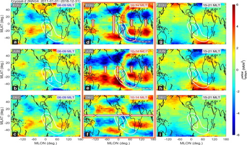
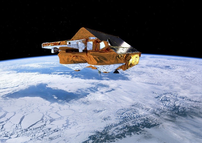
CryoSat-2 Data Used to Measure Ionospheric Currents
Recovery and Climate Experiment Follow-On (GRACE-FO) satellites can be used to diagnose weak low-/mid-latitude ionospheric currents
News - General News
27 Feb 2024Go-to guide to Third Party Mission data offering
Data Access Guide has been published, providing technical details and information on available data collections for all current
News - Success Stories
 12 July 2022
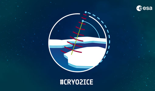
CRYO2ICE over Antarctica: revealing further insight on changing ice
The CryoSat-2 satellite is currently being aligned with ICESat-2 over Antarctica, unlocking fresh possibilities in the wealth
News - Success Stories
 24 Nov 2021
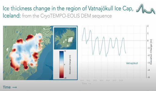
CryoTEMPO-EOLIS Products Now Available for Iceland, Svalbard, and the Canadian Arctic
Land-ice monitoring via Earth Observation methods in general, and altimetry in particular, are essential for tracking the current
News - Events and Proceedings
1 June 2023GLOC 2023: Democratising data access key to climate action
Currently, more than a trillion tonnes of ice is lost each year.
News - Thematic area articles
 29 Sept 2022
How satellite data help to shape society
Title: Current drought situation in Ebro basin Description: The SMOS soil-moisture-based drought monitor is updated monthly
News - General News
21 Mar 2023ESA's excellent Earth Explorer missions extended to 2025
Acting like the spinning conductor in a bicycle dynamo, it generates electrical currents and thus the continuously changing
News - Operational News
 12 Jan 2024
Delay in the availability of CryoSat Products
There is currently an ongoing technical issue at the CryoSat Payload Data Ground Segment (PDGS).
News - Operational News
 5 July 2019
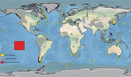
CryoSat new Geographical Mask in support to the French/US SWOT mission
With respect to the previous version, the new SWOT areas are reported in yellow in the figure (overlapping the current 3.9
News - Data Release news
 7 Aug 2019
CryoSat new Ice NRT products now available
The new Ice NRT products replace the current products, and can be downloaded from the SIR_NRT folder on the CryoSat Science
News - Data Release news
 15 Mar 2019
GOCE EGG L1b reprocessed data published
The GOCE L2 data, including the gravity field models, are currently being regenerated and will be available in Q2 2019.
News - Data Release news
 1 Mar 2019
CryoSat Ocean Baseline C reprocessed data available
The reprocessing activity is currently progressing and we are planning to publish batches of six months of data every 20
News - Data Release news
11 May 2020New CryoSat BUFR products for the meteorological community
The current CryoSat Ocean Processor is able to generate Near-real-time Ocean Products (NOP) with a latency of 2-3 hours after
News - Operational News
 3 Dec 2020
CryoSat Science Server parallel FTP sessions reminder
Considering that data access is also currently open to anonymous users, who cannot be directly contacted, be advised that
News - General News
 10 July 2020
CRYO2ICE is now on Earth Online
The resulting data will have applications in the fields of sea ice, land ice, polar ocean currents, inland water and atmosphere
News - Infographics
19 Mar 2024Explore sample data products from Third Party Missions
This new infographic summarises the missions that currently have sample data: Download the Infographic A link to each sample
News - Data Release news
 31 May 2019
CryoSat Ice Baseline D data products now available
Currently data is available on the Science Server in a continuous temporal sequence of the Baseline C data using the same
News - Thematic area articles
 31 Mar 2022
Satellite data central to ocean monitoring
microwave monitoring instruments, optical imagers, and infrared radiometers, which can map ocean variables related to ocean currents
News - Operational News
12 Sept 2019CryoSat - Geographical Mode Mask 4.0 released
SAR Interferometric (SARIn) (purple) mode is used over steeply sloping ice-sheet margins, over some geostrophic ocean currents