- All Categories (13513)
- Data (2)
- News (51)
- Missions (17)
- Events (10)
- Tools (2)
- Activities (6)
- Campaigns (2)
- Documents (13423)
MISSIONS
Explore the European Space Agency's Earth Observation satellite missions. Learn all about ESA's dedicated Earth Explorers or collaborations with other agencies through the Third Party Missions programme.
Mission - Earth Explorers

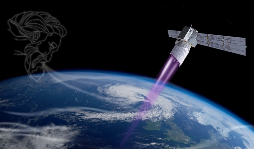
Aeolus
This is currently the only technology that can provide direct wind profile observations in clear air, inside thin clouds
Mission - Earth Explorers
Aeolus Data
Aeolus Quality Control Reports on L1B/Instrument, L2A and L2B products are currently available to Aeolus Cal/Val teams and
Mission - Earth Explorers
ALADIN
Aeolus Quality Control Reports on L1B/Instrument, L2A and L2B products are currently available to Aeolus Cal/Val teams and
Mission - Earth Explorers
Geographical Mode Mask
The current operational Geographical Mode Mask v5.0 The current version of the geographical mode mask v5.0 has been in operation
Mission - Earth Explorers

Special Datasets Overview
CryoSat Antarctic Digital Elevation Model - Download the current CryoSat product Antarctic DEM.
Mission - Earth Explorers
ALADIN Reports
quality reports about the public L2B Wind product: Monthly L2B reports Reports for the Aeolus L2A Aerosol/Cloud products are currently
Mission - Earth Explorers

Products Information
here, these are intended for the purpose of becoming familiar with the format of the CryoSat Science Products from the current
Mission - Earth Explorers
About CRYO2ICE
The measurements will also help map snow over the poles and advance our understanding of currents in polar oceans, with further
Mission - Earth Explorers

Ground Tracks
CryoSat instruments and it is generated at the beginning of every orbital repetition cycle around two months before the current
Mission - Earth Explorers

SIRAL
Access is provided to all CryoSat systematic data acquired according to the current geographical mode mask.
Mission - Earth Explorers
CryoSat Objectives
The density increase causes the surface waters to sink – in essence acting as a pump, driving cold, deep ocean currents from
Mission - Earth Explorers
Aeolus Overview
Currently, the global distribution of conventional wind profile measurements is not homogenous and mainly located over land
Mission - Earth Watch
SIRAL Overview
It is also operated over some geostrophic ocean currents and major hydrological basins.
Mission - Third Party Missions

Multi Spectral Scanner (MSS) Processor Releases
GCP displacement B TM radiometric calibration Update to radiometric calibration strategy for TM reflective bands (Dark Current
Mission - Third Party Missions

Thematic Mapper (TM) Processor Releases
GCP displacement B TM radiometric calibration Update to radiometric calibration strategy for TM reflective bands (Dark Current
Mission - Earth Watch
Instrument Processing Facilities
Level 1 Ice Products The current IPF1 installed at the Kiruna payload data segment for level-1 ice products is IPF1 vO2.3
Mission - Earth Explorers
CryoSat Overview
redundant Solid-State Recorder, total capacity 256 Gbits Ground Segment CryoSat ground segment The CryoSat ground segment is currently