- All Categories (40)
- Data (1)
- News (12)
- Missions (2)
- Events (6)
- Tools (1)
- Activities (3)
- Campaigns (1)
- Documents (14)
News - Events and Proceedings

Φ-Week Triumphs
Opening Session Title: Φ-Week's Opening Session Description: During the fourth edition of ESA’s Φ -Week, Josef Aschbacher, current
Document - Product Specifications

WorldDEM-Technical-Specification.pdf
This document describes the specification and format of the TerraSAR-X/TanDEM-X WorldDEM(TM) product portfolio. It provides a description of the post-processing (editing) process, the characteristics of the Digital Elevation Models and the ancillary data that are collected and/or generated during the data finishing process as well as the delivery formats.
Event - Meeting

VH-RODA and CEOS SAR workshop
The workshop provided an open forum for the presentation and discussion of current status and future developments related
News - General News

Three new Third Party Missions under evaluation
Currently it operates five RapidEye satellites, 122 Dove satellites (i.e. PlanetScope), and 15 SkySat satellites.
Document - General Reference

Third Party Missions Brochure
This brochure summarises ESA's Third Party Missions programme, providing a timeline and examples of content related to some of the missions.
Campaign

TerraSARSIM
The current mission design envisages flying two separate radars on separate platforms.
Document - Technical Note

Technical Note on Quality Assessment for Landsat 1-7
Technical Note on Quality Assessment for Landsat 1-7
Mission - Third Party Missions
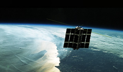
Spire Overview
It currently commercialises its platform on a "Space-as-a-Service" offering with aerospace and defence customers.
Data - Project Proposal (Restrained)

Spire live and historical data
The data also provides interesting research opportunities on topics as varied as ocean currents and GNSS-based planetary
News - Data Release news
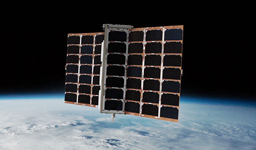
Spire data now open to users
Having launched more than 100 satellites since its creation, it currently operates a fleet of more than 90 CubeSats, the
Activity - Quality
SLAP
Currently, in excess of 701,000 Level 1 TM and 84,000 Level 1 ETM+ products have been reprocessed and released under the
Document - Proceedings

SEASAR-2012-sessions-summaries-seed-questions-recommendations.pdf
This document gathers together the sessions summaries with seed questions discussion and recommendations of the SEASAR 2012 workshop.
Event - Workshop

SEASAR 2012
Aouf 14:00 - 14:20 Towards consistent inversion of wind, waves and surface current from SAR Bertrand Chapron (IFREMER, France
News - Thematic area articles
Satellites expand research on Space Weather and Sun-Earth Interactions
This research – which is currently being completed – aims to explore how the process produces nitrogen oxide in the mesosphere
News - Events and Proceedings

National missions in the spotlight at the Living Planet Symposium
two sessions tomorrow, Thursday 26 May, to introduce attendees to the profusion of national Earth observation missions currently
Mission - Third Party Missions

Multi Spectral Scanner (MSS) Processor Releases
GCP displacement B TM radiometric calibration Update to radiometric calibration strategy for TM reflective bands (Dark Current
News - Success Stories

Long-term satellite data show wind farms can affect local air currents
Long-term measurements allow before and after comparison Data from the heritage Envisat satellite currently maintained accessible
Document - Product Document

LANDSAT_Products_Description_Document.pdf
This document acts as a User Guide to the Landsat MSS, TM and ETM+ archives, focussing more specifically on the Landsat TM and ETM+ products from the Kiruna, Maspalomas and Matera archives (including from the Matera, Fucino, Neustralitz, O’Higgins, Malindi, Libreville and Bishkek ground stations) that have been generated as part of the ESA archive bulk-reprocessing project.
News - Thematic area articles
How to use space data to probe humankind’s ancient past
SkySat captures Angkor Wat in Cambodia TPMs that are currently providing high resolution or very high resolution imagery
