- All Categories (74)
- Data (1)
- News (6)
- Missions (11)
- Events (4)
- Activities (2)
- Documents (50)
Mission - Earth Explorers

GOCE
Explorer (GOCE) mission mapped Earth's geoid very accurately, opening a window into Earth's interior structure as well as the currents
News - General News
Go-to guide to Third Party Mission data offering
Data Access Guide has been published, providing technical details and information on available data collections for all current
Event - Meeting

VH-RODA and CEOS SAR workshop
The workshop provided an open forum for the presentation and discussion of current status and future developments related
Data - EO Sign In Authentication (Open)
Landsat 8 Collection 2 European Coverage
terrain corrections applied and resampled for registration to a cartographic projection, referenced to the WGS84, G873, or current
Activity - Quality

EDAP
The following missions are currently being considered as part of the Automatic Identification System (AIS) and Radio Frequency
Event - Workshop

IDEAS+ Cal/Val Workshop 7
Regular workshops are held every nine months with the whole IDEAS+ Task 3-Cal/Val team in order to review the status of current
News - Thematic area articles

How satellite data help to shape society
Title: Current drought situation in Ebro basin Description: The SMOS soil-moisture-based drought monitor is updated monthly
Mission - Earth Explorers
GOCE Objectives
Thanks to this current, the coastal waters of Europe are 4°C warmer than waters at equivalent latitudes in the north Pacific
News - Data Release news

New Landsat-8 Collection-2 Level 1 and Level 2 data now available
The Online Dissemination service is still being populated, with the current availability of Collection-2 data as follows:
Activity - Quality
SLAP
Currently, in excess of 701,000 Level 1 TM and 84,000 Level 1 ETM+ products have been reprocessed and released under the
Document - User Guide

User Manual - LEDA 13 Landsat
This infosheet describes the Landsat databank. The databank is a catalogue of imagery remotely sensed by the Landsat series of satellites (Landsat l to 5) available at ESA/Earthnet and acquired at Fucino (Italy), Kiruna (Sweden) and Maspalomas (Canaries).
Document - General Reference

The Earth Observation Handbook, 2010 Update - Key Tables
This is the 2010 update of the CEOS Earth Observation Handbook. You can browse the live database at http://database.eohandbook.com/ or download the printable PDF of key tables based on the 2010 database contents for a handy reference.
Document - Product Cal/Val Plan/Report

Landsat-Product-Radiometric-Calibration.pdf
This document reports the new calibration procedures for Landsat.
Document - Technical Note

Landsat 4-5 TM Image Assessment System Radiometric Algorithm Theoretical Basis Document
Mission - Earth Watch

TIRS Product Anomalies
artifacts, how they are addressed and corrected, and provides up-to-date information and details regarding known issues and current
News - Data Release news

New Landsat-8 Collection-2 Level 1 and Level 2 data available from January
The old Landsat-8 portal, which currently hosts data for the mission, will be retained until the Landsat Dissemination Service
Mission - Earth Explorers
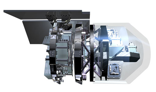
EGG
This opened a window into Earth's interior structure, as well as the currents circulating within the depths of its oceans
Document - Proceedings

Dragon Programme Mid-Term Results
Proceedings of the 2005 Dragon Symposium held on 27 June - 1 July 2005 in Santorini, Greece.
Mission - Earth Explorers
SSTI ANTEX Data
data were generated from 154 days in 2009 GOCE SSTI-B PCVs data were generated from the available data in 2010-2012 The current
Document - Proceedings
EO-Summer-School-6-ESA-explorer-mission-GOCE-earth-gravity-from-space.pdf
This presentation from ESA's EO Summer School 6 presents the ESA explorer mission GOCE earth gravity from space