- All Categories (13274)
- News (29)
- Missions (10)
- Events (1)
- Activities (1)
- Campaigns (1)
- Documents (13232)
News - Success Stories
CRYO2ICE over Antarctica: revealing further insight on changing ice
The CryoSat-2 satellite is currently being aligned with ICESat-2 over Antarctica, unlocking fresh possibilities in the wealth
News - Success Stories
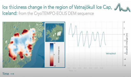
CryoTEMPO-EOLIS Products Now Available for Iceland, Svalbard, and the Canadian Arctic
Land-ice monitoring via Earth Observation methods in general, and altimetry in particular, are essential for tracking the current
Activity - Instrument characterisation and algorithm studies

ESA satellites and instruments calibration landing page
Data Outages: Information currently not available online.
News - General News
ESA's excellent Earth Explorer missions extended to 2025
Acting like the spinning conductor in a bicycle dynamo, it generates electrical currents and thus the continuously changing
News - Operational News

Delay in the availability of CryoSat Products
There is currently an ongoing technical issue at the CryoSat Payload Data Ground Segment (PDGS).
Mission - Earth Explorers
Geographical Mode Mask
The current operational Geographical Mode Mask v5.0 The current version of the geographical mode mask v5.0 has been in operation
Event - Training

EO Summer School 3
In line with observations it shows anti-cyclonically rotating surface currents and cyclonically rotating bottom currents.
Document - General Reference

CryoSat-Polar-Ice-Fields-are-they-melting.pdf
This article was published in the Earth Observation Quarterly Nr. 71 and is about CryoSat applications in experimental measurements in the Arctic.
Document - General Reference
Introduction-CryoSat-2-ICESat-2-Resonant-Orbits.pdf
This presentation describes the CRYO2ICE campaign.
News - Data Release news
New CryoSat BUFR products for the meteorological community
The current CryoSat Ocean Processor is able to generate Near-real-time Ocean Products (NOP) with a latency of 2-3 hours after
Document - Technical Note

Guidelines-for-the-SAR-Delay-Doppler-L1b-Processing.pdf
The purpose of this document is to present the major theoretical guidelines for a standard SAR (aka Delay Doppler) Processing from low-level data (FBR, aka L1a) to multi-looked waveforms (L1b) in case of the Closed-Burst instrument transmission mode (CryoSat-2 and Sentinel-3 case).
Document - General Reference
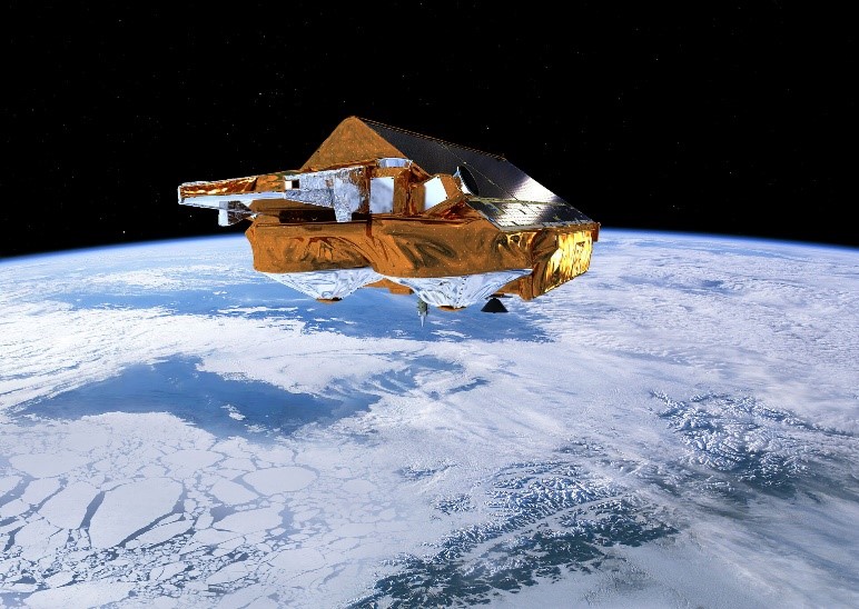
CryoSat-ESAs-Ice-Mission.pdf
This brochure describes the science behind the CRYOSAT mission and how the satellite works.
News - General News
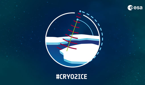
CRYO2ICE is now on Earth Online
The resulting data will have applications in the fields of sea ice, land ice, polar ocean currents, inland water and atmosphere
Mission - Earth Explorers
Special Datasets Overview
CryoSat Antarctic Digital Elevation Model - Download the current CryoSat product Antarctic DEM.
News - Thematic area articles

Satellite data central to ocean monitoring
microwave monitoring instruments, optical imagers, and infrared radiometers, which can map ocean variables related to ocean currents
News - Operational News
CryoSat - Geographical Mode Mask 4.0 released
SAR Interferometric (SARIn) (purple) mode is used over steeply sloping ice-sheet margins, over some geostrophic ocean currents
News - Data Release news

Back-processed data from 2010 now available for CryoTEMPO-EOLIS Baseline 2
Arctic Canada North High Mountain Asia (Central/South East/South West Asia) Russian Arctic Svalbard Iceland Regions that are currently
News - Success Stories

COP26 fuels interest in satellite data
operational and non-operational ESA missions provide long-term Earth observational records, giving essential context to current
News - Data Release news
New version of the SMOS-CryoSat level 4 sea ice thickness product is now available
The current version 205 replaces the previous baseline version 204.
News - Operational News

Announcement for CryoSat Quaternions Product users
The Quaternions Products, generated by the Ice Star Tracker processor are currently available to download from the cryo-proqua