- All Categories (495)
- Data (2)
- News (24)
- Missions (15)
- Events (12)
- Activities (3)
- Campaigns (1)
- Documents (438)
Mission - Earth Explorers

GOCE
Explorer (GOCE) mission mapped Earth's geoid very accurately, opening a window into Earth's interior structure as well as the currents
News - Operational News

SMOS data distribution resumed
SMOS data distribution to end users was resumed on 12 March 2024 after confirmation of the adequate quality of the current
Event - Workshop

2nd Space for Hydrology Workshop
The workshop aimed to assess the current stage of knowledge and activities in space-based hydrological observations and to
News - General News
Go-to guide to Third Party Mission data offering
Data Access Guide has been published, providing technical details and information on available data collections for all current
Event - Meeting

VH-RODA and CEOS SAR workshop
The workshop provided an open forum for the presentation and discussion of current status and future developments related
Data - EO Sign In Authentication (Open)
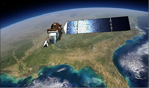
Landsat 8 Collection 2 European Coverage
terrain corrections applied and resampled for registration to a cartographic projection, referenced to the WGS84, G873, or current
Activity - Quality

EDAP
The following missions are currently being considered as part of the Automatic Identification System (AIS) and Radio Frequency
News - Success Stories

Satellite data predicts lower wheat crop yield
Title: Current drought situation in Ebro basin Description: The SMOS soil-moisture-based drought monitor is updated monthly
Event - Workshop
IDEAS+ Cal/Val Workshop 7
Regular workshops are held every nine months with the whole IDEAS+ Task 3-Cal/Val team in order to review the status of current
Activity - Instrument characterisation and algorithm studies

ESA satellites and instruments calibration landing page
Data Outages: Information currently not available online.
News - Thematic area articles

How satellite data help to shape society
Title: Current drought situation in Ebro basin Description: The SMOS soil-moisture-based drought monitor is updated monthly
Mission - Earth Explorers
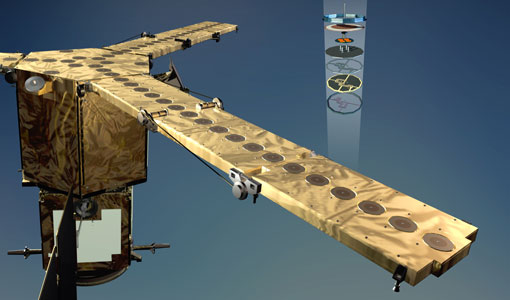
SMOS product availability
+ NIR + Long LO + FTT LO + Electrical Stability LO + NIR + Long + FTT LO + Short LO + Long + Short Current
Event - Training

EO Summer School 4
Keynote lectures on global change issues are also given to discuss the current state of the science of global change and
News - General News
ESA's excellent Earth Explorer missions extended to 2025
Acting like the spinning conductor in a bicycle dynamo, it generates electrical currents and thus the continuously changing
News - Events and Proceedings
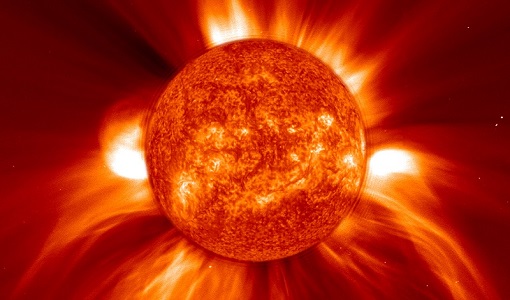
SMOS data advances space weather and ionospheric research
Title: Tracking the solar activity cycle using SMOS data Description: This graph shows the “rise” of our current solar activity
Mission - Earth Explorers
GOCE Objectives
Thanks to this current, the coastal waters of Europe are 4°C warmer than waters at equivalent latitudes in the north Pacific
News - Data Release news
New Landsat-8 Collection-2 Level 1 and Level 2 data now available
The Online Dissemination service is still being populated, with the current availability of Collection-2 data as follows:
Activity - Quality
SLAP
Currently, in excess of 701,000 Level 1 TM and 84,000 Level 1 ETM+ products have been reprocessed and released under the
Document - User Guide

User Manual - LEDA 13 Landsat
This infosheet describes the Landsat databank. The databank is a catalogue of imagery remotely sensed by the Landsat series of satellites (Landsat l to 5) available at ESA/Earthnet and acquired at Fucino (Italy), Kiruna (Sweden) and Maspalomas (Canaries).
News - Operational News

SMOS data outage since 22 February 2024
spacecraft has been back in nominal mode since 25 February and on 27 February, the MIRAS instrument was switched on and is currently